MPI / Archive Photos via Getty Images

Kean Collection / Archive Photos via Getty Images
Kean Collection / Archive Photos via Getty Images
Hulton Archive / Hulton Archive via Getty Images
Hulton Archive / Hulton Archive via Getty Images
MPI / Archive Photos via Getty Images
MPI / Archive Photos via Getty Images
MPI / Archive Photos via Getty Images
MPI / Archive Photos via Getty Images
MPI / Archive Photos via Getty Images
MPI / Archive Photos via Getty Images
Fotosearch / Archive Photos via Getty Images
Fotosearch / Archive Photos via Getty Images
Archive Photos / Archive Photos via Getty Images
Archive Photos / Archive Photos via Getty Images
MPI / Archive Photos via Getty Images
MPI / Archive Photos via Getty Images
Mathew Brady / Archive Photos via Getty Images
Mathew Brady / Archive Photos via Getty Images
MPI / Archive Photos via Getty Images
MPI / Archive Photos via Getty Images
Archive Photos / Archive Photos via Getty Images
Archive Photos / Archive Photos via Getty Images
Kean Collection / Archive Photos via Getty Images
Kean Collection / Archive Photos via Getty Images
Archive Photos / Archive Photos via Getty Images
Archive Photos / Archive Photos via Getty Images
Archive Photos / Archive Photos via Getty Images
Archive Photos / Archive Photos via Getty Images






14 Haunting Civil War Photos That Hit Differently in Color
The American Civil War tore the United States apart from 1861 to 1865. The Union initially fought primarily to preserve the country, while the seceding states created the Confederacy in a crisis centered on the future of slavery. As the war continued, emancipation became an explicit Union war aim, culminating in the destruction of legal slavery in the United States.
The scale of the fighting was staggering. More than 10,000 armed conflicts took place, from enormous battles to small skirmishes, and modern scholarship places the death toll at roughly 750,000. Photography was still young, but the Civil War became one of the first conflicts documented on a massive scale. Cameras could not freeze battlefield action the way modern photography can, so photographers recorded soldiers, camps, fortifications, cities, and, most famously, the grim aftermath of combat.
Mathew Brady became the best-known name associated with Civil War photography, but he was part of a much larger story. Photographers including Alexander Gardner, Timothy O'Sullivan, George N. Barnard, Andrew J. Russell, and others produced thousands of surviving images. Gardner's photographs of the dead after Antietam were displayed at Brady's New York gallery only weeks after the September 1862 battle, confronting civilians with scenes of battlefield death in a way newspapers and illustrations never had before.
24/7 Tempo reviewed Civil War photographs and archival information from sources including the Library of Congress, National Archives, National Park Service, Getty Images, and Wikimedia Commons. The historic photographs below are paired with digitally colorized versions. The added color can make small details easier to notice, but it should be viewed as an artistic interpretation rather than evidence of the precise colors present when the photograph was taken.
The Confederate Flag Over Fort Sumter
- Date: April 1861
- Location: Charleston Harbor, South Carolina
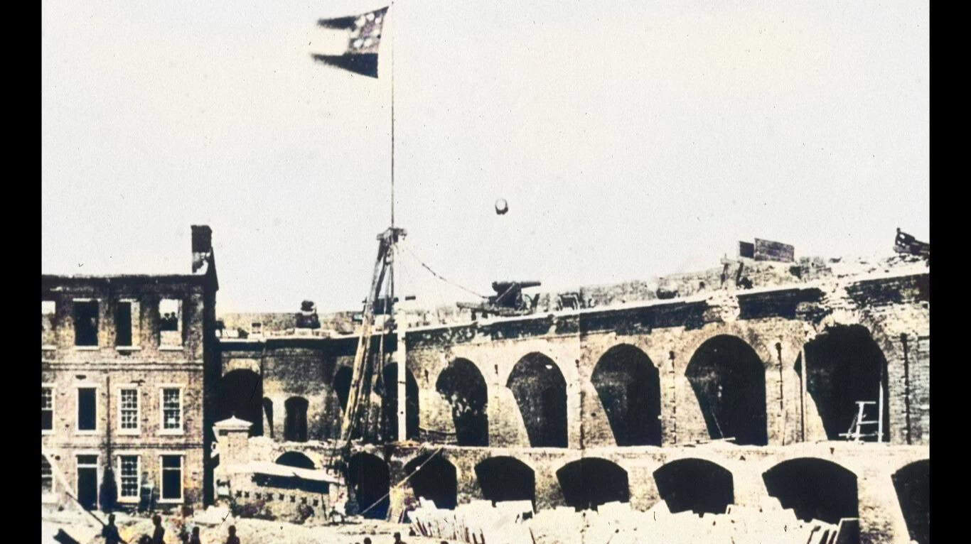
Fort Sumter became the opening battlefield of the Civil War when Confederate forces bombarded the U.S. garrison beginning April 12, 1861. Major Robert Anderson surrendered the fort the following day. Photographer Alma A. Pelot recorded a Confederate flag flying inside the damaged fort shortly afterward, creating one of the earliest photographs connected directly to the war's opening engagement.
The flag visible in these early Fort Sumter photographs was not the later Confederate battle flag that became more familiar. The Confederacy's First National Flag, commonly called the Stars and Bars, used horizontal red and white stripes with a blue canton containing white stars.
Colorized View: Fort Sumter
Adding color separates the flag, masonry, sky, and deep shadows inside the fort, making the physical damage easier to take in at a glance. The original photograph remains the historical document. The colorized version is useful for visual interpretation, but its palette is a modern reconstruction rather than something captured by the camera in 1861.
Captured Confederate Fortifications in Atlanta
- Date: 1864
- Location: Atlanta, Georgia
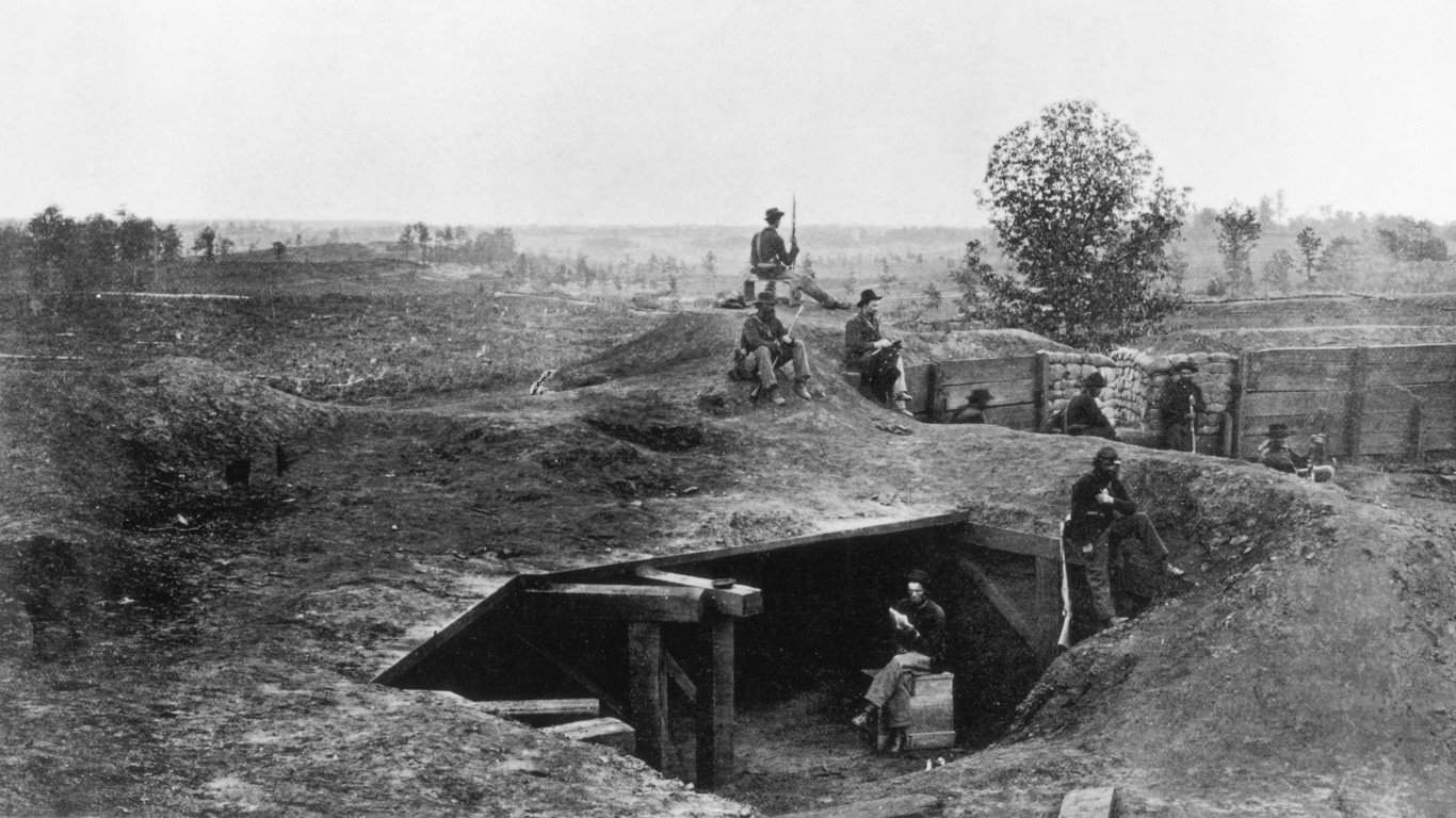
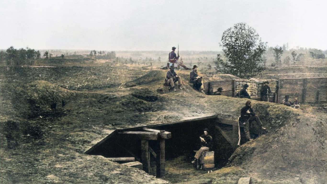
Atlanta was one of the Confederacy's most important railroad, industrial, and supply centers. Confederate forces surrounded the city with extensive earthworks during the 1864 Atlanta Campaign. After Union troops occupied Atlanta in September, some of those defensive positions were reused and remodeled. Photographer George N. Barnard documented Confederate fortifications and Union-held works around the city later that year.
Colorized View: Atlanta's Earthworks
The added greens and browns make these fortifications feel less like an abstract pile of dirt and timber and more like part of the landscape soldiers actually occupied. Civil War defenses were often built from whatever was immediately available, including earth, logs, timber, and existing terrain. Colorization makes those materials easier to distinguish, even if the exact tones remain interpretive.
Union Troops at Camp Northumberland
- Date: Winter 1861-1862
- Location: Fairfax County, Virginia, near Washington, D.C.
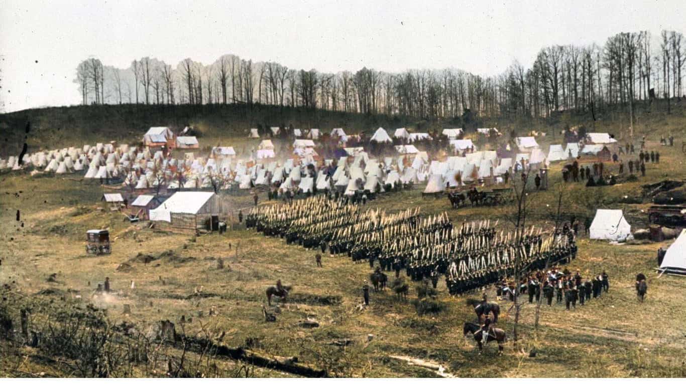
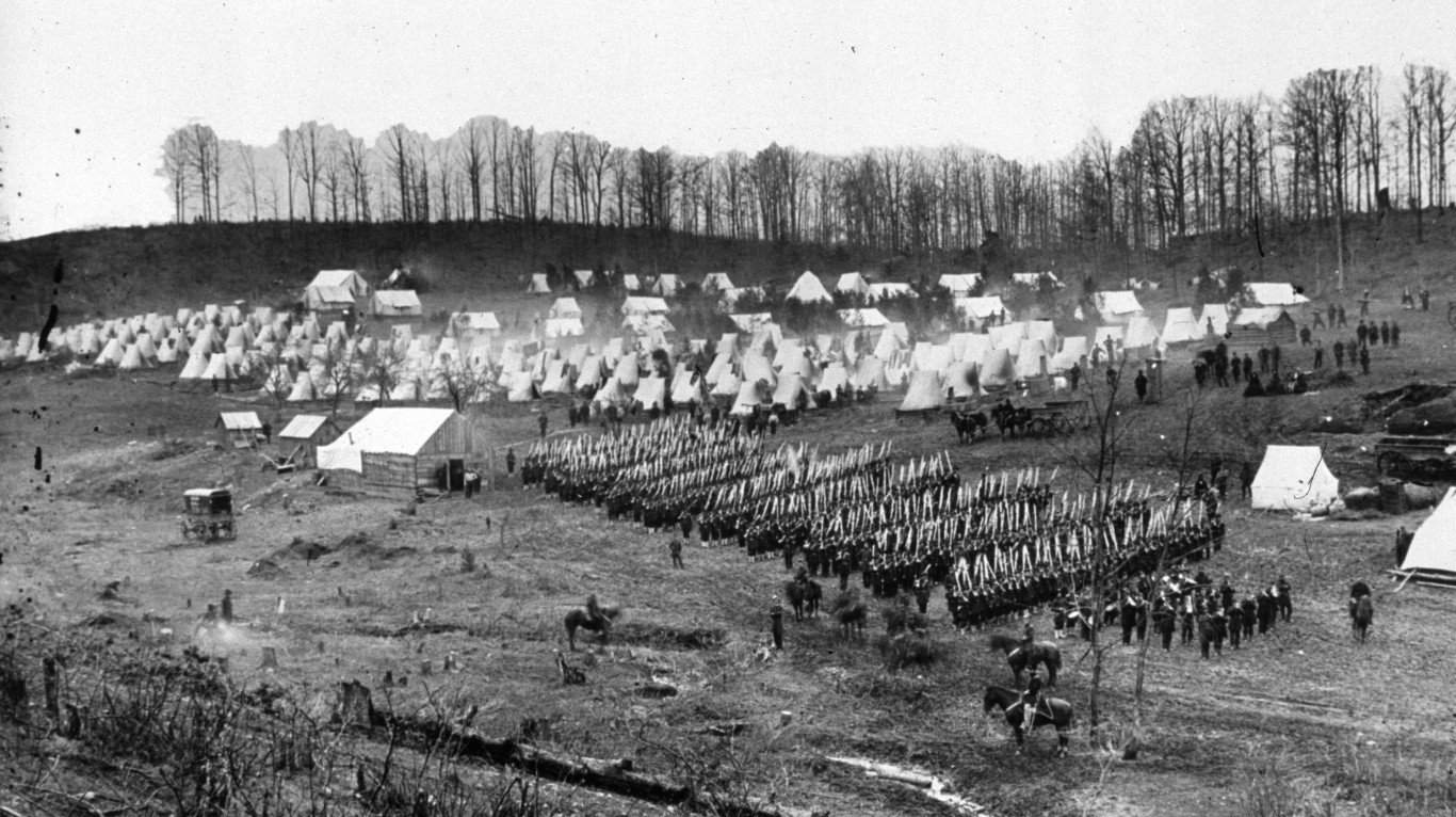
This scene is identified by the National Archives as probably showing the 96th Pennsylvania Infantry at Camp Northumberland. The regiment reached the Washington area in November 1861 and spent the winter helping defend the capital before joining active campaigns in Virginia in March 1862. The orderly rows of tents are a reminder that much of a Civil War soldier's life was spent drilling, marching, waiting, and trying to stay comfortable between battles.
Colorized View: Camp Life
Colorization makes the tents, fires, smoke, and surrounding terrain easier to separate visually, giving the encampment a surprisingly immediate feel. The important caveat is that the colors themselves were added later. Unless an object was independently documented, a colorized photograph cannot tell us exactly what shade a tent, uniform, tree, or patch of earth actually was.
Union Dugouts at Vicksburg
- Date: 1863
- Location: Vicksburg, Mississippi
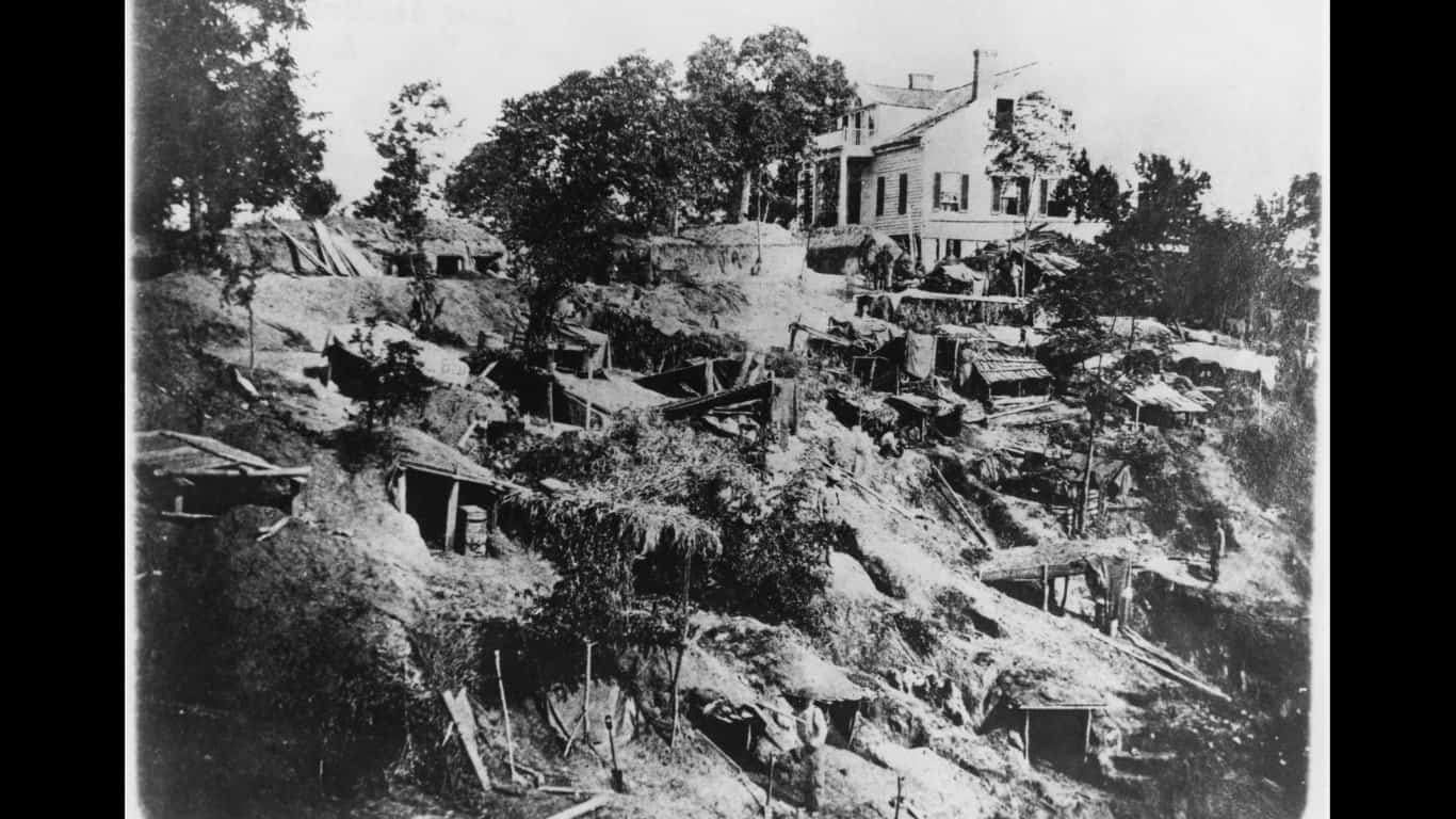
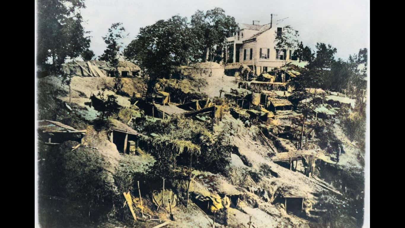
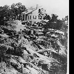
Union troops spent weeks digging trenches, shelters, and artillery positions during the siege of Vicksburg. The campaign tightened around the Confederate stronghold from May until its surrender on July 4, 1863. Surviving photographs show troops living in dugouts carved into hillsides and trenches, turning the earth itself into both protection and temporary housing.
Vicksburg's fall gave the Union control of the Mississippi River and split the Confederacy geographically, making it one of the most important strategic victories of the war.
Colorized View: Life in the Trenches
The timber bracing and bare earth are easier to pick out once color has been added. These shelters were hardly comfortable, but they offered troops some protection from weather and enemy fire. The scene also looks surprisingly similar to trench systems associated with later wars, one reason historians sometimes describe the Civil War as an important step toward modern industrial warfare.
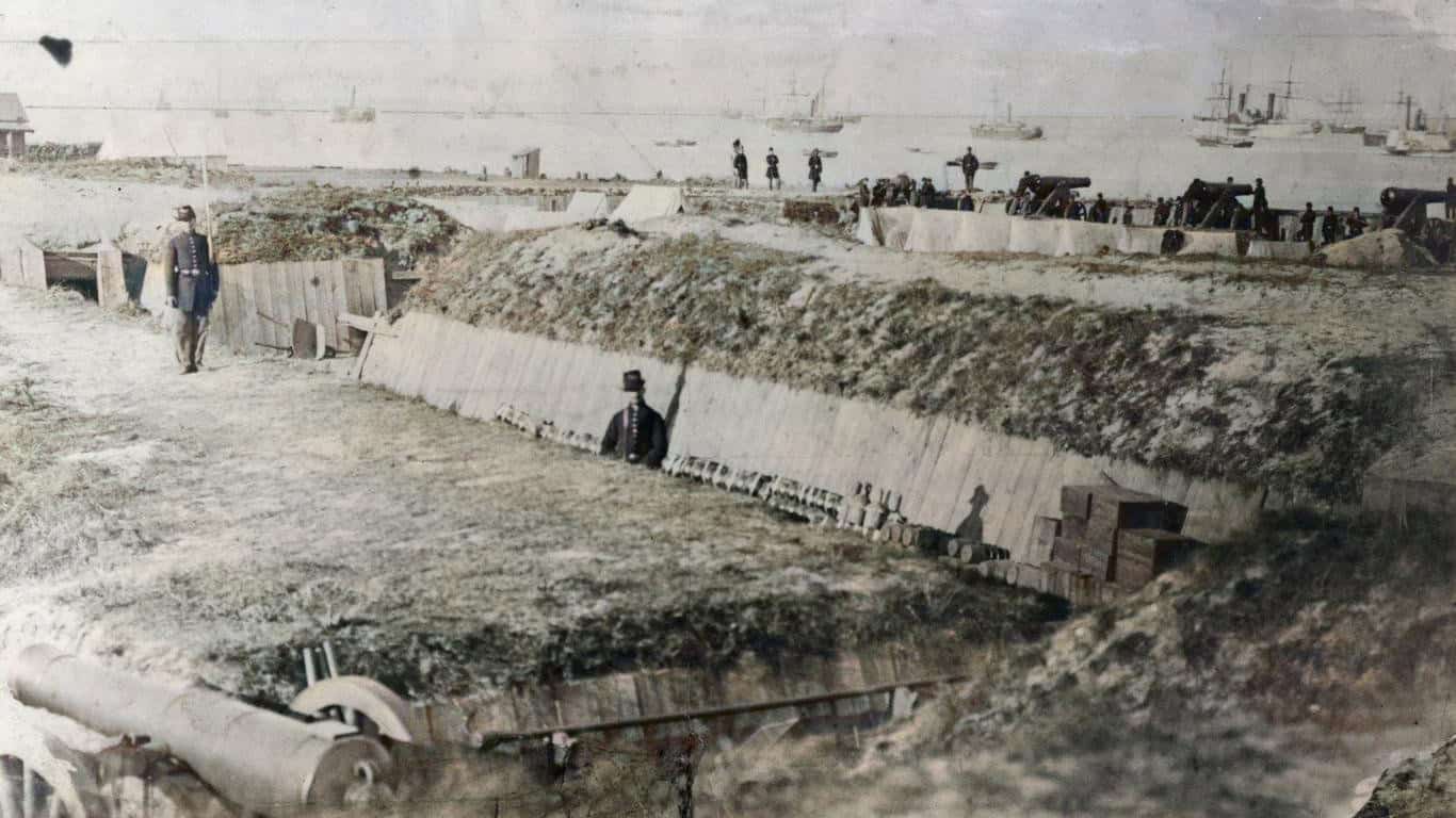
Standing Guard at Fort Walker
- Date: 1861
- Location: Hilton Head Island, South Carolina
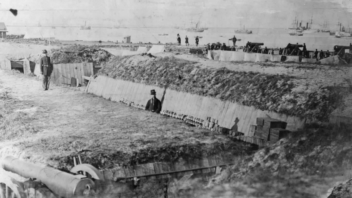
Fort Walker was built by Confederate forces in 1861 to defend the entrance to Port Royal Sound. Historical accounts document that enslaved laborers from nearby plantations were forced to haul logs, dig trenches, and help construct the fort. Union naval forces overwhelmed Fort Walker and neighboring Fort Beauregard during the Battle of Port Royal on November 7, 1861.
The victory gave Union forces an important base along the South Carolina coast. It also helped create the conditions for the Port Royal Experiment, in which thousands of formerly enslaved people in the Sea Islands began building new lives under Union occupation.
Colorized View: A Soldier at Fort Walker
Color makes the soldier's clothing and the fort's rough surroundings stand apart more clearly, but this is exactly where colorized history requires caution. Unless surviving records identify the clothing or equipment in detail, the hues are educated artistic choices rather than information contained in the original photograph.
Black Laborers Building a Stockade
- Date: Civil War era, circa 1864
- Location: Alexandria, Virginia
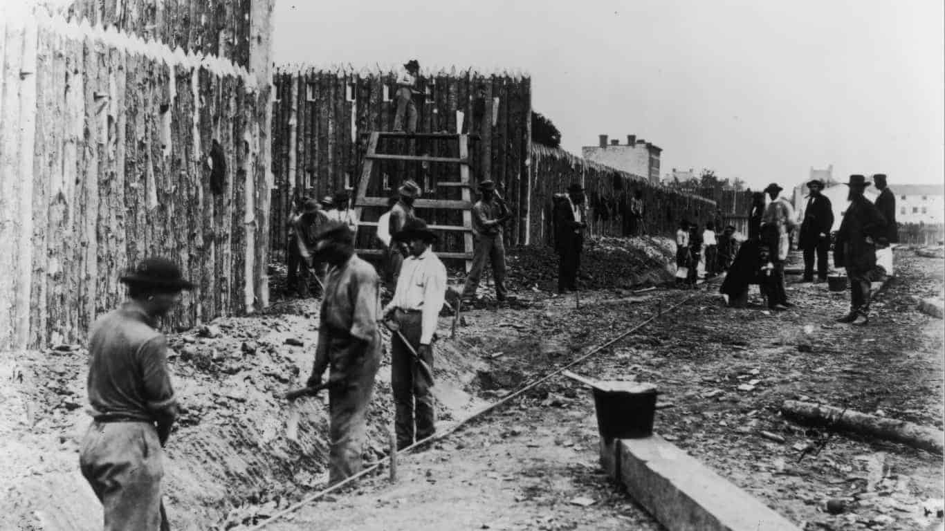
Library of Congress records describe a Civil War photograph titled “Building Stockade, Alexandria, Va.” as showing Black construction workers digging a ditch in front of a wooden stockade. Black labor was indispensable to Union military transportation, construction, supply, and fortification work during the war.
Some Black workers in Union-held Virginia were formerly enslaved people seeking freedom, but the surviving catalog description for this particular scene does not identify each man's personal history. That makes the original draft's claim that they were specifically fugitives who found paid work too certain.
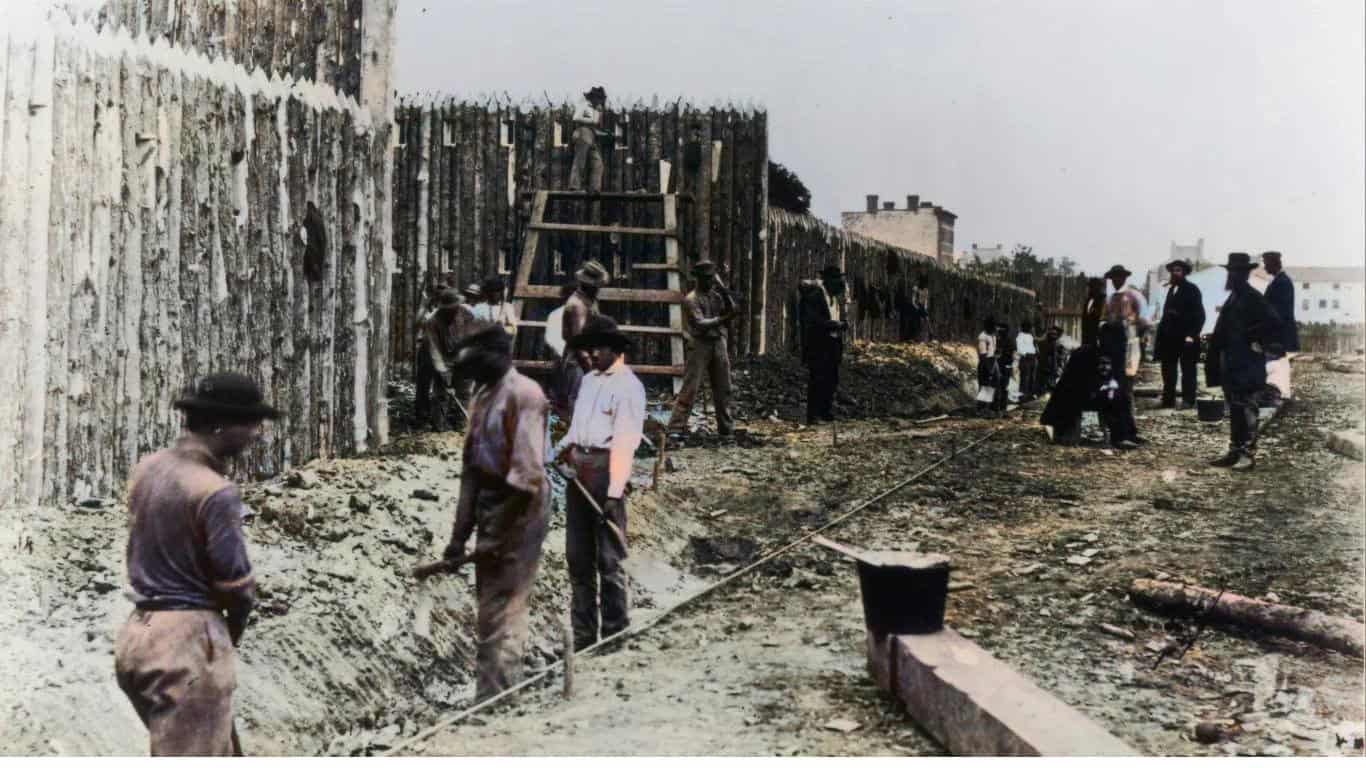
Colorized View: Building the Stockade
The sharpened timber posts dominate the colorized version of the scene. Stockades could protect military depots, camps, hospitals, rail facilities, and prisoners. The photograph also preserves a part of Civil War history that battlefield narratives can miss: armies depended on enormous numbers of laborers to build and maintain the infrastructure that kept soldiers in the field.
The Battered Lighthouse at Mobile Point
- Date: 1864
- Location: Fort Morgan, Alabama
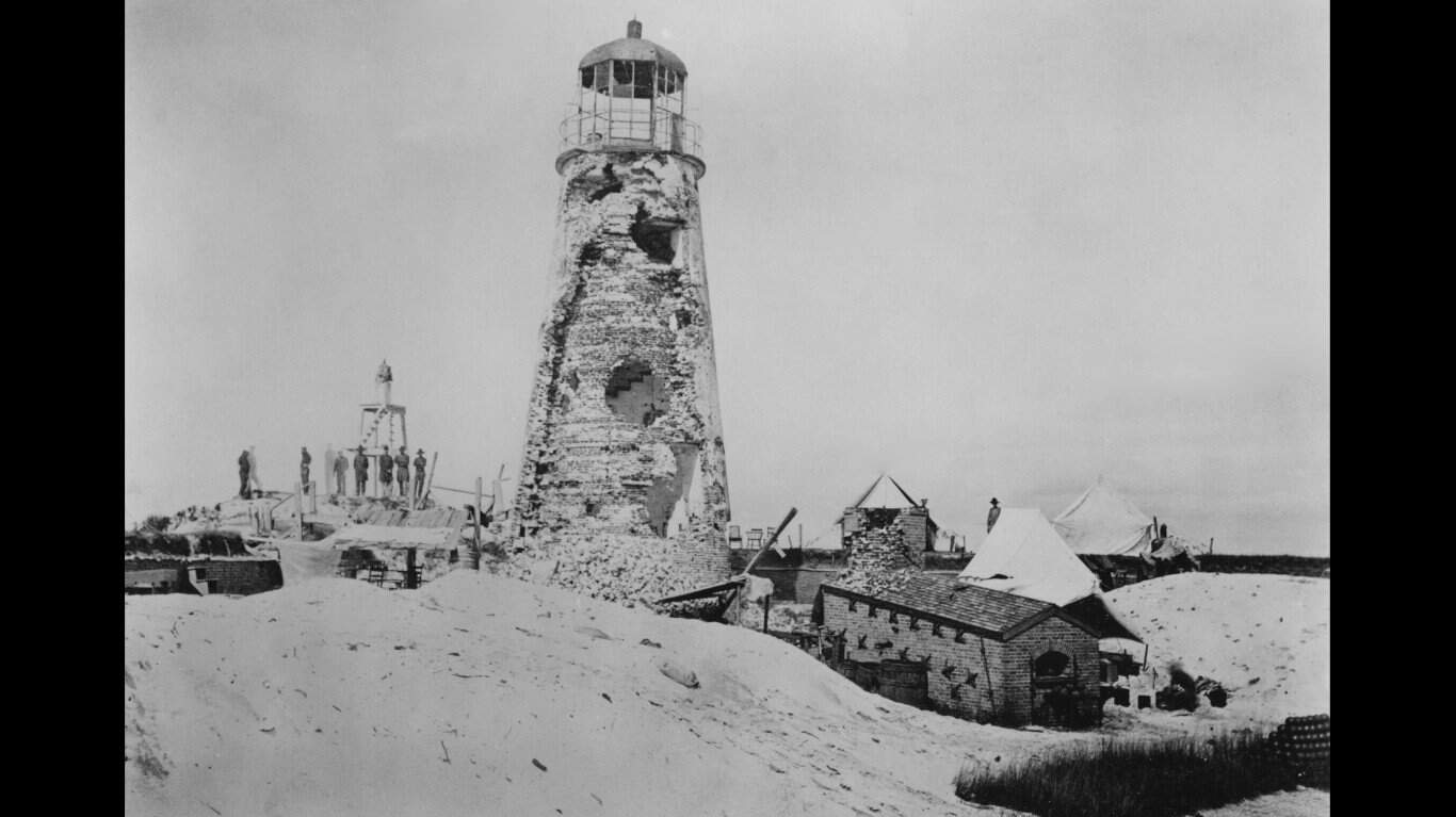
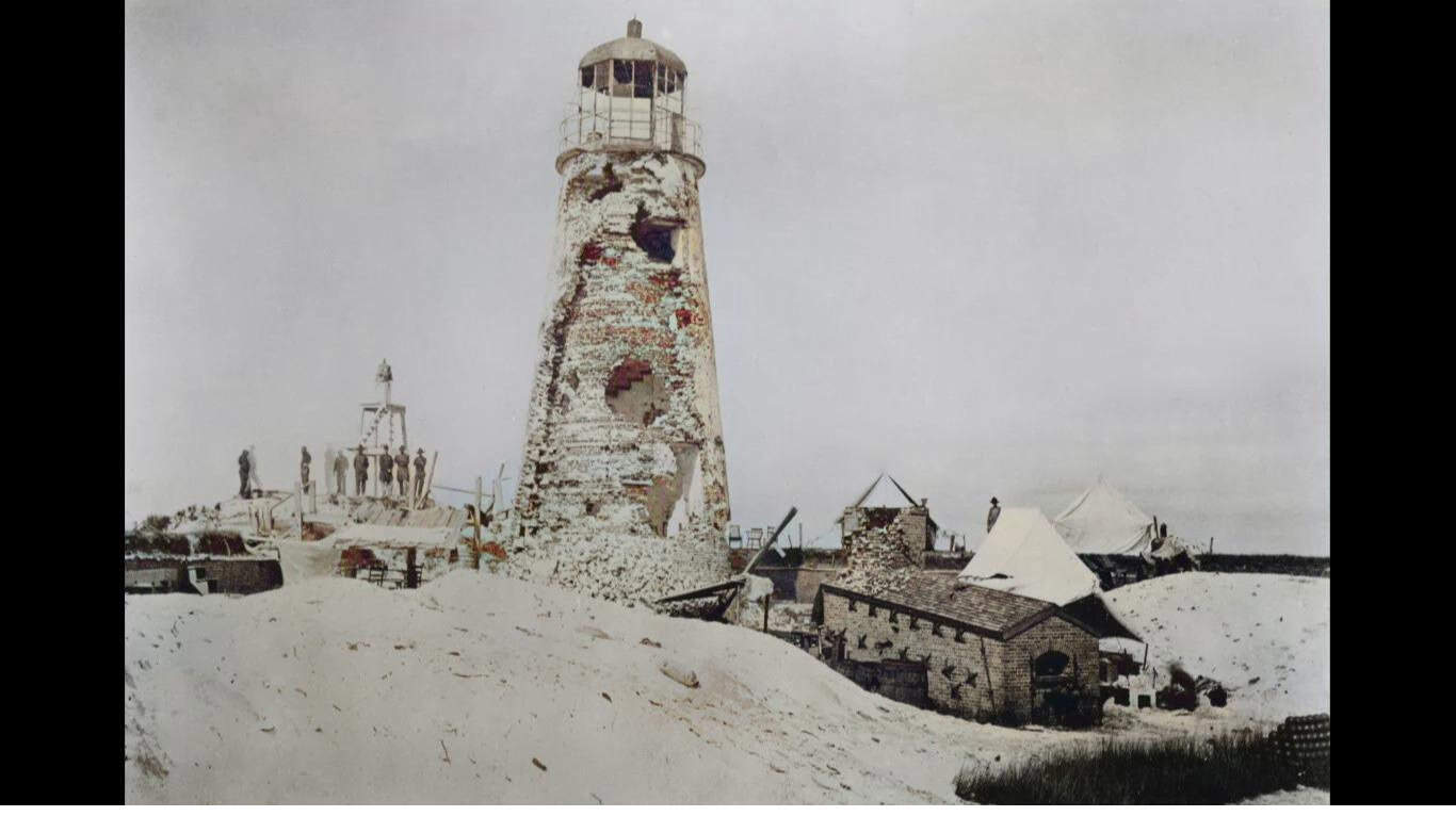
The lighthouse at Mobile Point stood beside Fort Morgan at the entrance to Mobile Bay and was badly damaged during the 1864 campaign. Admiral David Farragut's Union fleet fought its way into the bay on August 5, defeating the Confederate naval force. Fort Morgan held out until August 23 before surrendering after a sustained bombardment.
The victory effectively closed Mobile Bay to Confederate blockade runners, but it did not mean the city of Mobile itself had been captured that day. Union forces did not take Mobile until April 1865, near the end of the war.
Colorized View: A Lighthouse Shattered by War
The damage is difficult to miss even in black and white, but added color makes the broken masonry and scarred surroundings more visually immediate. National Park Service material uses photographs of the damaged lighthouse and Fort Morgan to illustrate just how destructive large-caliber naval artillery could be against older masonry defenses.
Richmond in Ruins
- Date: April 1865
- Location: Richmond, Virginia
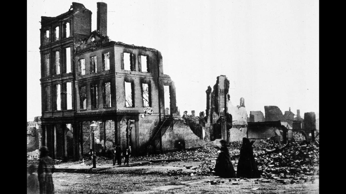
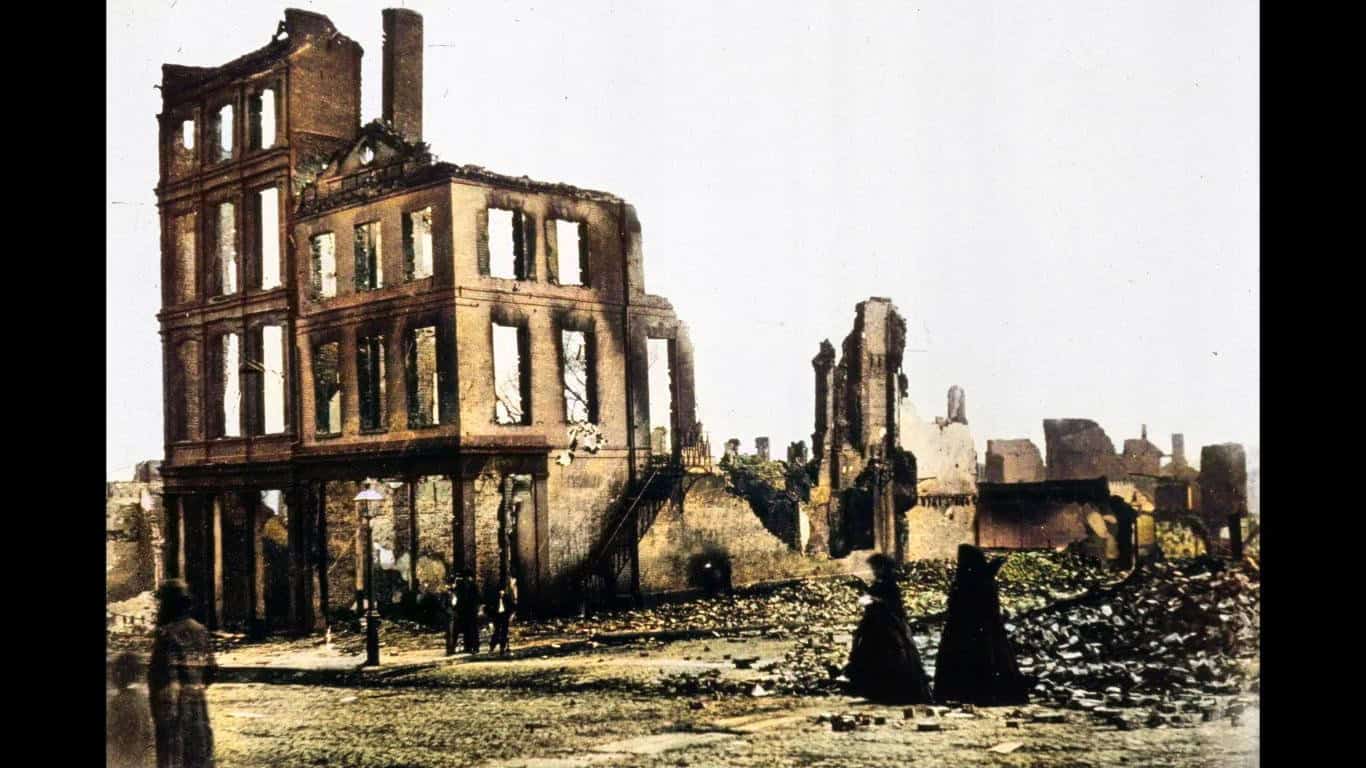
Large sections of Richmond's commercial and industrial district were devastated as Confederate forces evacuated their capital in early April 1865. Fires spread through warehouses and other structures before Union troops entered the city on April 3. Photographers arrived soon afterward and recorded blocks of burned-out buildings, twisted infrastructure, and streets surrounded by ruins.
Richmond had served as the Confederate capital since 1861. Its fall came only days before Robert E. Lee surrendered the Army of Northern Virginia at Appomattox Court House on April 9.
Colorized View: Richmond's Burned District
The colorized version gives the surviving brickwork and streets more visual separation, making the scale of the destruction easier to read. What looks almost archaeological in monochrome becomes recognizably urban once walls, rubble, sky, and ground are distinguished from one another.
That added immediacy is useful, but it is still worth remembering that the original photographers recorded the scene in monochrome. The color is a modern layer placed over a genuine historical image.
The Potomac Creek Bridge
- Date: Circa 1862-1863
- Location: Stafford County, Virginia
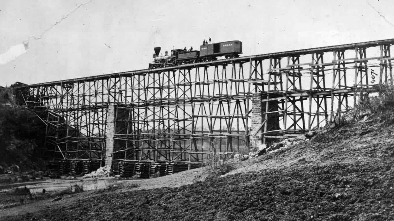
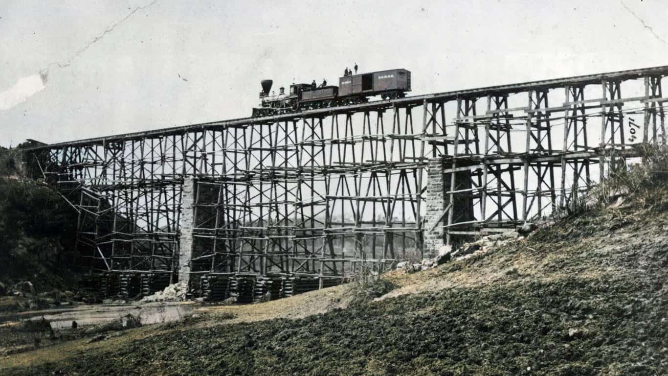
The U.S. Military Railroad's Potomac Creek Bridge became a showcase for wartime engineering. Herman Haupt's construction corps rebuilt the railroad crossing using timber cut nearby, completing the structure in only nine days. President Abraham Lincoln reportedly marveled at the towering wooden bridge during a visit to the area.
The Library of Congress credits the surviving photograph of the bridge to Andrew J. Russell, an important correction to older captions that attributed it to Mathew Brady. Russell extensively photographed the Union Army's railroad and engineering operations.
Colorized View: A Bridge Built for War
The spindly timber structure can look almost impossible by modern standards, especially once color separates it from the landscape behind it. Yet bridges like this were vital pieces of military infrastructure. Railroads moved troops, ammunition, food, horses, medical supplies, and equipment far more efficiently than armies relying entirely on roads and wagons.
Washington Arsenal
- Date: 1861-1865
- Location: Washington, D.C.
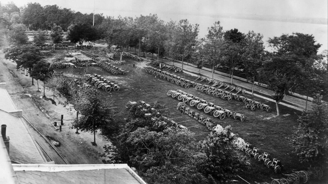
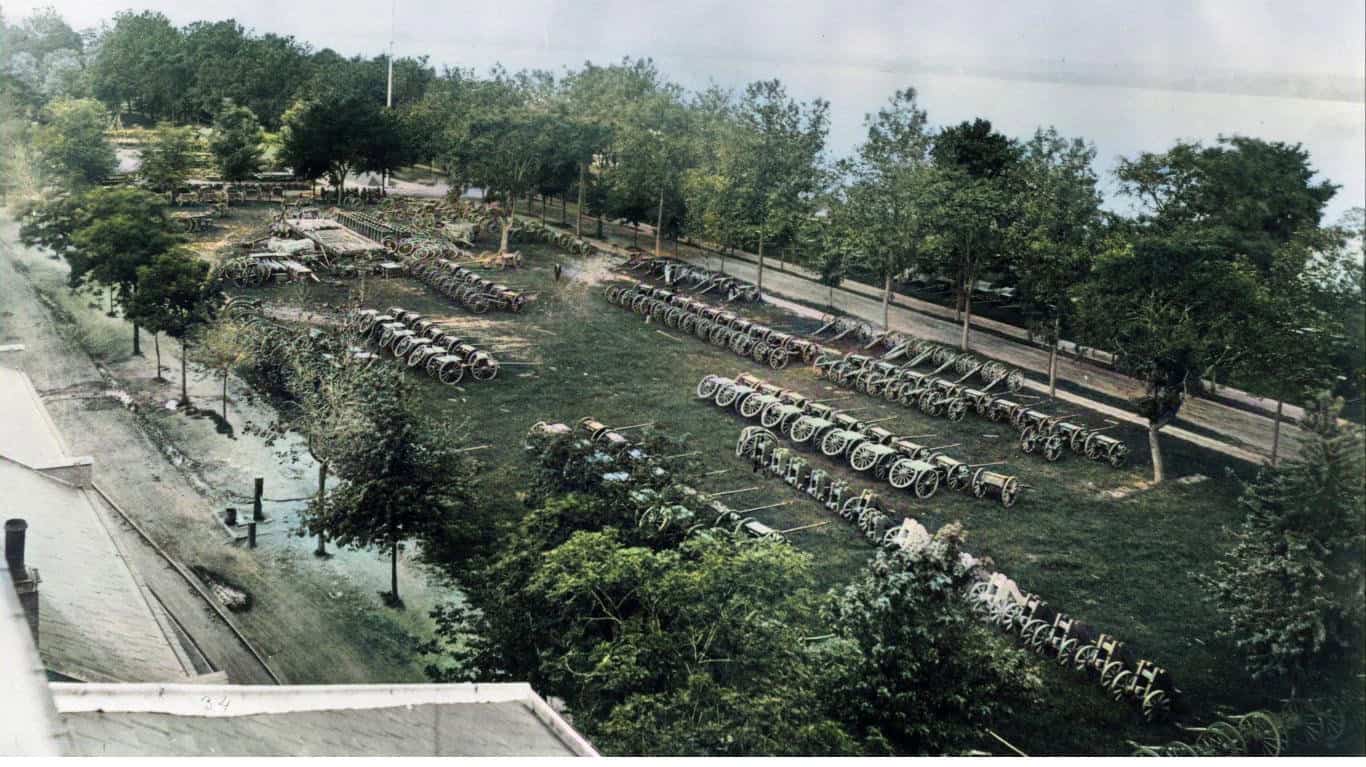
Washington Arsenal stood on Greenleaf Point near the meeting of the Anacostia River and Washington Channel. During the Civil War it became an important military installation for storing, repairing, and producing weapons and ammunition. A surviving Library of Congress photograph shows soldiers and civilians standing among rows of artillery pieces.
The exact photograph is broadly dated to sometime between 1861 and 1865 rather than specifically to 1861. The arsenal site later became Fort Lesley J. McNair.
Colorized View: Rows of Artillery
Color makes the repeated shapes of the gun carriages, wheels, and cannon barrels easier to follow across the image. The sheer number of weapons also hints at the scale of the war's logistical demands. Armies did not just need men in the field. They needed industrial facilities, repair shops, ammunition stores, transport networks, and enormous quantities of equipment behind them.
The Former Slave Pen in Alexandria
- Date: 1861-1865
- Location: Alexandria, Virginia
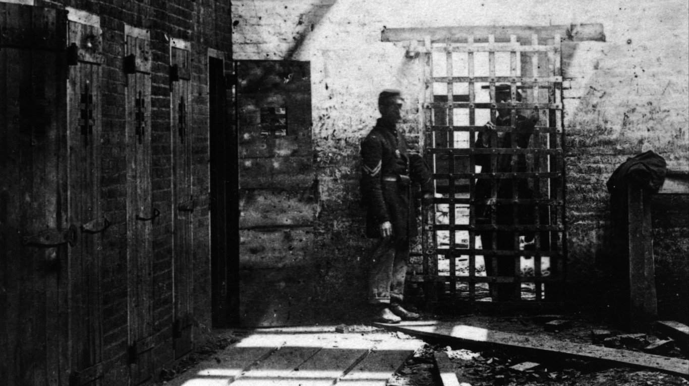
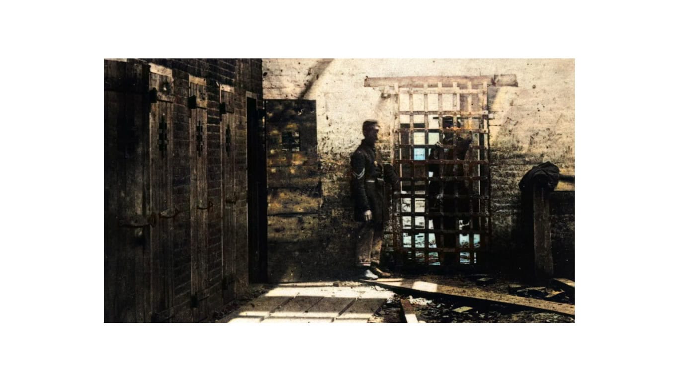
This photograph shows Union soldiers outside the former Price, Birch & Co. slave-trading complex at 1315 Duke Street in Alexandria. Before Price, Birch & Co., the property had been operated by Franklin & Armfield, one of the largest domestic slave-trading firms in the United States.
After Union troops occupied Alexandria in May 1861, the former slave jail took on an extraordinary reversal of purpose: the U.S. Army later used the building to hold Confederate prisoners. The surviving photograph puts Union soldiers directly beside a place where enslaved people had previously been confined before sale and forced transportation south.
Colorized View: The Slave Pen
Color cannot make the history behind this building any less grim. What it can do is strip away some of the psychological distance created by a 160-year-old black-and-white image. Brick, wood, clothing, and faces become easier for a modern viewer to separate, even though the added hues themselves remain interpretive.
Union Artillery Near Fredericksburg
- Date: December 1862
- Location: Fredericksburg, Virginia
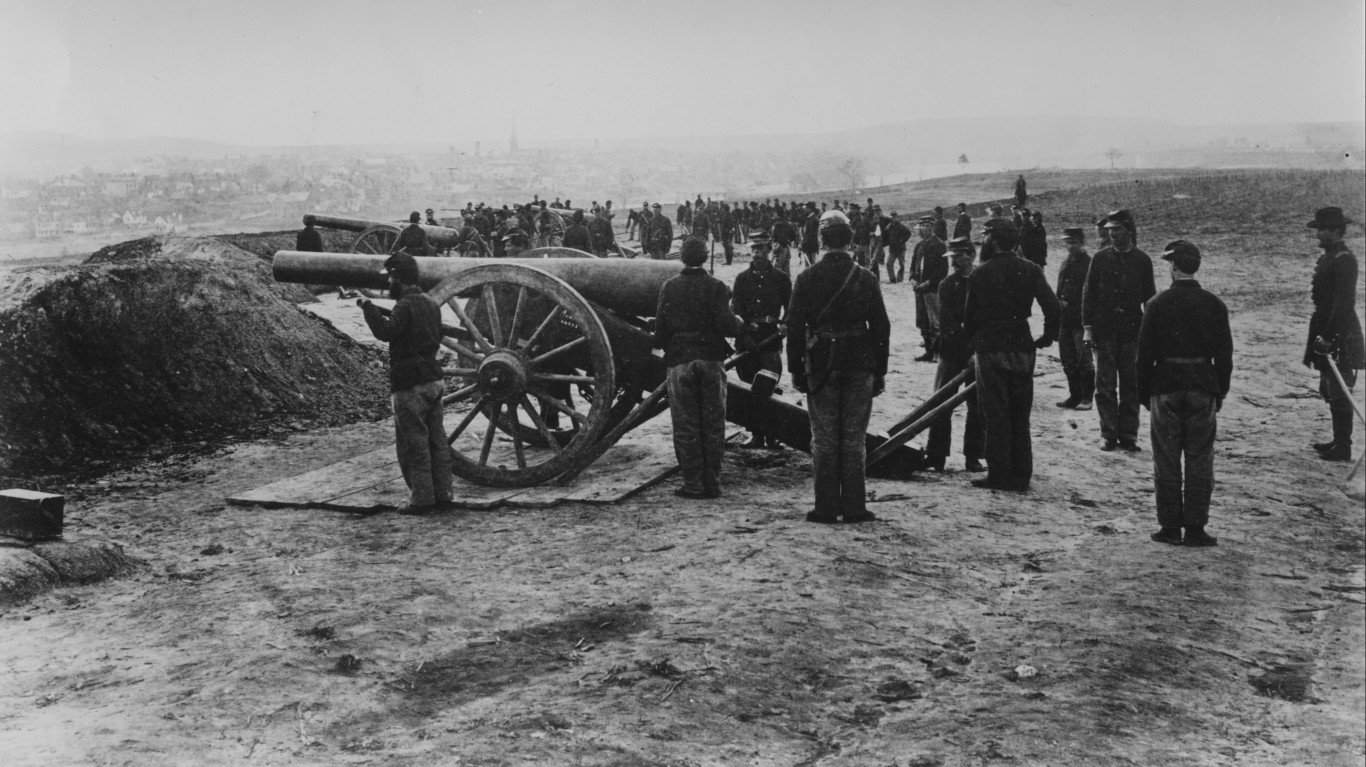
This scene is identified as a Union artillery battery preparing near Fredericksburg in December 1862. The battle that followed became one of the Union Army's most punishing defeats. Ambrose Burnside's forces repeatedly attacked strong Confederate positions, including the famously deadly ground below Marye's Heights.
The fighting took place from December 11 through December 15 and produced thousands of casualties on both sides. Photographs and drawings of artillery positions around Fredericksburg help show just how heavily the armies relied on cannon to shape the battlefield before infantry ever reached the enemy lines.
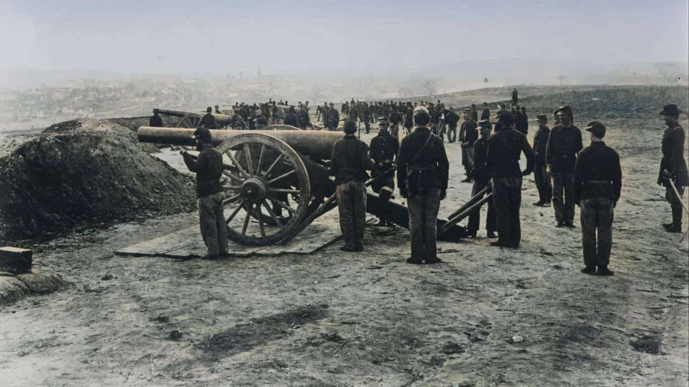
Colorized View: Before Fredericksburg
The colorized scene still feels bleak, which is probably appropriate. Added earth tones make the gun positions, uniforms, and surrounding terrain easier to distinguish, but there is little romantic about what these men were preparing to face. Fredericksburg became a brutal example of what happened when massed infantry attacked well-defended positions under modern artillery and rifle fire.
Elmira's Confederate Prison Camp
- Date: 1864-1865
- Location: Elmira, New York
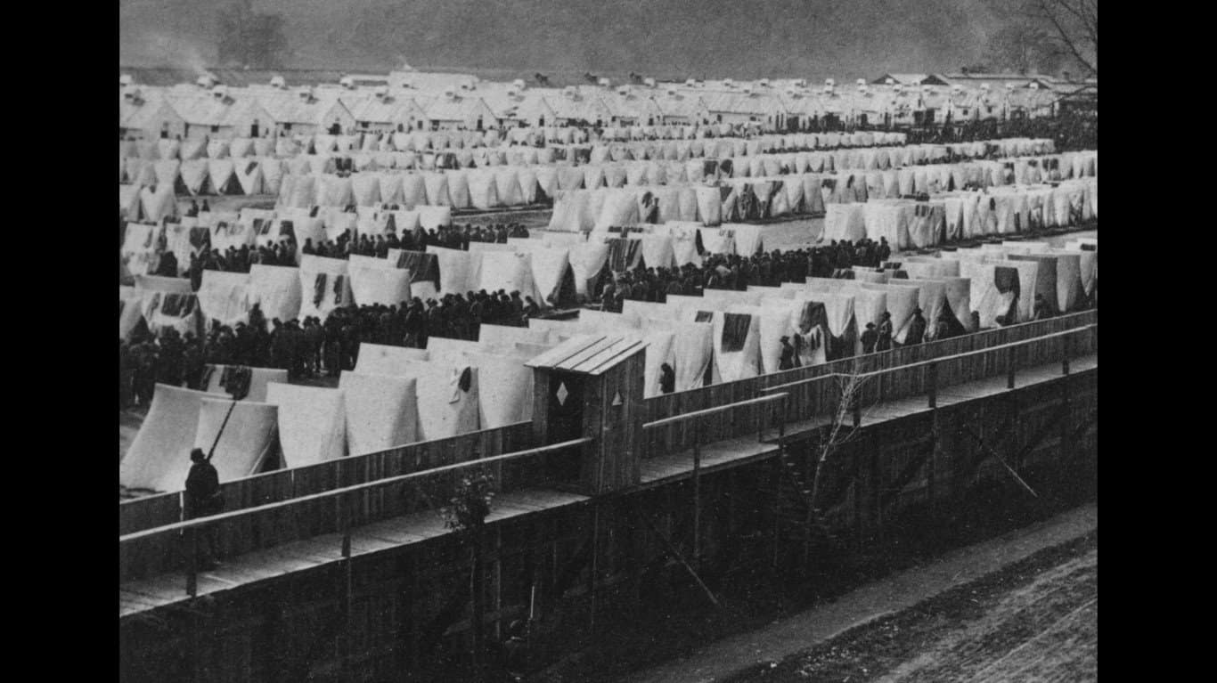
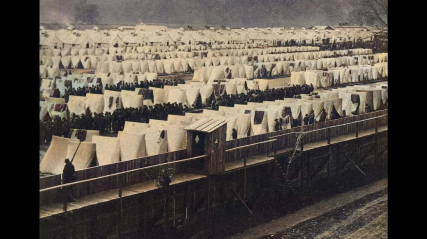
Camp Rathbun began as a Union training camp before part of the facility was converted into a prison for captured Confederate soldiers in 1864. Library of Congress photographs show rows of tents packed inside the stockade during its use as Elmira Prison.
Civil War prison camps on both sides became notorious for overcrowding, disease, poor sanitation, and inadequate food. Elmira developed an especially grim reputation as thousands of prisoners were confined there during the final year of the war.
Colorized View: Inside Elmira Prison
The colorized image emphasizes just how much of the enclosed ground was occupied by tents, buildings, and people. Photographs like this are valuable precisely because they show something statistics cannot: the physical density of a wartime prison camp and how little room thousands of men had to live inside its boundaries.
A Broken Cartwheel on an Abandoned Battlefield
- Date: 1863
- Location: Unknown
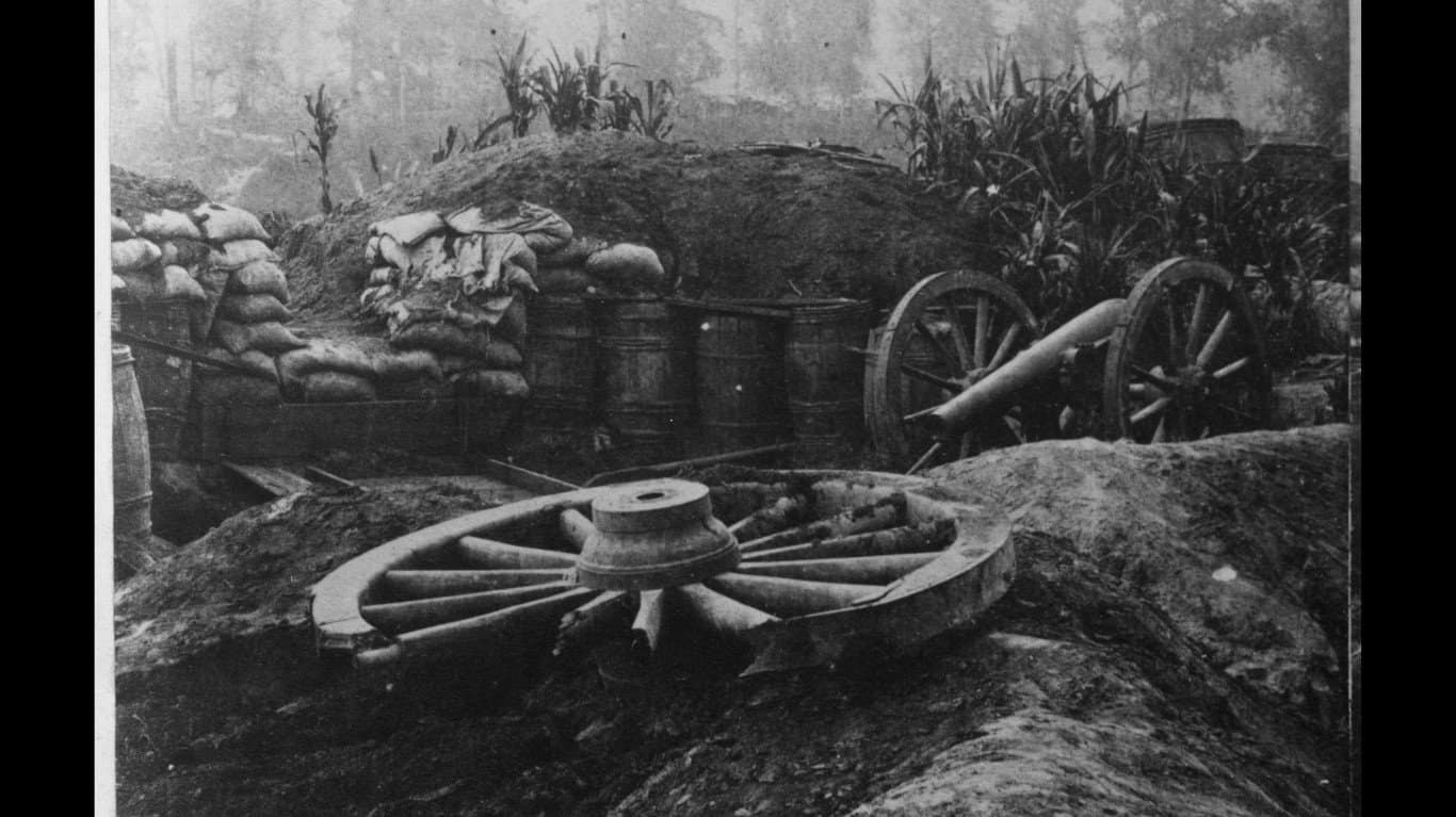
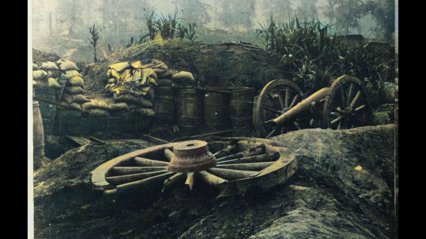
A shattered wheel, cannon, barrels, and scattered equipment sit abandoned in this stark Civil War scene. The source material dates the photograph to 1863 but does not provide a reliably verified battlefield location, so it is better not to attach it to a specific engagement without stronger archival evidence.
That uncertainty is not unusual. Civil War photographs have been copied, reprinted, retitled, and separated from their original captions for more than a century. In some cases historians can identify a landscape, photographer, or military unit; in others, the image itself is the strongest evidence that survives.
Colorized View: What the Army Left Behind
Color separates the vegetation, barrels, timber, wheel, and artillery more clearly, turning what can initially look like visual clutter into a scene of abandoned equipment. There is no dramatic charge or line of soldiers here. That's what makes the photograph work. It captures the quieter aftermath of war, when the fighting has moved on and broken machinery is left sitting where people once fought.