ajansen / iStock via Getty Images
Juan Pablo Bayona Galvis / iStock via Getty Images
Lost_in_the_Midwest / Shutterstock.com

PrabhatK / Shutterstock.com
Dawid Liebthal / 500px / 500px via Getty Images
ajansen / iStock via Getty Images
Jason Edwards / The Image Bank via Getty Images
Jason Persoff Stormdoctor / Image Source via Getty Images
mdesigner125 / iStock via Getty Images

Listy Dwi / Shutterstock.com
koto_feja / E+ via Getty Images
mdesigner125 / iStock via Getty Images

George Trumpeter / Shutterstock.com
© 2014 Yoann JEZEQUEL / Moment Open via Getty Images
Evgenia Gordienko / iStock via Getty Images
z1b / iStock via Getty Images
2018 Getty Images / Getty Images News via Getty Images
Did'pics / Shutterstock.com
Terri Attridge Photo / Shutterstock.com
Vladlen Tian / iStock via Getty Images
JordiStock / iStock via Getty Images
Art Wolfe / Stockbyte via Getty Images
Michael Ransburg / Shutterstock.com
samuel howell / iStock via Getty Images
Stocktrek Images / Stocktrek Images via Getty Images
© mike lyvers / Moment via Getty Images


25 Wild Weather Phenomena That Look Almost Impossible
Weather gets a lot stranger than thunderstorms, blizzards and the occasional rainbow. Under just the right conditions, the atmosphere can create glowing pillars over cities, clouds that look like breaking ocean waves, spinning columns of fire and flashes of light dozens of miles above a thunderstorm.
A few of the phenomena below stretch beyond weather in the strictest sense and into atmospheric optics, ocean science and unusual ice formations. They all have one thing in common, though: if you saw one without knowing what it was, there is a decent chance you would wonder whether your eyes were playing tricks on you.
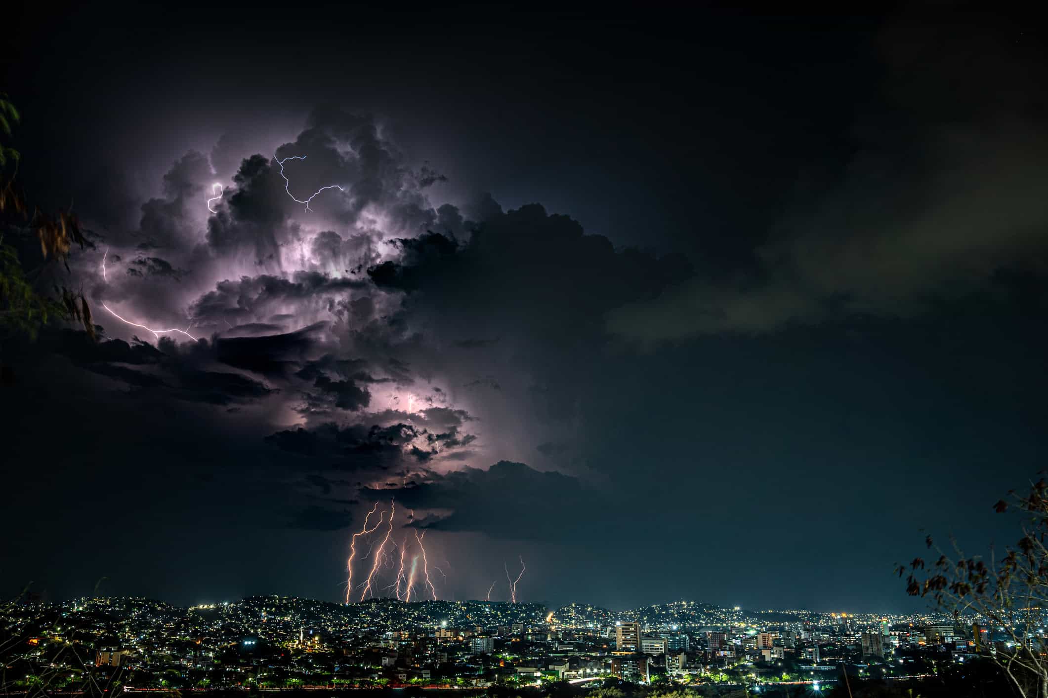
Catatumbo Lightning Turns One Part of Venezuela Into a Light Show
There are places with frequent thunderstorms, and then there is Venezuela's Lake Maracaibo region. Near where the Catatumbo River reaches the lake, thunderstorms repeatedly produce spectacular displays of lightning that have become famous around the world.
The area receives roughly 250 lightning flashes per square kilometer per year, one of the highest concentrations measured anywhere on Earth. Displays can occur on as many as 300 nights in a year and continue for hours. Local geography, warm lake water and surrounding mountains all help create an environment where thunderstorms can develop again and again.
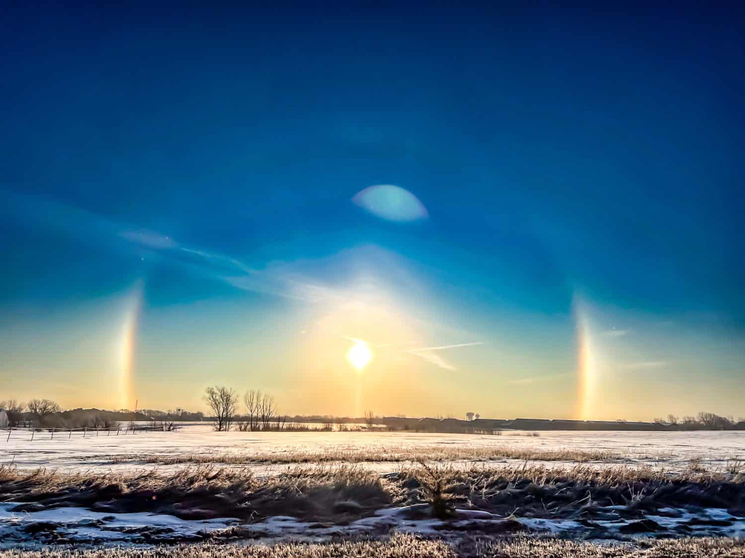
Sun Dogs Can Make It Look Like There Are 3 Suns
If you ever look toward the sun and notice what appear to be two bright companions sitting beside it, you may be looking at sun dogs. Their scientific name is parhelia, and they typically appear about 22 degrees to either side of the sun at roughly the same elevation.
The effect comes from sunlight passing through hexagonal ice crystals in high cirrus-type clouds. Those crystals bend the light toward your eyes and can even separate it into faint colors. Sun dogs are often easiest to notice when the sun is relatively low in the sky.
Snow Rollers Look Like Someone Started Building Snowmen and Left
Snow rollers look so perfectly curled that it is easy to assume someone made them. Nature can do the work on its own, but it needs a very specific combination of snow, temperature, moisture and wind.
A light layer of snow has to be sticky enough to roll onto itself without firmly attaching to the surface beneath it. Wind can then push the snow along until it begins curling into a cylinder. On a slope, gravity can sometimes do the same job. The conditions are finicky enough that fields full of natural snow rollers are relatively rare.
A Heat Burst Can Make the Temperature Suddenly Shoot Up at Night
Imagine stepping outside at night and feeling the temperature suddenly jump instead of cool down. That can happen during a rare event known as a heat burst, usually associated with a weakening or decaying thunderstorm.
Rain falling from high in the atmosphere may evaporate before reaching the ground. The resulting air sinks, then warms rapidly as it is compressed on the way down. At the surface, that can produce a sudden temperature increase, sharply lower dew points and gusty winds. NOAA notes that temperatures during documented heat bursts have jumped by 10 to 20 degrees within minutes.
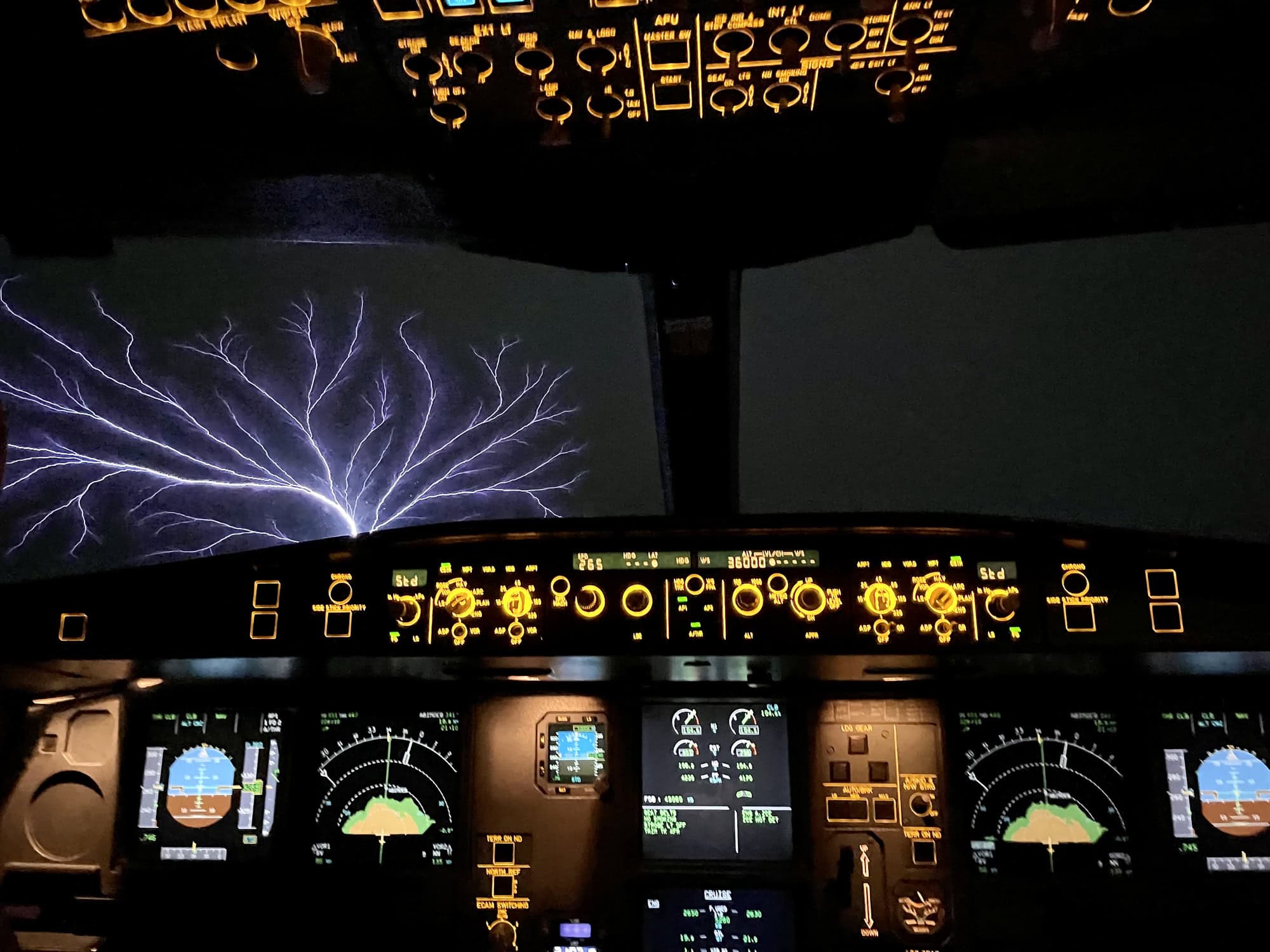
St. Elmo's Fire Can Make an Airplane Glow
Seeing blue or violet light crawling across part of an airplane while flying through stormy weather would be enough to make most passengers start asking questions. Fortunately, it does not necessarily mean the plane has been struck by lightning.
St. Elmo's Fire is a corona discharge caused when an intense atmospheric electric field ionizes the air around a pointed object. Ship masts were famous for producing the glow centuries ago, but it can also appear around aircraft windshields, wings and other protruding surfaces. It is atmospheric electricity putting on a surprisingly colorful show.
Brinicles Look Like Underwater Icicles Growing Toward the Seafloor
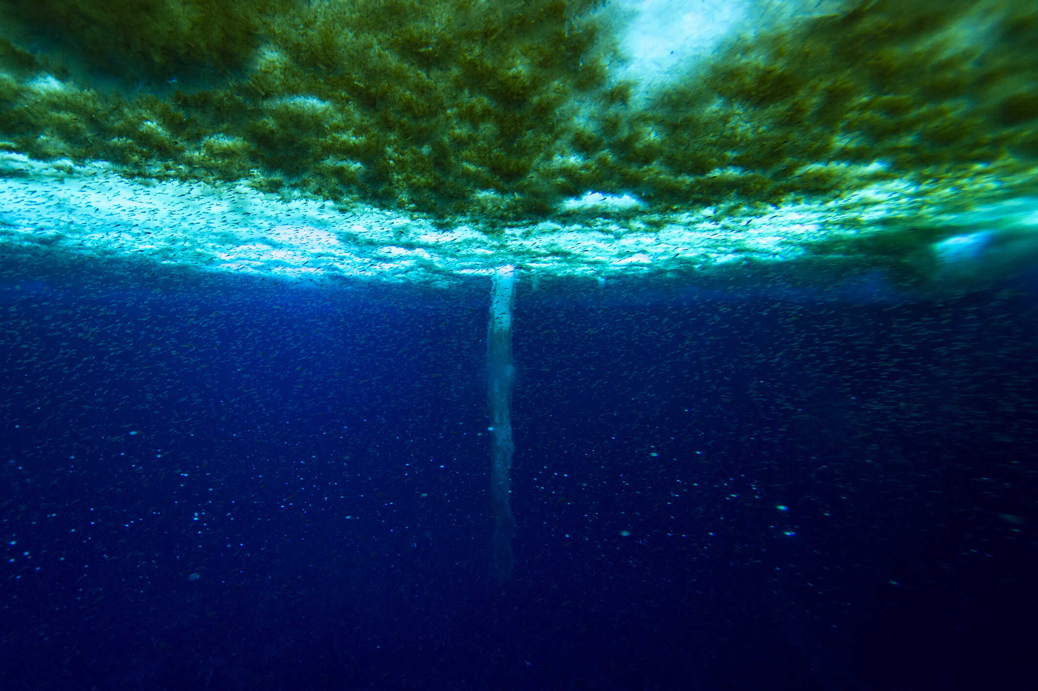
A brinicle looks like an icicle growing in the wrong direction. Instead of hanging from a roof, these strange tubes of ice form beneath sea ice and extend downward into the ocean.
When seawater freezes, much of its salt is pushed out of the new ice. Extremely cold, concentrated brine can then drain downward. Because that brine is colder than the surrounding seawater, water around the descending stream freezes and builds a hollow tube around it. The result is one of the eeriest ice formations in the ocean.
Kelvin-Helmholtz Clouds Look Like Waves Breaking Across the Sky
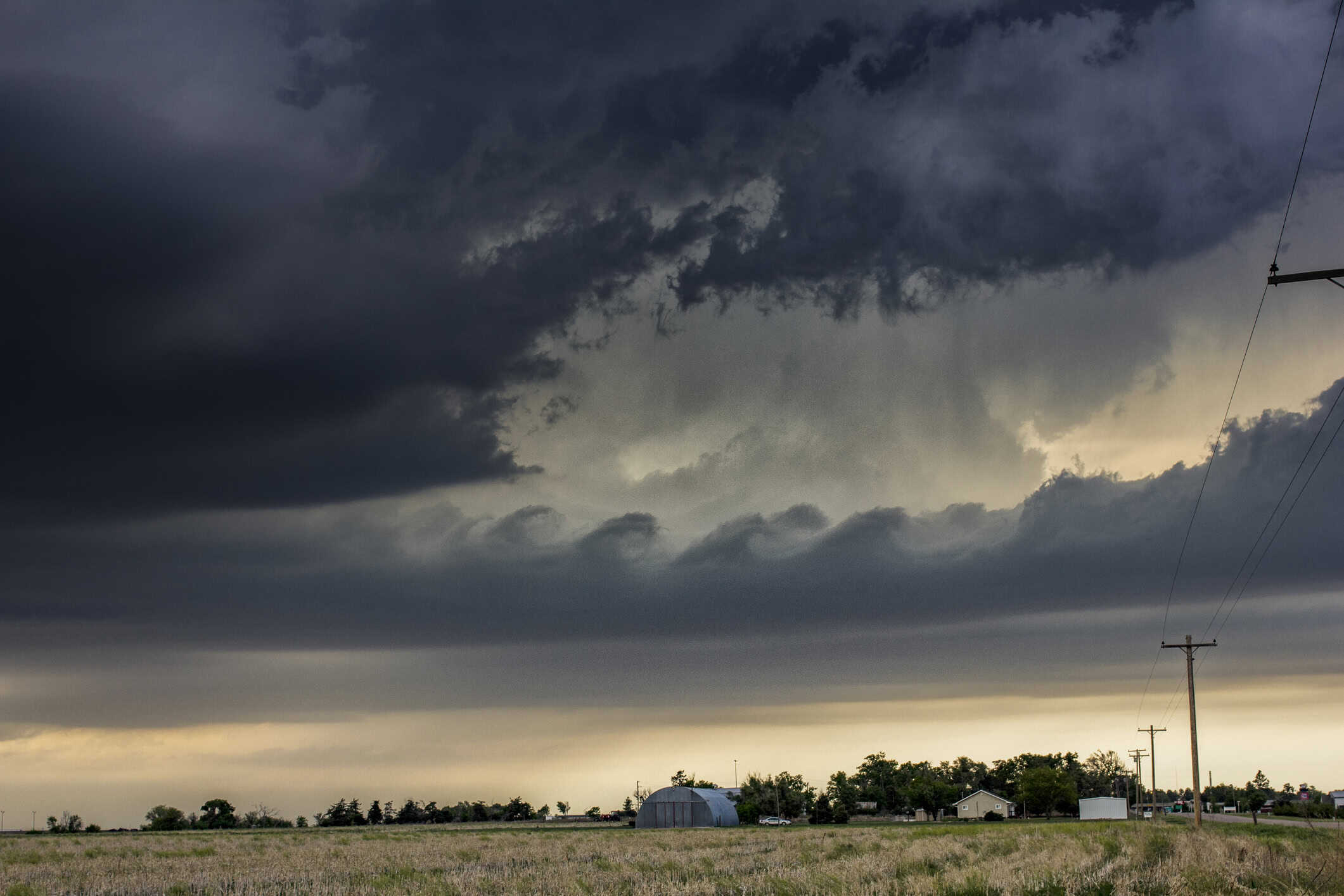
These are among the easiest clouds to mistake for something from a painting. Kelvin-Helmholtz clouds develop into a series of curling crests that look remarkably similar to waves breaking across the ocean.
The pattern can form when two layers of air move at different speeds, creating strong vertical wind shear. Faster air moving over slower air causes waves to develop along the boundary between them. If clouds happen to be present, they make those otherwise invisible waves visible for everyone on the ground.
A Derecho Can Leave Damage Across Hundreds of Miles
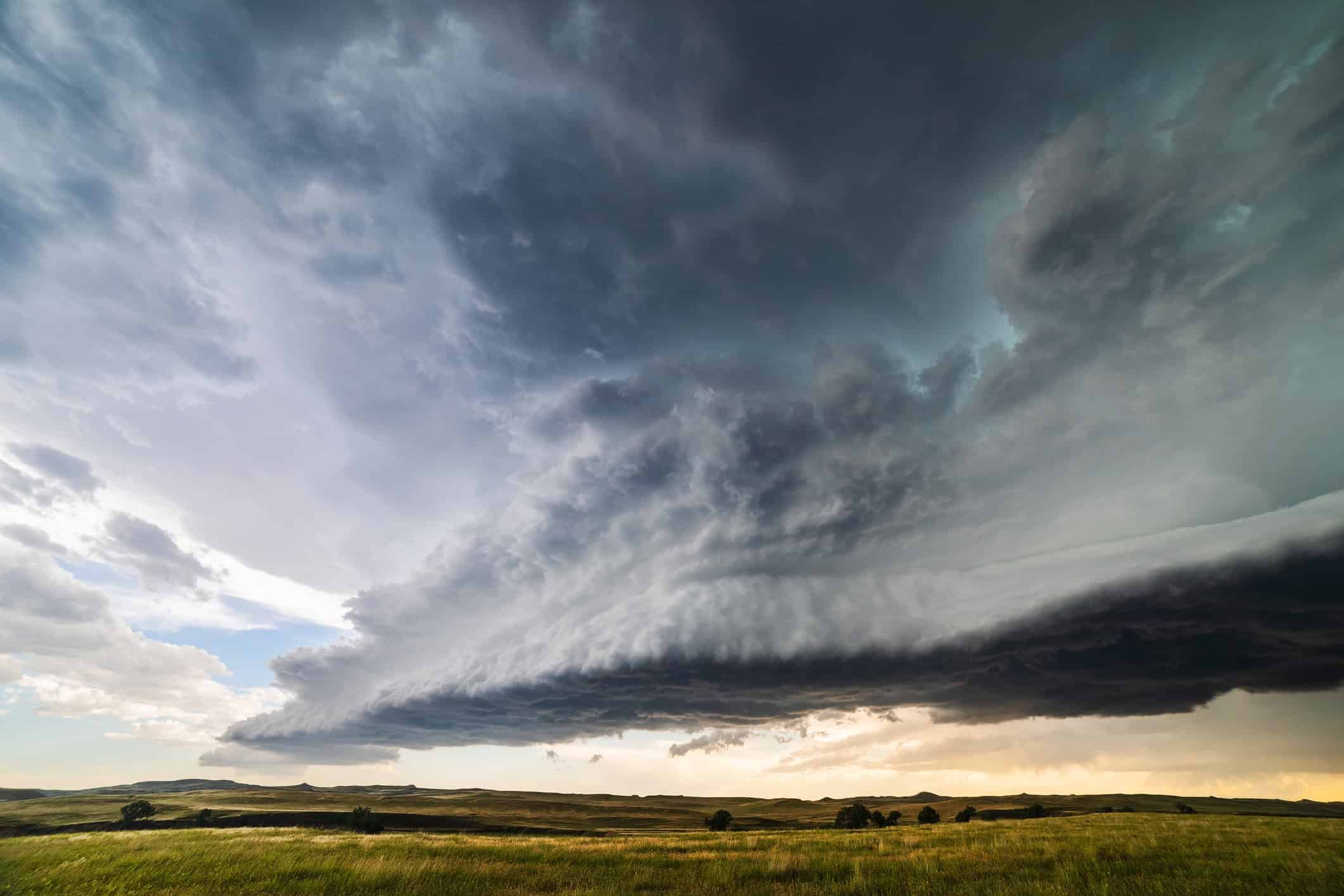
A derecho is not simply a really windy thunderstorm. It is a widespread, long-lived convective windstorm capable of leaving a corridor of damage stretching across multiple states.
National Weather Service criteria require a wind-damage swath extending more than 240 miles, with damaging winds along much of that path. Derechos are primarily associated with straight-line winds rather than tornadoes, although tornadoes can occur within the same storm system. The strongest wind gusts can rival hurricane-force winds, only without a hurricane anywhere nearby.
The Smell After Rain Has a Name: Petrichor
You have probably noticed this one hundreds of times without knowing there was a word for it. Petrichor is the familiar earthy smell that can become especially noticeable when rain finally arrives after a long dry stretch.
Australian researchers Isabel Joy Bear and Richard Thomas coined the term in a 1964 paper. Rain can release compounds associated with soil, rocks, plants and microorganisms into the air, helping create that unmistakable scent. So no, the smell of rain is not just in your imagination.
Not Every Waterspout Is a Tornado That Wandered Offshore
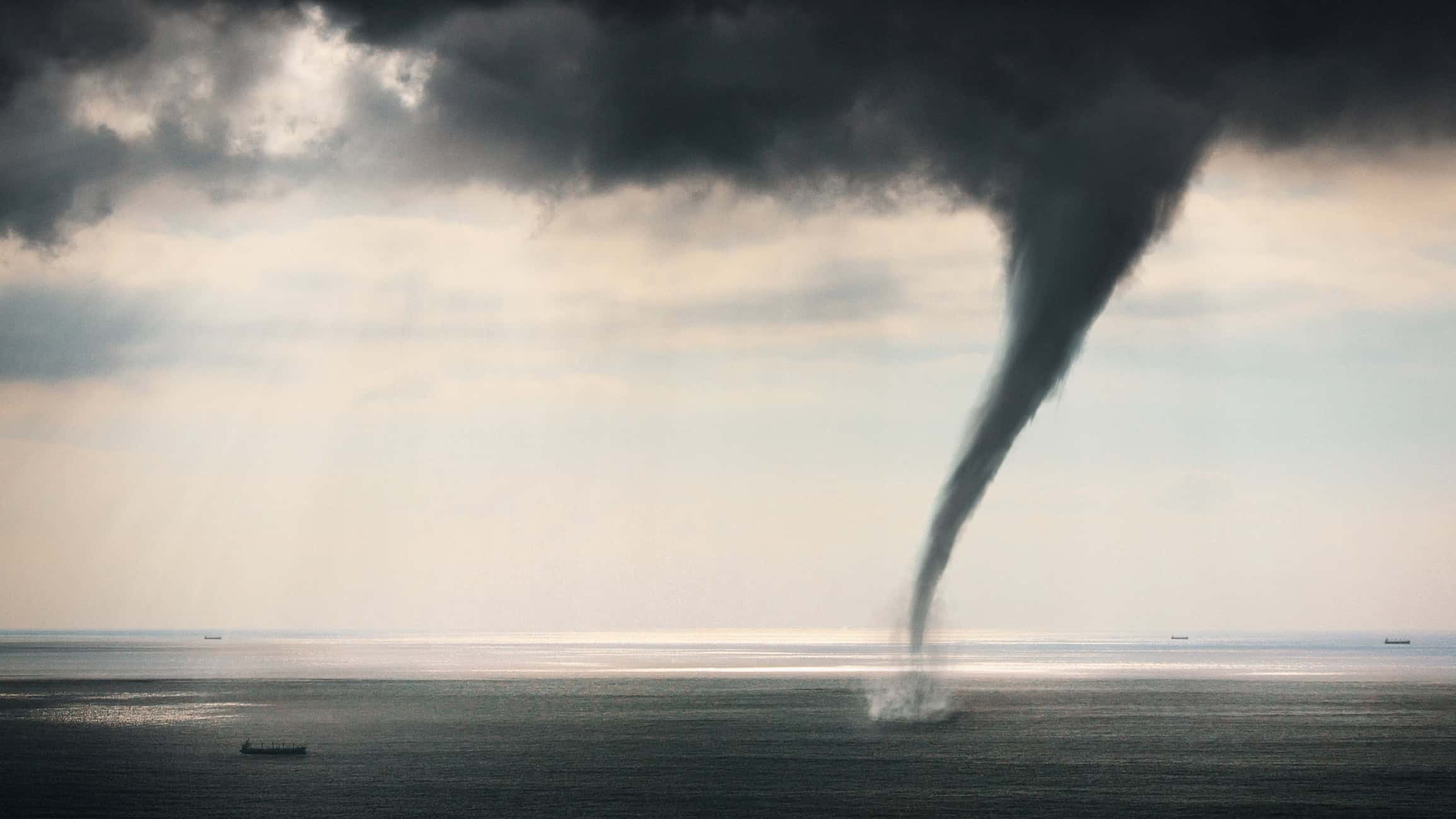
Waterspouts are generally divided into two categories, and the difference matters. Tornadic waterspouts really are tornadoes that form over water or move from land onto water. They are associated with thunderstorms and can be every bit as dangerous as their land-based counterparts.
Fair-weather waterspouts form differently. They typically develop from the water upward beneath growing cumulus clouds in relatively light-wind environments. They are usually weaker, but "weaker" does not mean harmless, especially if you happen to be on a boat when one forms nearby.
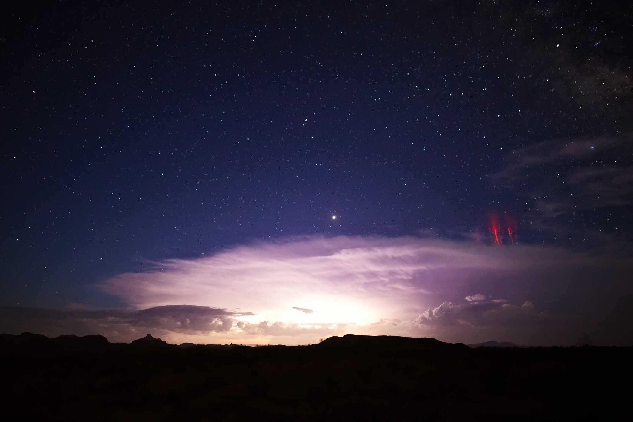
Sprites and Elves Flash Miles Above Thunderstorms
Thunderstorms can put on a show far above the clouds, too. Sprites and elves belong to a family of extremely brief upper-atmosphere flashes known as transient luminous events.
Sprites often appear reddish and can stretch tens of miles across the upper atmosphere, sometimes with tendrils that make them look almost like glowing jellyfish. Elves spread outward in enormous disk-like flashes. Both are triggered by electrical activity from thunderstorms below and usually last only milliseconds, which helps explain why people went so long without documenting them clearly.
Stormy Skies Really Can Turn an Almost Unreal Shade of Purple
You may hear dramatic purple skies around storms described as "purple rain," but the effect is mostly about the color of the sky, not purple raindrops. It has also been photographed around tropical systems, including hurricanes.
When the sun sits low near the horizon, its light takes a much longer path through the atmosphere. Scattering removes and redirects different wavelengths, while clouds, moisture and particles can change the colors that ultimately reach your eyes. Under the right combination of conditions, the result can be a deep pink, violet or purple sky that barely looks real.
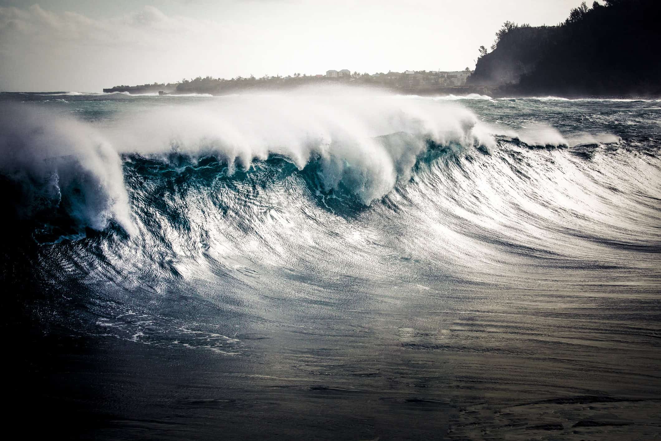
Rogue Waves Went From Sailor Stories to Scientific Reality
For centuries, stories of enormous walls of water appearing almost without warning were easy to dismiss as sailors exaggerating what they had seen. Modern instruments eventually made it clear that rogue waves are very real.
NOAA describes rogue waves as large, unexpected and dangerous, with scientists generally classifying them as waves more than twice the height of the surrounding sea state. Exactly why they form is still an active area of study. Their unpredictability is part of what makes them so dangerous to ships and offshore structures.
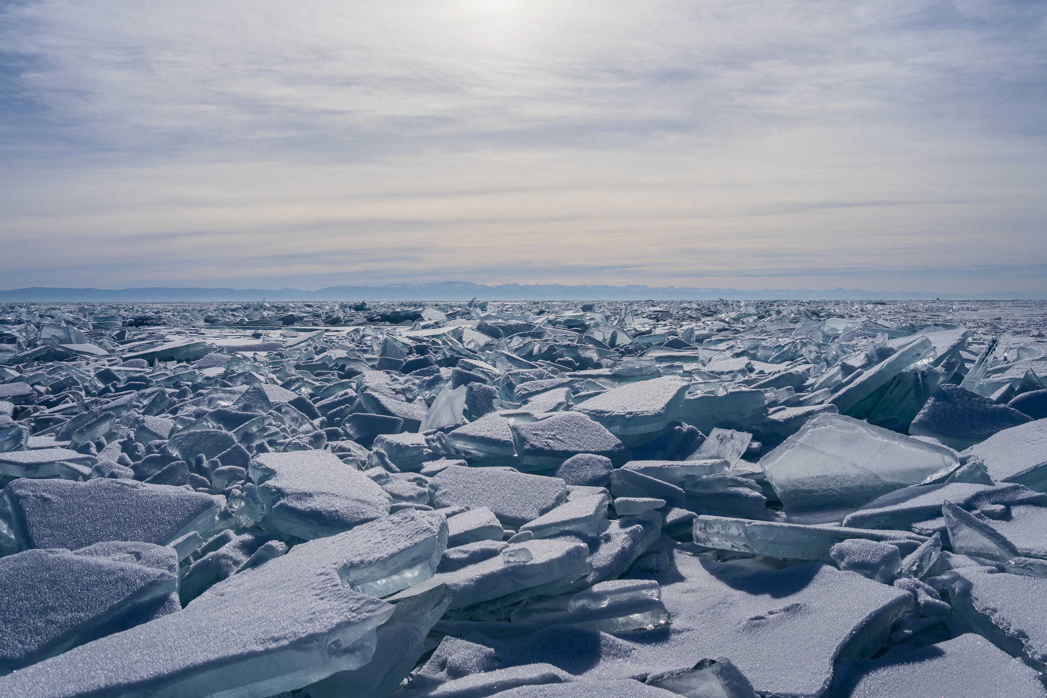
A Frost Quake Can Make Frozen Ground Suddenly Boom
Hearing what sounds like an explosion outside during a brutally cold night does not necessarily mean there was an earthquake. In some cold-weather regions, the culprit can be a frost quake, also known as a cryoseism.
Water in shallow soil or rock can freeze and expand during a rapid plunge in temperature. Enough stress can eventually cause the frozen ground to fracture with a surprisingly loud bang. The U.S. Geological Survey notes that these events are commonly reported during intense cold snaps and can easily be mistaken for something more dramatic happening underground.
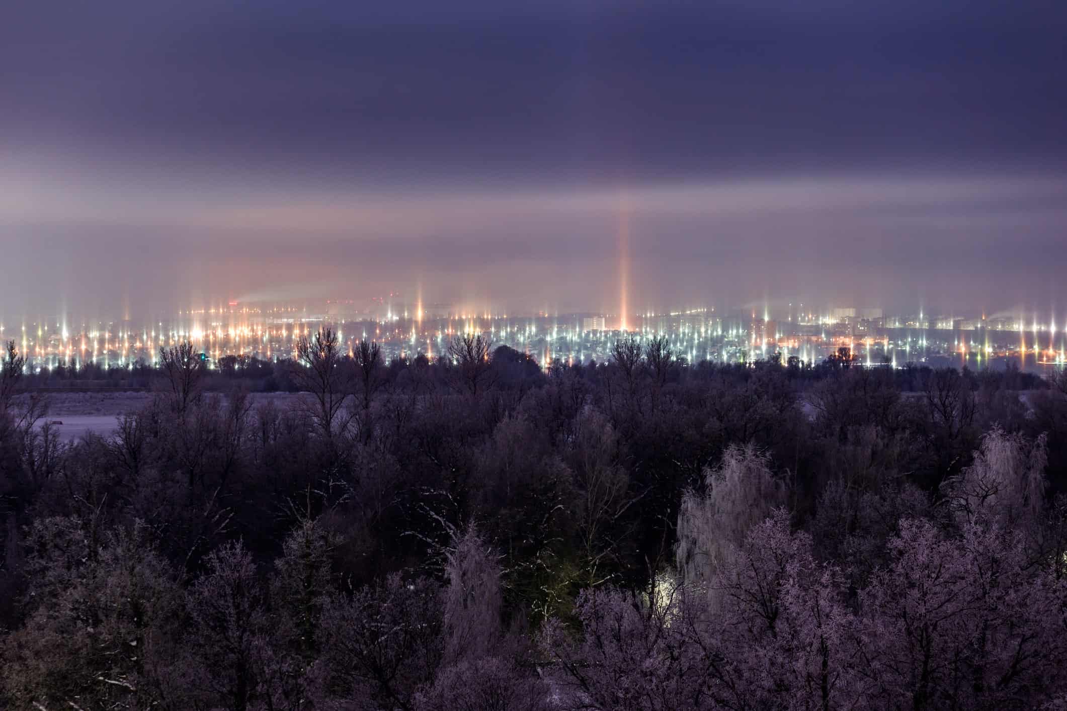
Light Pillars Can Make a City Look Like Science Fiction
On a bitterly cold night, streetlights can suddenly appear to send enormous glowing beams straight into the sky. They look like spotlights, but the pillars are really an optical illusion created by ice crystals.
Flat ice crystals suspended in cold air can reflect light toward an observer. Millions of those tiny reflections line up visually and create the appearance of a vertical column. Similar pillars can form from sunlight or moonlight, although artificial lights can create some of the most colorful versions.
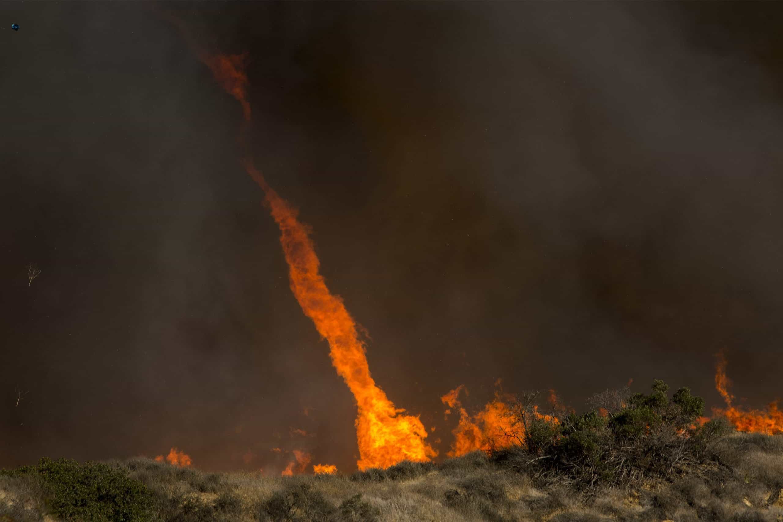
Fire Whirls Are Exactly as Unsettling as They Sound
Intense heat from a fire can create rapidly rising air. Combine that with the right wind pattern and rotation, and the result can be a spinning column that pulls flames, embers, smoke and hot gases upward.
These vortices are usually called fire whirls, and most are not tornadoes in the traditional meteorological sense. Very intense wildfire-generated vortices can occasionally become much larger and develop tornado-like characteristics, but the smaller spinning columns commonly photographed around fires belong to a broader family of fire whirls.
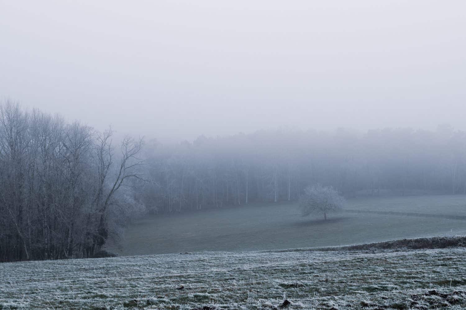
Ice Fog Is Fog Made From Tiny Ice Crystals
Ordinary fog is made primarily of tiny liquid droplets. Get the air cold enough, however, and you can end up with ice fog, a suspension of microscopic ice particles hanging near the surface.
The National Weather Service says true ice fog occurs at extremely low temperatures and is rare when temperatures are warmer than about minus 30 degrees Celsius, or minus 22 degrees Fahrenheit. It is most associated with high latitudes, calm conditions and sources of water vapor. That also makes it very different from the more familiar freezing fog that coats roads and trees with ice.
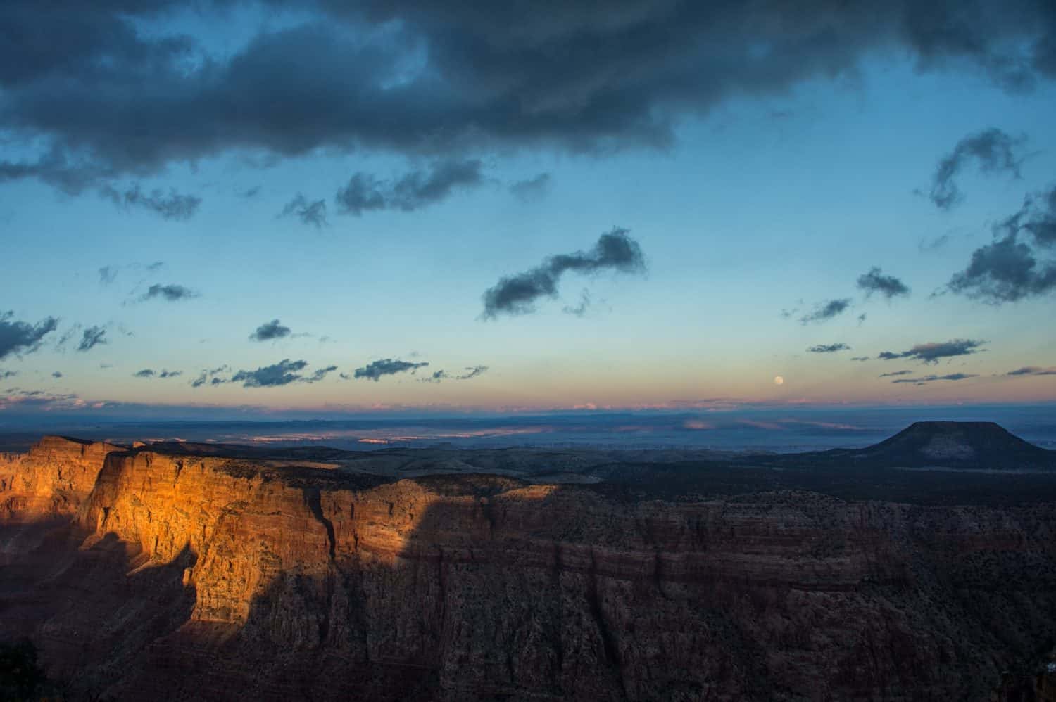
You Can Actually Watch Earth's Shadow Climb Into the Sky
The sunset gets all the attention, but sometimes the more interesting view is directly behind you. Shortly after sunset, look toward the eastern horizon and you may notice a dark blue-gray band slowly climbing upward.
That really is Earth's shadow being projected onto the atmosphere. A pink or reddish band known as the Belt of Venus often sits immediately above it. Before sunrise the effect reverses, appearing in the west. You have probably seen it before without realizing what you were looking at.
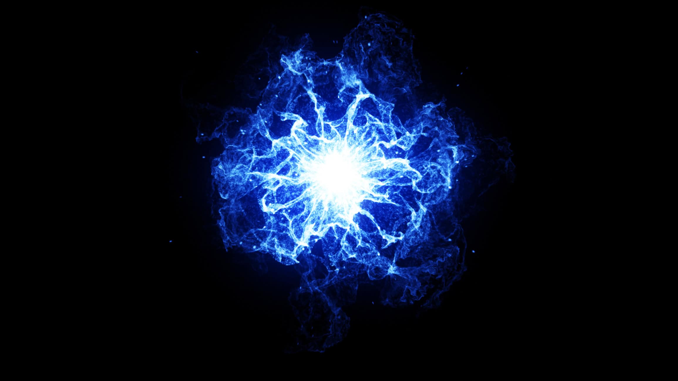
Ball Lightning Is Real Enough to Study, but Still Deeply Mysterious
Reports of glowing balls appearing during or around thunderstorms go back centuries. Witnesses have described luminous spheres that hover or move through the air for seconds, far longer than an ordinary lightning flash.
The catch is that ball lightning is extremely difficult to study. Scientists have proposed a long list of explanations involving plasma, electromagnetic energy, vaporized material and other mechanisms, but there is still no universally accepted explanation that accounts for every credible observation. This is one case where the mystery is very much still alive.
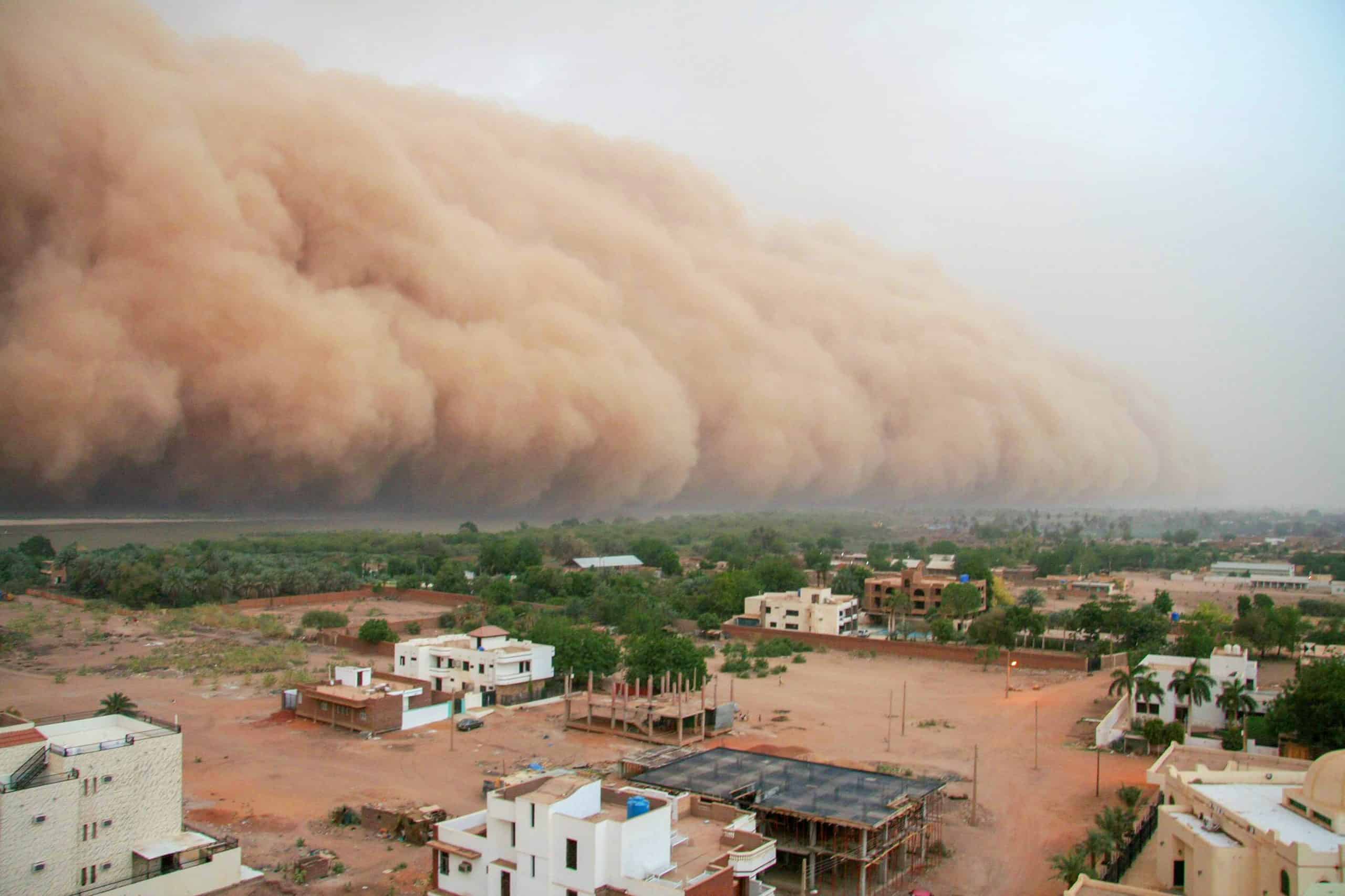
A Haboob Can Turn Daylight Into a Wall of Dust
A haboob is a fast-moving wall of dust driven by strong thunderstorm outflow. As cooler air rushes outward from a storm and hits the ground, it can scoop up huge amounts of loose dust and push it forward like a moving wall.
The most immediate danger is visibility. Conditions on a road can go from perfectly manageable to nearly zero visibility in a remarkably short time. If one is approaching, driving into it to see what happens is about the worst experiment you could try.
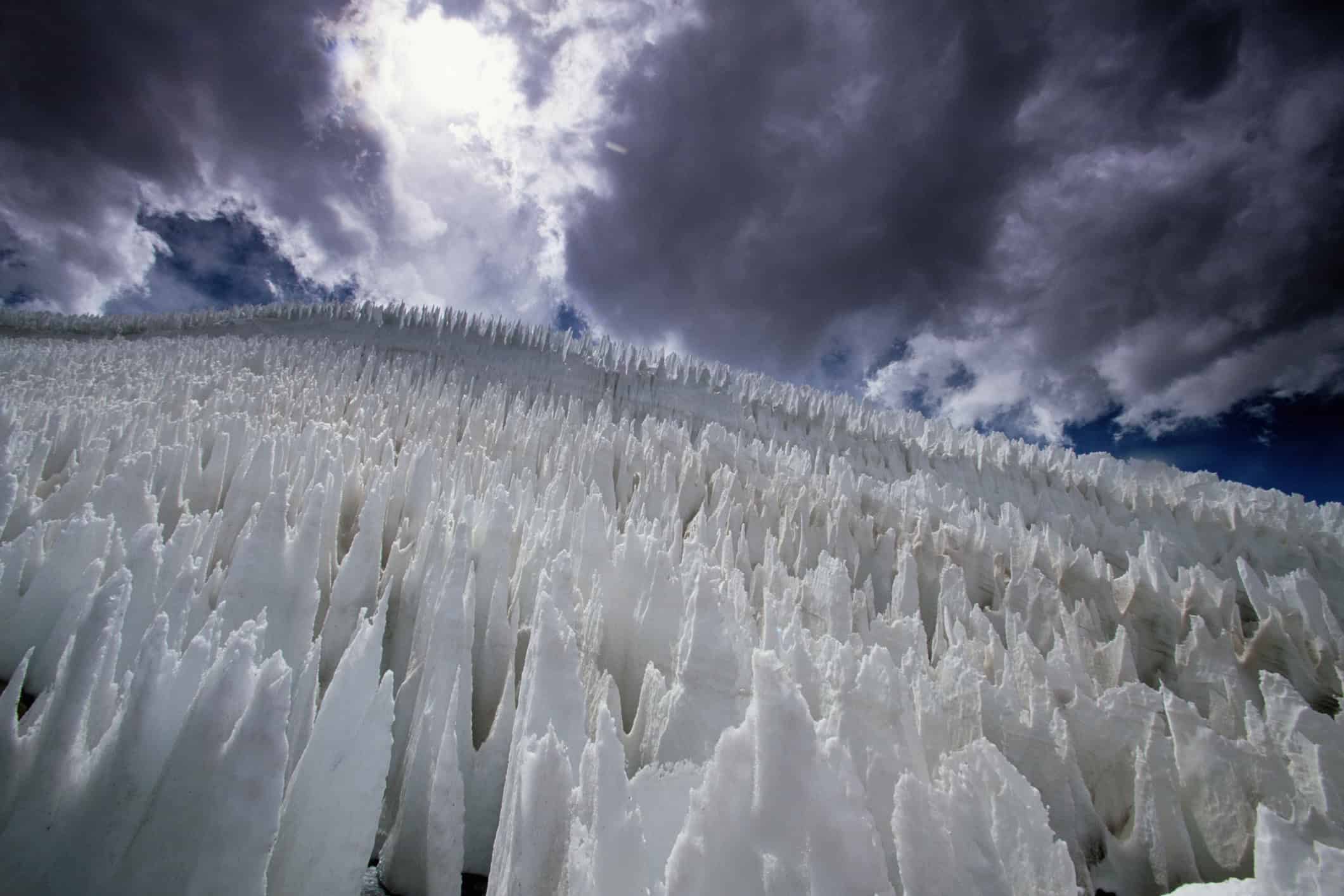
Penitentes Create Entire Fields of Ice Spikes
High in dry mountain environments, snow and ice can gradually turn into fields of sharp blades pointing toward the sun. These formations are known as penitentes, or nieves penitentes.
Instead of simply melting, ice in cold, dry conditions can turn directly into water vapor through sublimation. Sunlight does not remove the surface evenly, so small depressions deepen while the areas between them survive as tall spikes. Some penitentes reach several feet high, turning a mountain slope into something that looks much more like another planet.
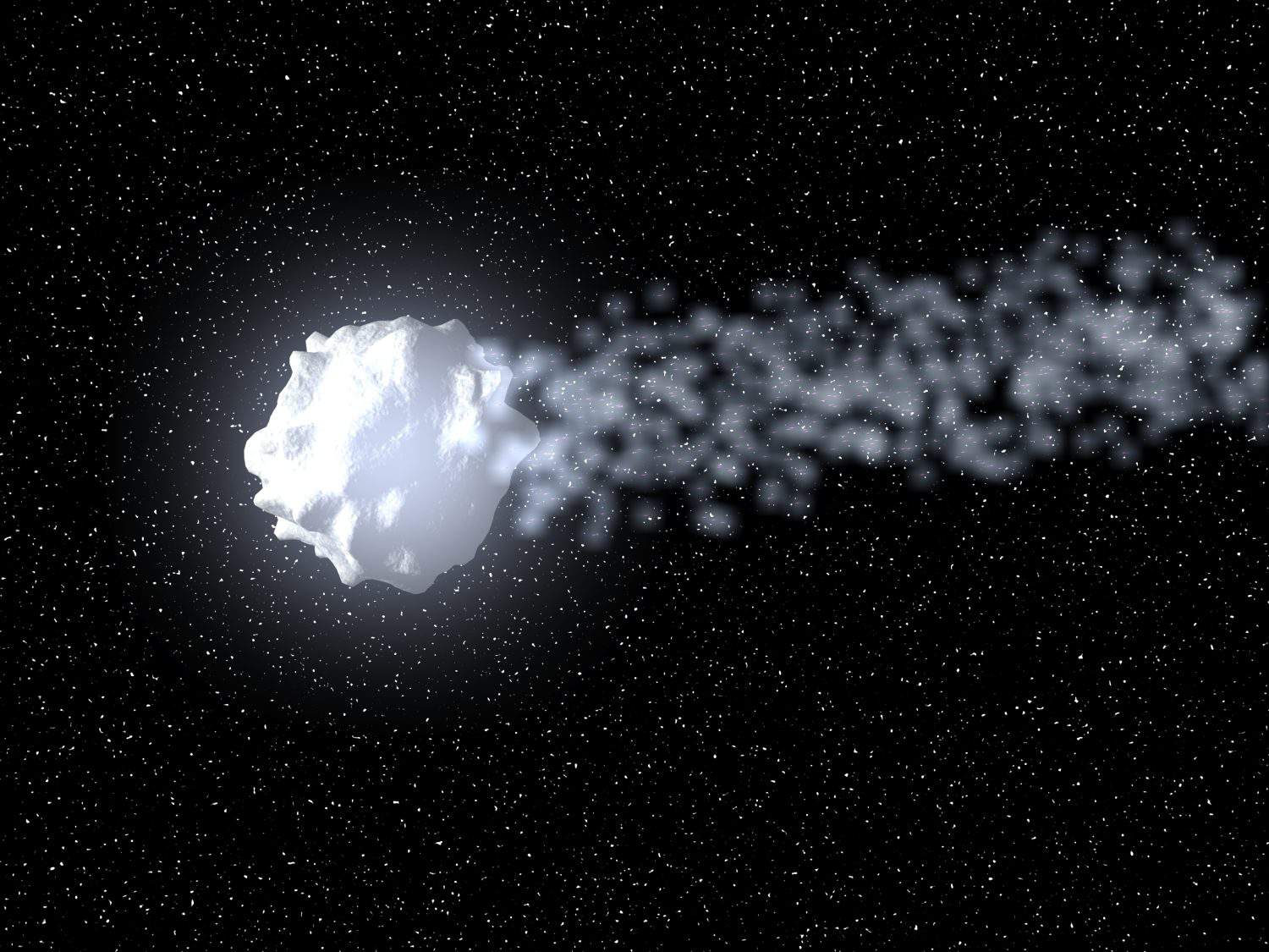
Megacryometeors Are Giant Ice Chunks That Fall Without a Hailstorm
Every so often, an unusually large chunk of ice reportedly falls from a seemingly clear sky. Researchers studying confirmed examples use the term megacryometeor for very large atmospheric ice conglomerations that do not form through the normal thunderstorm process responsible for hail.
Scientists have analyzed recovered specimens and found evidence that at least some formed naturally in the atmosphere, but exactly what atmospheric conditions create them remains an open question. Researchers have explored whether broader atmospheric changes could influence their formation, but there is not enough evidence to simply label megacryometeors a proven consequence or indicator of climate change.
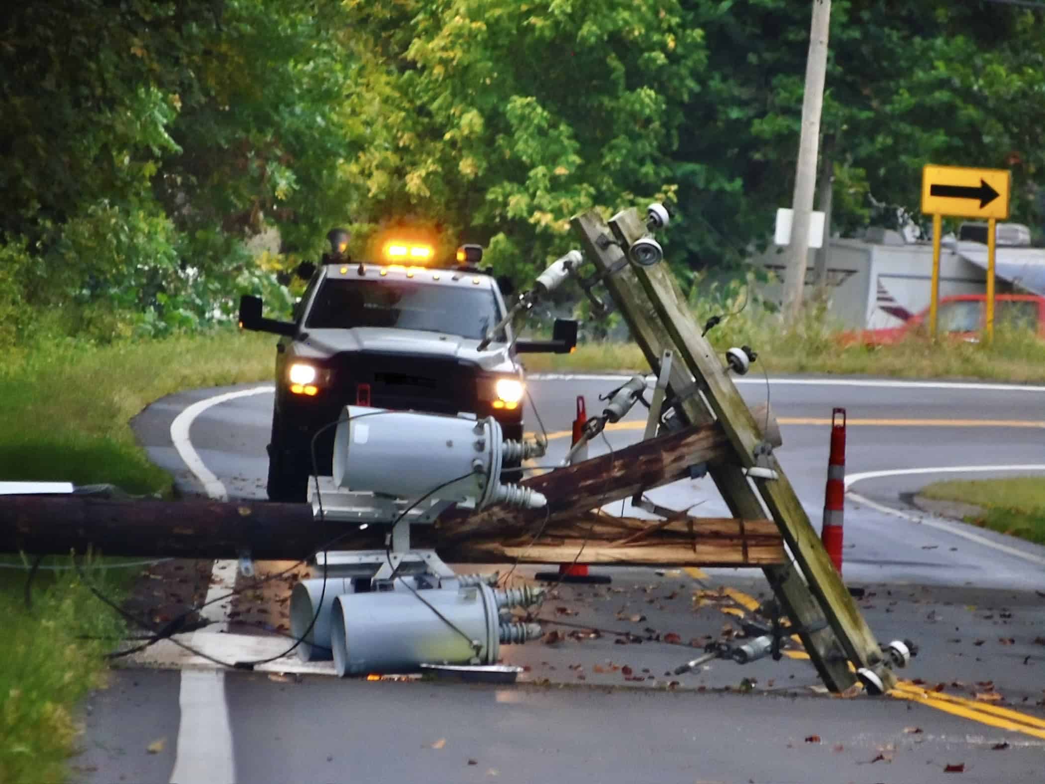
A Power Flash Can Reveal Severe Wind Damage at Night
A power flash is not technically weather, but severe weather can cause one. When strong winds or falling debris damage electrical lines, transformers or other equipment, the resulting electrical arc can produce an intense blue, green or white flash near the ground.
That location is an important clue. Lightning generally appears to connect the clouds, air and ground, while repeated bright flashes right near ground level during a violent storm can indicate electrical infrastructure being damaged. National Weather Service tornado guidance even lists ground-level power flashes as one possible nighttime clue that extremely strong winds are nearby.
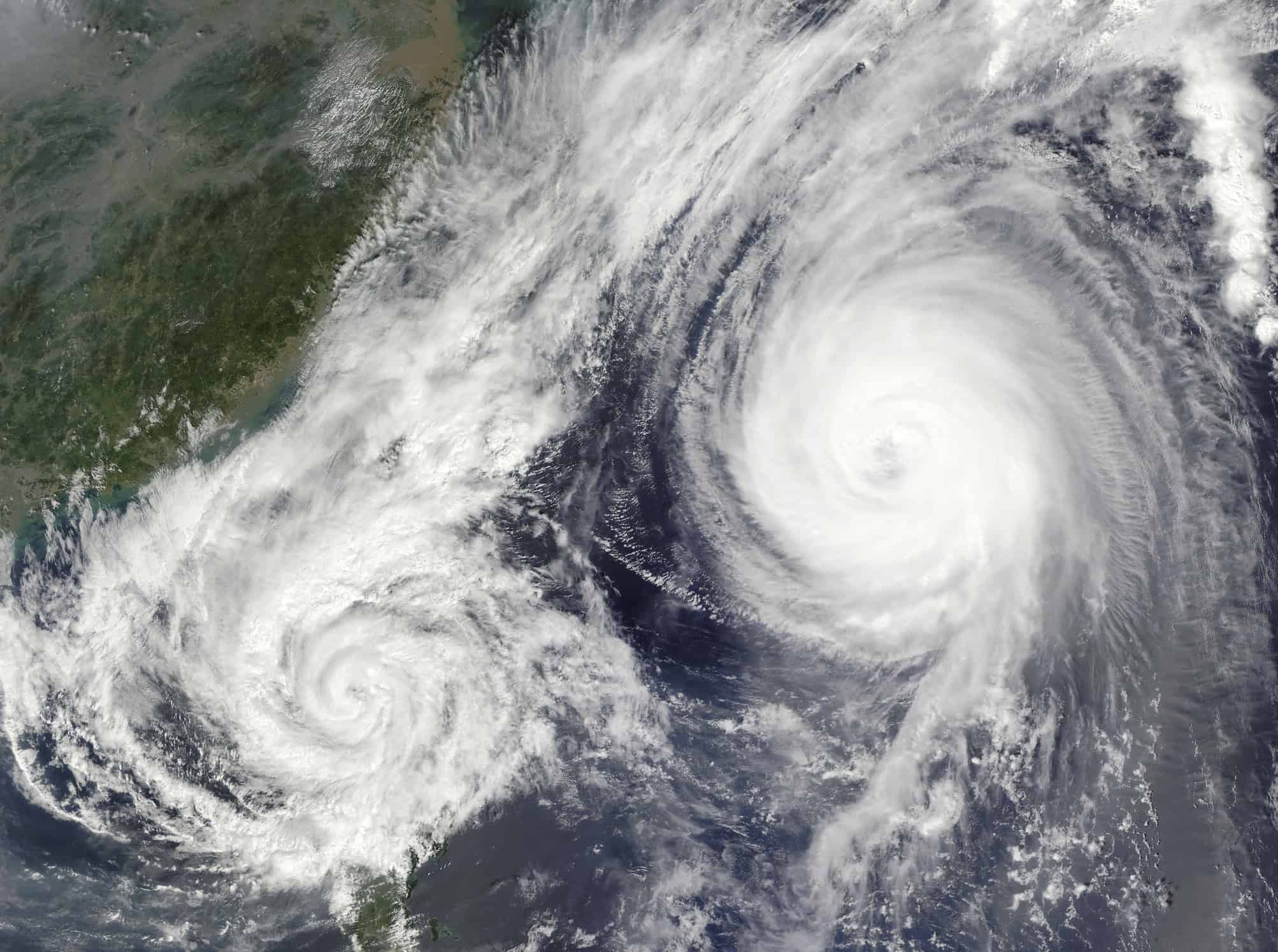
The Fujiwhara Effect Makes Tropical Cyclones Orbit Each Other
Put two tropical cyclones close enough together and they can begin influencing each other's movement. That interaction is called the Fujiwhara effect.
Rather than their centers simply crashing together, the storms begin rotating around a shared midpoint. What happens next depends heavily on their sizes, strengths and surrounding weather pattern. A smaller cyclone may orbit a larger one, two storms may merge, or they can rotate around each other for a time and eventually separate. Watching the interaction on satellite imagery really does look like a slow atmospheric dance.
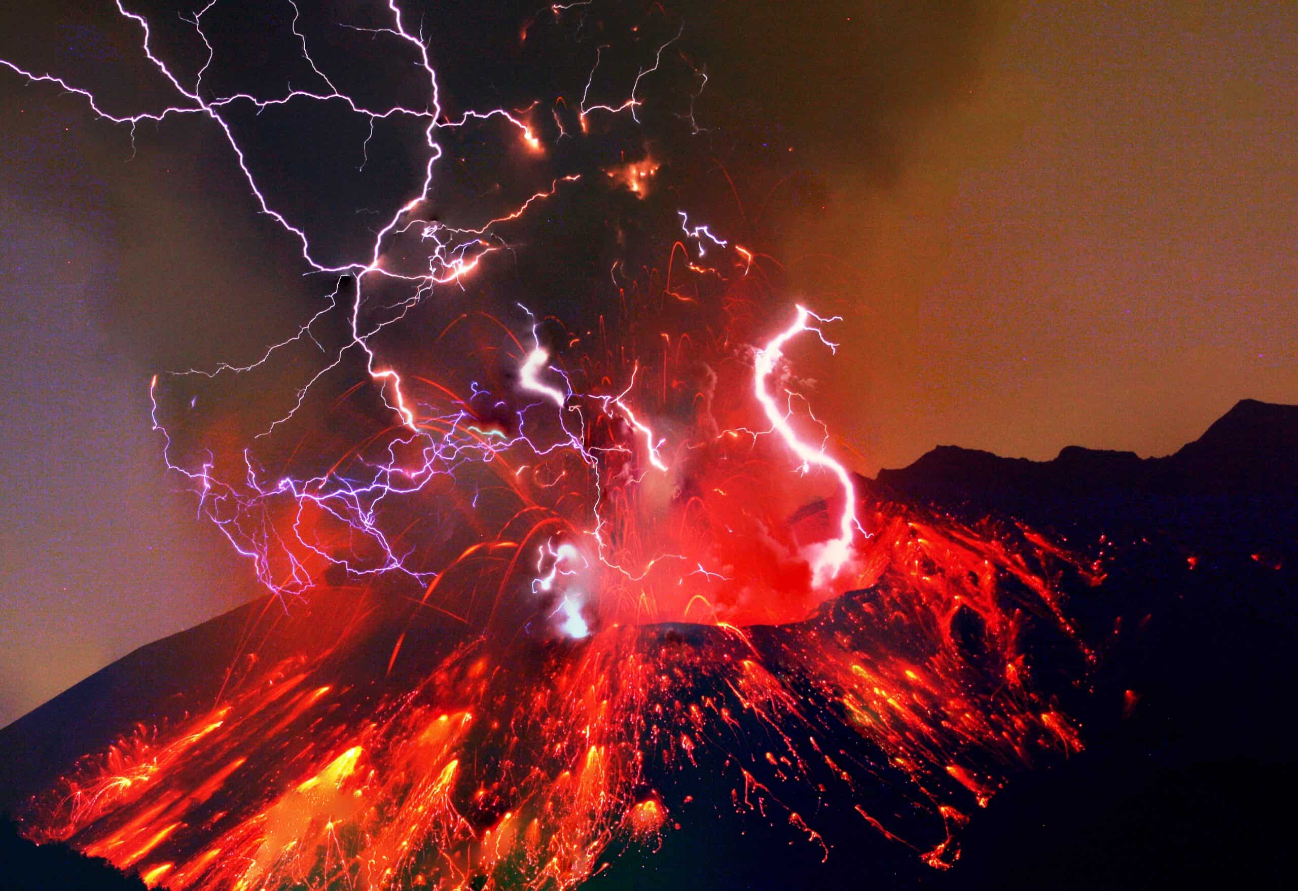
Volcanoes Can Generate Their Own Lightning
An explosive volcanic eruption is already dramatic enough before lightning starts flashing through the ash cloud. Yet volcanic lightning is a well-documented part of some major eruptions.
As ash and other particles collide, separate and move through an eruption plume, electrical charges can build up. Ice formation higher in a tall plume can add another charging mechanism similar to what happens inside a thunderstorm. Eventually the electrical imbalance becomes large enough for a discharge, producing lightning through a cloud that is already filled with volcanic ash.