Kenzos/Shutterstock.com
Altairisfar (Jeffrey Reed) / BY-SA 3.0
James St. John / BY 2.0
M McBey / BY 2.0
NevinThompson / BY-SA 4.0

Adam Jones, Ph.D. - Global Photo Archive / BY 2.0

Jeffrey Beall / BY 4.0

KFD129 / BY-SA 3.0
roy.luck / BY 2.0
TravelingOtter / BY-SA 2.0

Northfielder / BY 2.0
polkbritton / PDM 1.0

amanderson2 / BY 2.0

jaygannett / BY-SA 2.0
Ken Lund / BY-SA 2.0

Andrew Balet / BY 3.0

Wrangell-St. Elias National Park / BY-SA 2.0






16 American Towns That Boomed, Busted, or Changed Forever
American towns rarely disappear for one reason. A mine closes. A railroad changes the way it operates. A highway gets rerouted. A flood hits at exactly the wrong time. In a few places, the ground itself becomes the problem. The result can be a town that empties almost overnight, or one that survives as a much smaller version of what it used to be.
These 16 places do not all fit the same definition of a ghost town, and a few are still very much alive. What they share is a dramatic break between what they were built to do and what happened next. Some were mining communities that lost their economic reason for existing. Others were bypassed, contaminated, partially demolished, or simply overshadowed by a larger city nearby.
Taken together, they make a strange little map of American boom, bust, and survival. Here is what actually happened in each place, and what is still there now.
Cahaba, Alabama
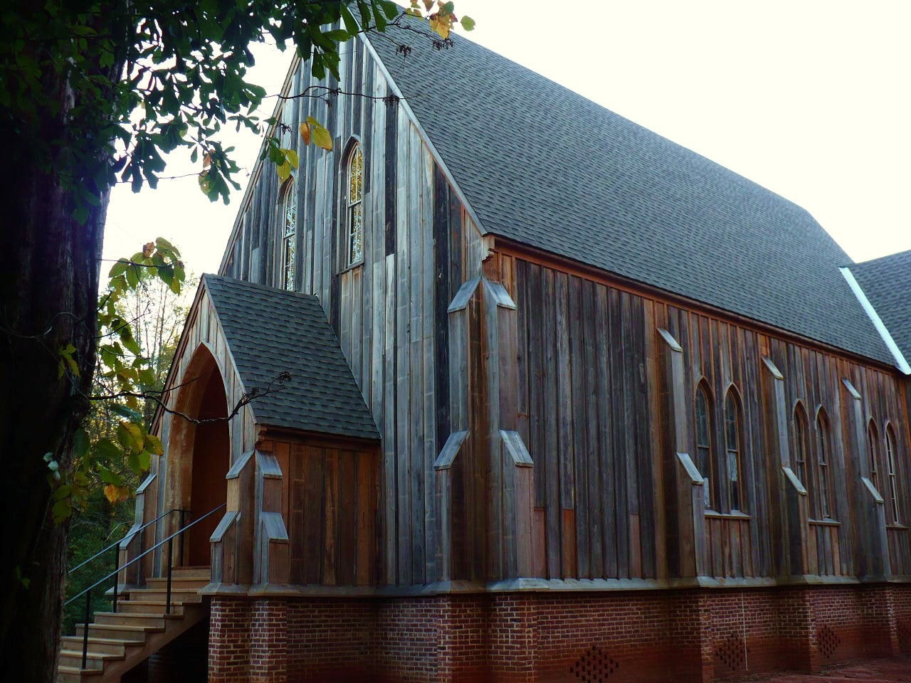
Cahaba served as Alabama's first permanent state capital from 1819 to 1826. Opponents used flooding and health concerns to argue for moving the capital to Tuscaloosa, although the Alabama Historical Commission says those fears were greatly exaggerated. Cahaba nearly emptied after the move, then rebounded as a cotton-shipping center on the Alabama River and had more than 3,000 residents on the eve of the Civil War. The harder break came later: the war disrupted the railroad, a major flood struck in 1865, and the Dallas County seat moved to Selma in 1866. Businesses and families followed. Today, Old Cahawba Archaeological Park preserves the townsite, including ruins, foundations, cemeteries, and historic St. Luke's Church. It is less a town frozen in time than a city whose layers are still being uncovered.
Centralia, Pennsylvania
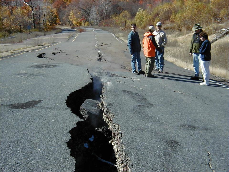
Centralia is the Pennsylvania coal town most people know through its underground fire, and it also became a real-world reference for the 2006 film adaptation of Silent Hill, though not for the original video game. The mine fire began in May 1962 and proved extraordinarily difficult to control. As the dangers from subsidence and noxious gases became clearer, Congress funded a large voluntary relocation program in 1984; by the early 1990s, hundreds of homes and businesses had been acquired. Pennsylvania still monitors the fire, and the 2020 census counted just five residents. Centralia is not quite the smoking, cracked-road spectacle it is sometimes made out to be, but the underlying problem is very real: a town of roughly 1,100 people in 1962 was reduced to a tiny remnant by a fire that never stopped being a public-safety problem.
Bodie, California
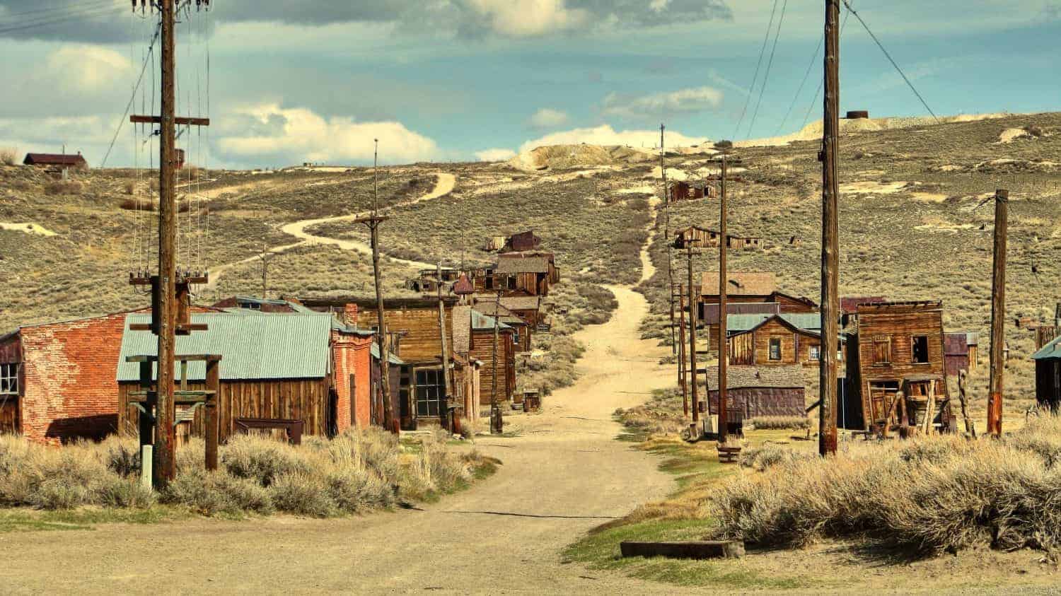
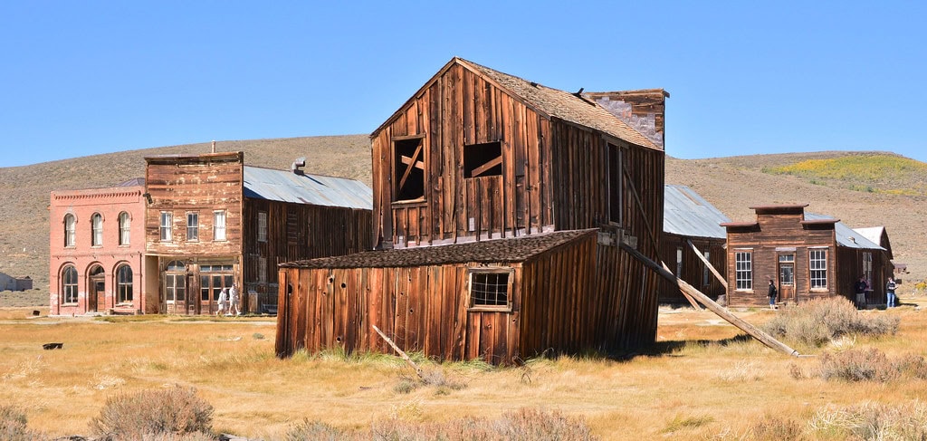
Bodie's gold story began in 1859, when W.S. Bodey and companions found gold north of Mono Lake. The real boom came later, after a rich strike in the mid-1870s turned a tiny camp into a town of thousands. California State Parks says Bodie may have held 8,000 to 10,000 people at its height. The bust began in the early 1880s, and fires in 1892 and 1932 destroyed much of what was left. Mining officially ended in 1942, but Bodie was never quite as empty as the legend suggests. Caretakers remained until it became a state historic park in 1962, and park staff still live and work there. What visitors see now is intentionally preserved in a state of "arrested decay," with buildings stabilized rather than restored to look new and many interiors still holding furnishings and goods. It is about as close as California gets to a boomtown hitting pause.
Picher, Oklahoma
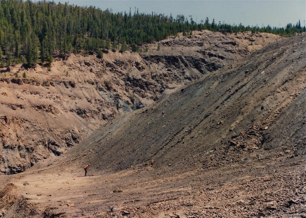
Picher grew out of one of the richest lead-and-zinc districts in the country after a major ore discovery in 1914. The boom left an ugly inheritance: enormous piles of mine waste known as chat, contaminated soil and water, and underground workings that created long-term cave-in risks. EPA records show mining peaked in the 1920s and largely faded by the late 1950s, but the environmental problems stayed put. Then a tornado heavily damaged Picher in May 2008, piling a natural disaster onto an existing public-health crisis. From 2009 to 2012, government-backed buyouts, demolitions, and relocations emptied most of the community, and Picher was eventually dissolved as a municipality. Cleanup at the Tar Creek Superfund site is still ongoing. The giant waste piles remain the most visible reminder of the industry that built the town and helped make it unlivable.
Thurmond, West Virginia
Thurmond was a railroad town in the most literal sense. In the early 1900s, coal pouring out of the New River Gorge made it one of the Chesapeake & Ohio Railway's most important revenue centers, and tens of thousands of passengers passed through its depot each year. The decline came in layers: the Great Depression hurt local businesses, automobiles pulled travelers off the rails, nearby mines closed, and the switch from steam to diesel locomotives wiped out much of the service work Thurmond had been built around. The 2020 census counted only five residents, but the town is still incorporated. The National Park Service maintains more than 20 historic structures there, the restored depot operates as a seasonal visitor center, and Amtrak still treats Thurmond as a flag stop. Tiny, yes. Dead, not quite.
Gilman, Colorado
Perched above the Eagle River, Gilman was the company town tied to the Eagle Mine, where gold and silver mining began in the late 1800s and zinc later became a major focus. Most mining activity stopped in 1977, with some copper and silver production continuing until the mine finally closed in 1984. Workers moved out, and in 1985 Eagle County's environmental health officer ordered the last 14 families to leave because of potential health hazards. The wider Eagle Mine area was placed on the federal Superfund list in 1986. Gilman's buildings are still there, but this is not an open ghost town you can casually wander through: access is restricted, and contaminated soil, water, and mine waste remain part of the site's long-term cleanup.
Kennett, Missouri
Kennett is the big outlier on this list because it is not remotely a ghost town. The city remains the seat of Dunklin County and an important agricultural center in Missouri's Bootheel. Its growth was tied closely to the huge drainage projects that transformed southeast Missouri's swamps into productive farmland in the early 20th century, helping make crops including cotton, soybeans, rice, and corn central to the regional economy. Kennett has lost population, but not on a ghost-town scale: the Census Bureau estimated 10,118 residents in 2025, down from 10,932 in 2010. That is a real decline, but it is a very different story from Centralia or Picher. Kennett belongs here as an example of how once-dominant local economies change over time, not because the town itself has nearly disappeared.
Cobalt, Idaho
Cobalt was not an old frontier camp that happened to share a name with a mineral. It was a company town built by Howe Sound Company in the 1940s to house workers serving the nearby Blackbird Mine. During the 1950s, the district became a major domestic source of cobalt as well as copper and gold. The Calera Mine shut down in 1960 after a federal contract to purchase cobalt ended, while mining elsewhere at Blackbird continued intermittently until 1982. Company-owned buildings in Cobalt were later sold or disposed of, and EPA documents now describe the former townsite as having no permanent residents. The neighboring Blackbird Mine remains under long-term environmental cleanup and monitoring. In Cobalt's case, the town did not fade because the ore simply vanished; it faded because the company town and the government demand supporting it did.
Buford, Wyoming
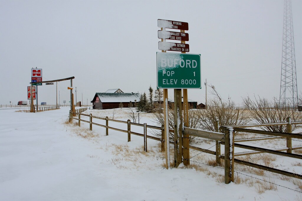
Buford's "smallest town in America" reputation came with an asterisk: it was never an incorporated municipality. The unincorporated settlement traces its roots to the transcontinental railroad era and was once far larger than the one-person curiosity it later became. By 2012, Don Sammons was the lone resident and owner of the roughly 10-acre roadside property along Interstate 80. He auctioned it that year for $900,000 to a buyer from Vietnam. A year later, the new owner rebranded the site as PhinDeli Town Buford and used its convenience store to launch a Vietnamese coffee business. So the coffee idea was not some vague future plan; it actually happened. Buford is better understood as a privately owned roadside place with an oversized legend than as a conventional town that simply dwindled to one person.
Cahokia, Illinois
Cahokia is in a completely different category from the mining and railroad towns here. This was a major Indigenous city centuries before the United States existed, near present-day Collinsville and St. Louis. UNESCO estimates that 10,000 to 20,000 people lived at Cahokia at its peak between roughly 1050 and 1150, making it the largest pre-Columbian settlement north of Mexico. The city began declining after 1200 and had been abandoned by around 1400. Archaeologists still debate why; there is no single accepted explanation, and no written record left by Cahokia's residents to settle the question for us. Today, Cahokia Mounds is a UNESCO World Heritage Site, with surviving earthworks including the enormous Monks Mound. Calling it a ghost town is a little crude, but the scale is still startling: this was once one of the largest population centers in North America.
Copperhill, Tennessee
Copperhill sits on the Tennessee-Georgia line in a district where copper mining, processing, and chemical manufacturing reshaped the landscape for more than a century. The environmental damage was severe: Tennessee regulators describe large areas left barren and badly eroded, with huge volumes of soil and mine waste carried into the Ocoee River watershed. Mining ended in 1987 and chemical production in 2000, but cleanup and revegetation work have continued for decades. Copperhill itself never became a true ghost town. The 2020 census counted 443 residents, and the community still exists alongside a landscape that is visibly greener than it was during the industry's worst years. The striking part of Copperhill's story is not that everyone left; it is that a small town survived while the land around it had to be repaired.
Lowell, Arizona
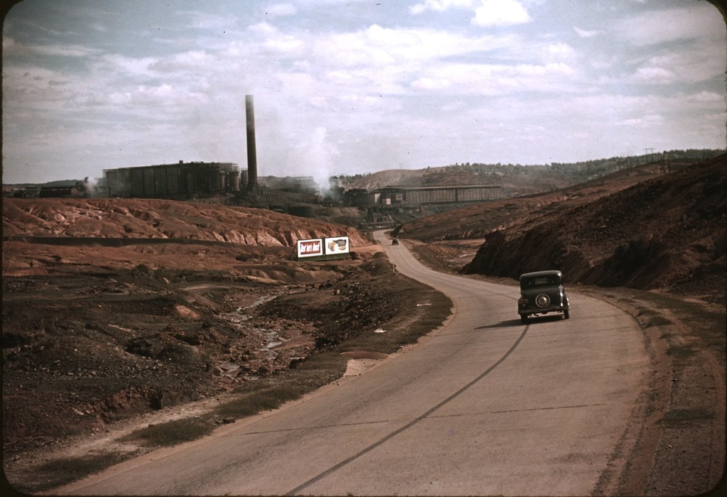
Lowell is no longer a separate town; it is a neighborhood within Bisbee. In the early 1900s, though, it was a busy part of the Warren Mining District, with homes and businesses built around the copper industry. The biggest change came in the 1950s, when expansion of the Lavender Pit open-pit mine consumed most of the old townsite. A historic district nomination for Bisbee says about 250 houses were relocated as the pit grew. What survived is centered on Erie Street, where vintage signs, storefronts, old gas pumps, and parked classic cars create the deliberately time-warped look visitors know today. Lowell is not abandoned, and there are still residents and businesses, but much of the original community quite literally disappeared into the mine. That is a stranger fate than simply being left behind.
Glenrio, Texas/New Mexico
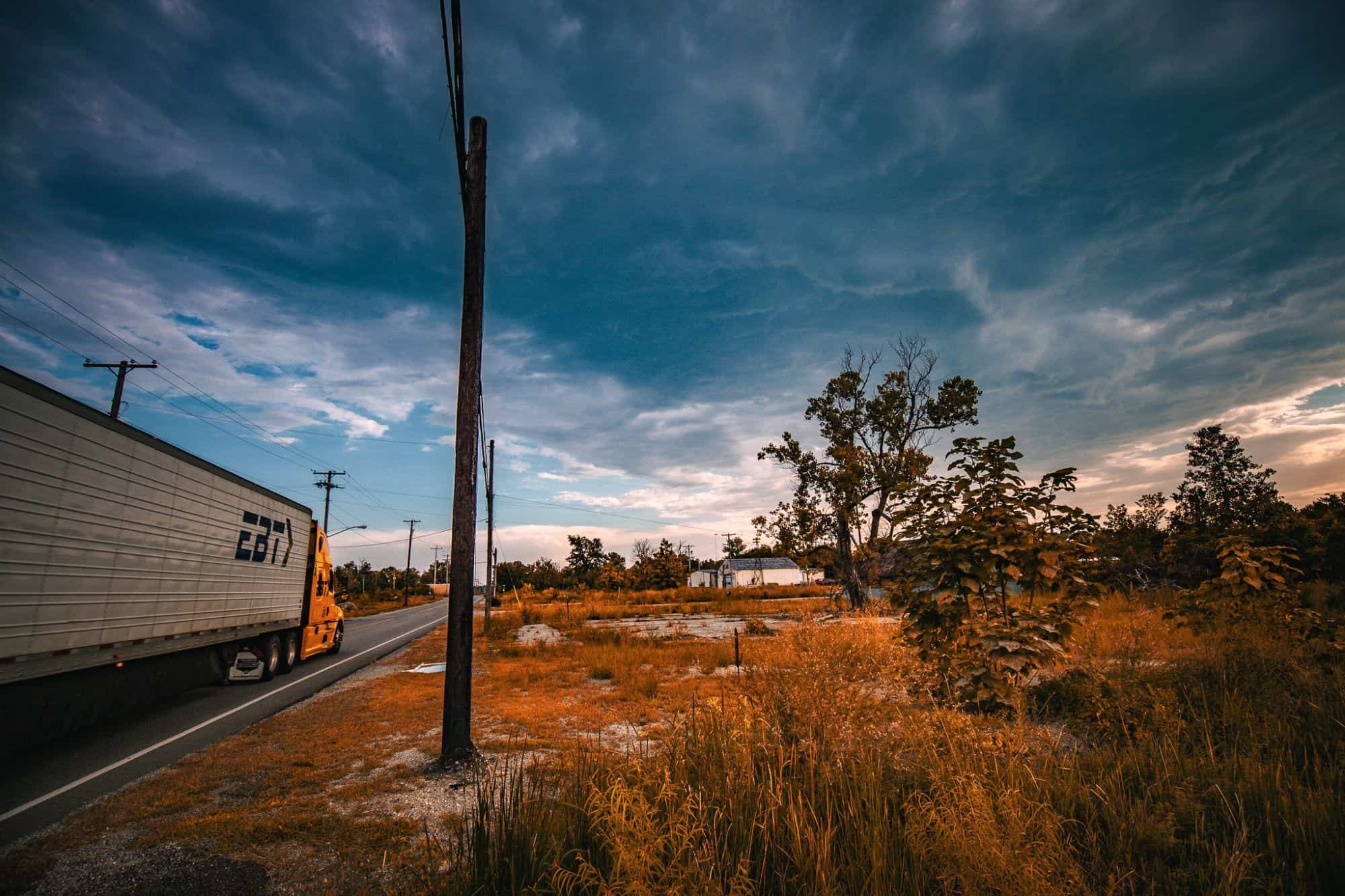
Glenrio straddles the Texas-New Mexico line, and its entire life story is basically a transportation map. It began as a Rock Island Railroad stop, then found a second act when Route 66 brought motorists past diners, gas stations, bars, and motels. That traffic vanished in 1975 when Interstate 40 bypassed the community. Businesses closed, residents left, and Glenrio became one of the better-preserved reminders of what the interstate system did to some Route 66 towns. The National Park Service says the historic district still contains 17 abandoned buildings, while only two buildings are occupied. You can still pick out landmarks such as the Little Juarez Diner and the State Line Motel sign. Glenrio did not lose its natural resource or suffer a disaster. The road simply moved, and the town's reason for existing moved with it.
Rhyolite, Nevada
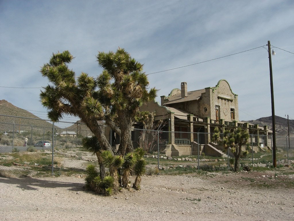
Rhyolite exploded into existence after Frank "Shorty" Harris and E.L. Cross found gold in the Bullfrog district in 1904. Within a few years, the desert settlement had thousands of residents, electric power, telephone service, banks, and a frankly ridiculous number of saloons for a place that had barely existed. Then the financial panic of 1907 hit, investment dried up, and the mines began closing. By 1910, only 611 residents remained; the Montgomery Shoshone mine shut down the following year, and the town's power was switched off in 1916. Rhyolite is now one of Nevada's most photogenic ghost towns, with portions of the three-story bank, the railroad depot, the jail, and the famous bottle house still standing. The boom lasted barely a decade. The ruins have had a much longer career.
Ste. Genevieve, Missouri
Ste. Genevieve is another place where the original ghost-town premise falls apart. Founded around 1750, it was the first permanent European settlement in what is now Missouri and an important French colonial community on the Mississippi. After a major flood in 1785, residents gradually moved the village to higher ground. St. Louis later outgrew Ste. Genevieve as the region's economic center, but Ste. Genevieve itself did not fade away. The Census Bureau estimated 5,065 residents in 2025, more than it had in 2010. What makes the city remarkable today is preservation, not abandonment. The National Park Service says Ste. Genevieve and its historic district contain the largest surviving collection of French vernacular vertical-log buildings in the United States. This one belongs in a story about places that changed, not places that emptied.
Kennecott, Alaska
Kennecott was the mill town for one of the richest high-grade copper deposits in the American West. Mining operations ran from 1901 to 1938, with ore moving out by rail beginning in 1911. By the late 1920s, the best ore was becoming harder to find, while costs, including maintaining the remote railroad, kept rising. The company shut the operation down in 1938, and much of the equipment and many everyday objects were left behind. Kennecott was designated a National Historic Landmark in 1986, and the National Park Service acquired many of its major buildings and surrounding lands in 1998. Getting there is still part of the experience: the McCarthy Road is a long gravel drive, public vehicles stop near the Kennicott River, and visitors continue the last five miles by shuttle, bike, or on foot. Remote, yes. Accidentally preserved, not anymore.