Juan Pablo Bayona Galvis / iStock via Getty Images
Evgenia Gordienko / iStock via Getty Images
Lost_in_the_Midwest / Shutterstock.com
George Trumpeter / Shutterstock.com
Juan Pablo Bayona Galvis / iStock via Getty Images
ajansen / iStock via Getty Images
Dawid Liebthal / 500px / 500px via Getty Images
Jason Persoff Stormdoctor / Image Source via Getty Images

Listy Dwi / Shutterstock.com
z1b / iStock via Getty Images
PrabhatK / Shutterstock.com
Michael Ransburg / Shutterstock.com
koto_feja / E+ via Getty Images
Did'pics / Shutterstock.com
© 2014 Yoann JEZEQUEL / Moment Open via Getty Images
JordiStock / iStock via Getty Images
mdesigner125 / iStock via Getty Images
2018 Getty Images / Getty Images News via Getty Images
samuel howell / iStock via Getty Images
Vladlen Tian / iStock via Getty Images
mdesigner125 / iStock via Getty Images
Terri Attridge Photo / Shutterstock.com
Jason Edwards / The Image Bank via Getty Images
Art Wolfe / Stockbyte via Getty Images
Stocktrek Images / Stocktrek Images via Getty Images
© mike lyvers / Moment via Getty Images


25 Unbelievably Real Weather Phenomena That Belong In a Sci-Fi Movie
The world is still an unimaginable place, full of wonder and unbelievable happenings. This is especially true when we contemplate weather and atmospheric phenomena around the world. The weather can be truly unpredictable and shocking, so much so that we may not even understand fully what's happening as it happens.
At times, places or pictures affected by weather can appear so amazing that they are almost unimaginable.Some weather phenomena cause you to stare in wonder, in awe of the beauty you see. Others are so extreme that you are content never experiencing them in real life.
To compile this list of bizarre weather events you didn't know were real, 24/7 Tempo reviewed a few sites, including the National Weather Service, which highlights weird weather events and lists an explanation for each.
This post was updated on August 11th, 2025, to reflect additional information.
Frost Quake
This weather phenomenon is also called cryoseism. It's a loud event with booming sounds emanating from the ground. The reason for this is a drop in temperature. Water in the ground freezes so rapidly that the rock and soil fracture. These events produce vibrations and are often mistaken for true seismic events.
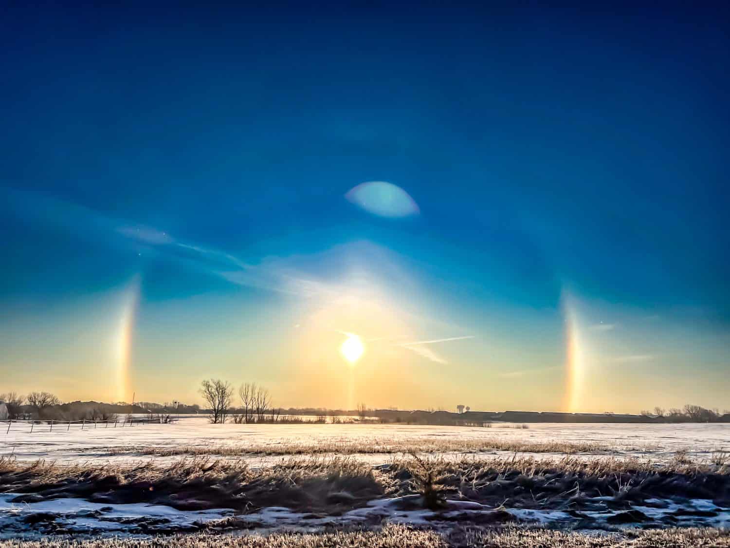
Sun Dog
The name of this weather event alone makes it unforgettable. But if you witness a sun dog, you'll be mesmerized. It's a large halo that forms around the sun, only the brightest spots are on either side. At first glance, it may look like there are three suns but upon closer inspection, you can see the halo-shaped ring. It occurs when the sun is angled high, the weather is cold, and there is a presence of light cirrus clouds.
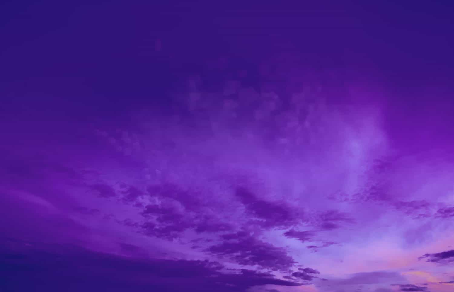
Purple Rain
If you live in an environment with high pollen counts, you've likely witnessed purple rain. To spot it, it has to be raining. When it occurs, you can look at the sky and see a purple glow. This happens when those airborne bits like pollen mix in with the rain. The result is a strikingly beautiful purple hue.
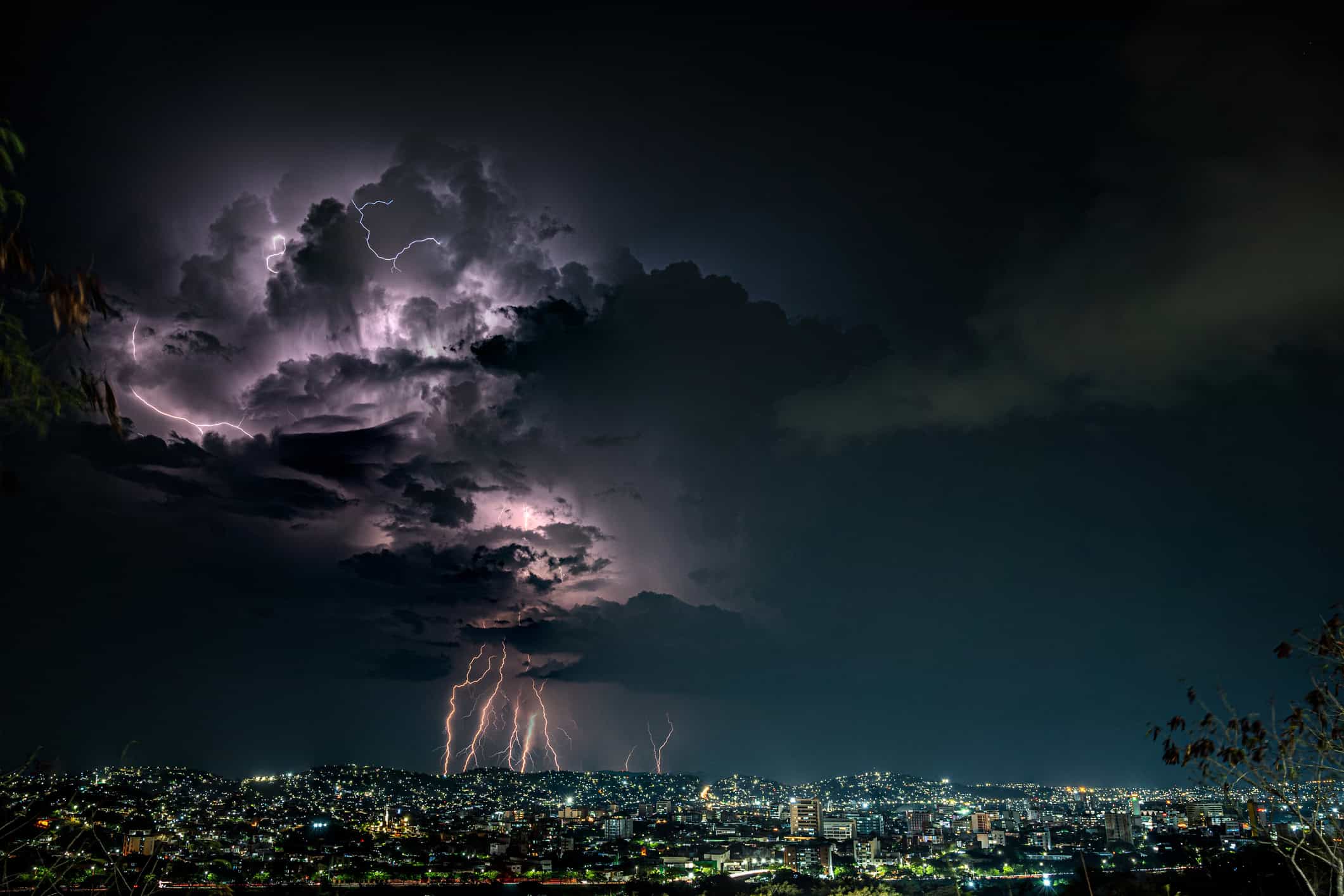
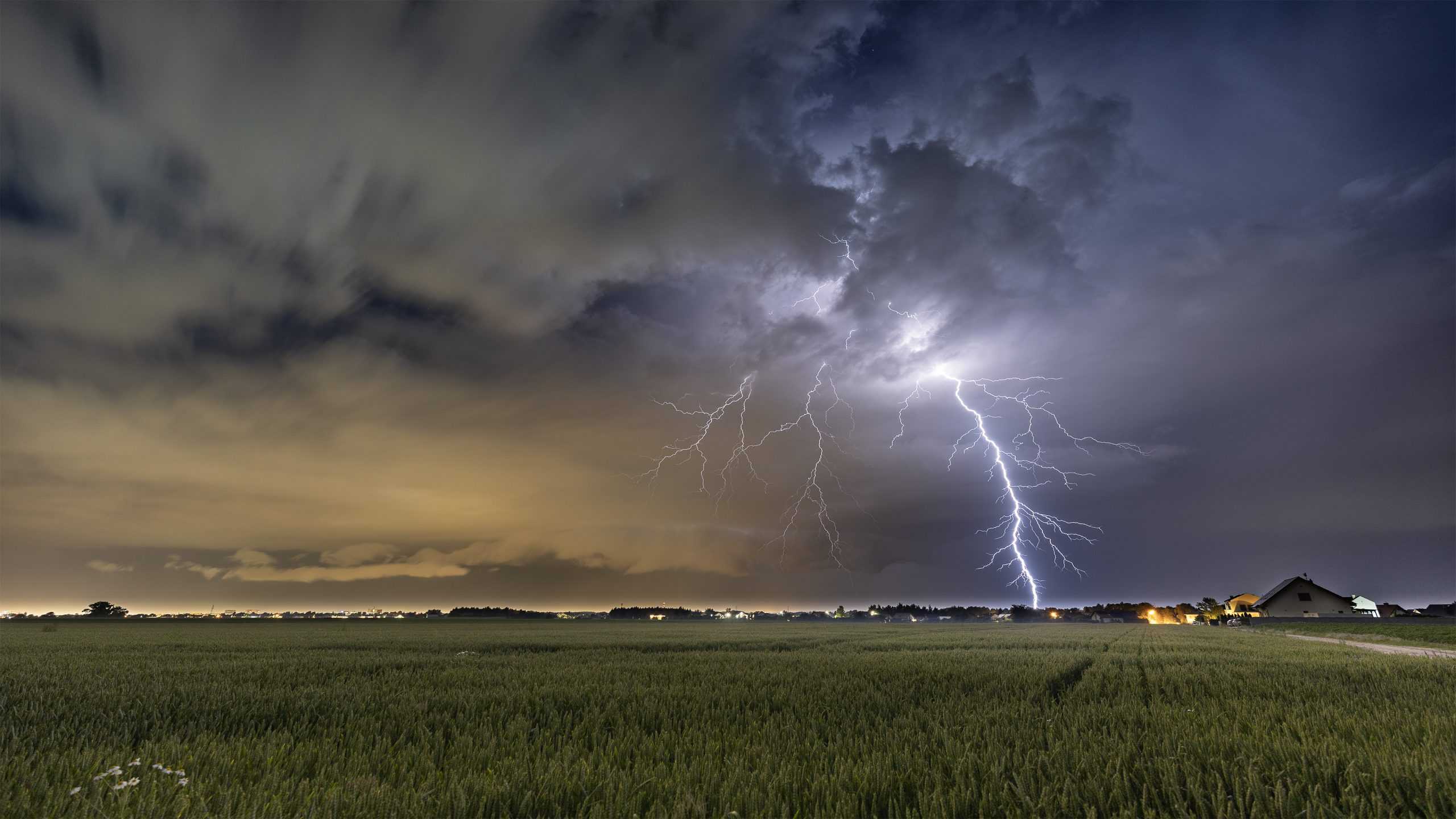
Catatumbo Lightning
This type of lightning is restricted to a specific location: The Catatumbo River where it empties into Lake Maracaibo in Venezuela. It's a unique phenomenon where lightning persists up to 160 nights each year, nearing 300 strikes per hour. It's known as the location that receives the most lightning strikes worldwide. The lightning frequency changes from year to year.
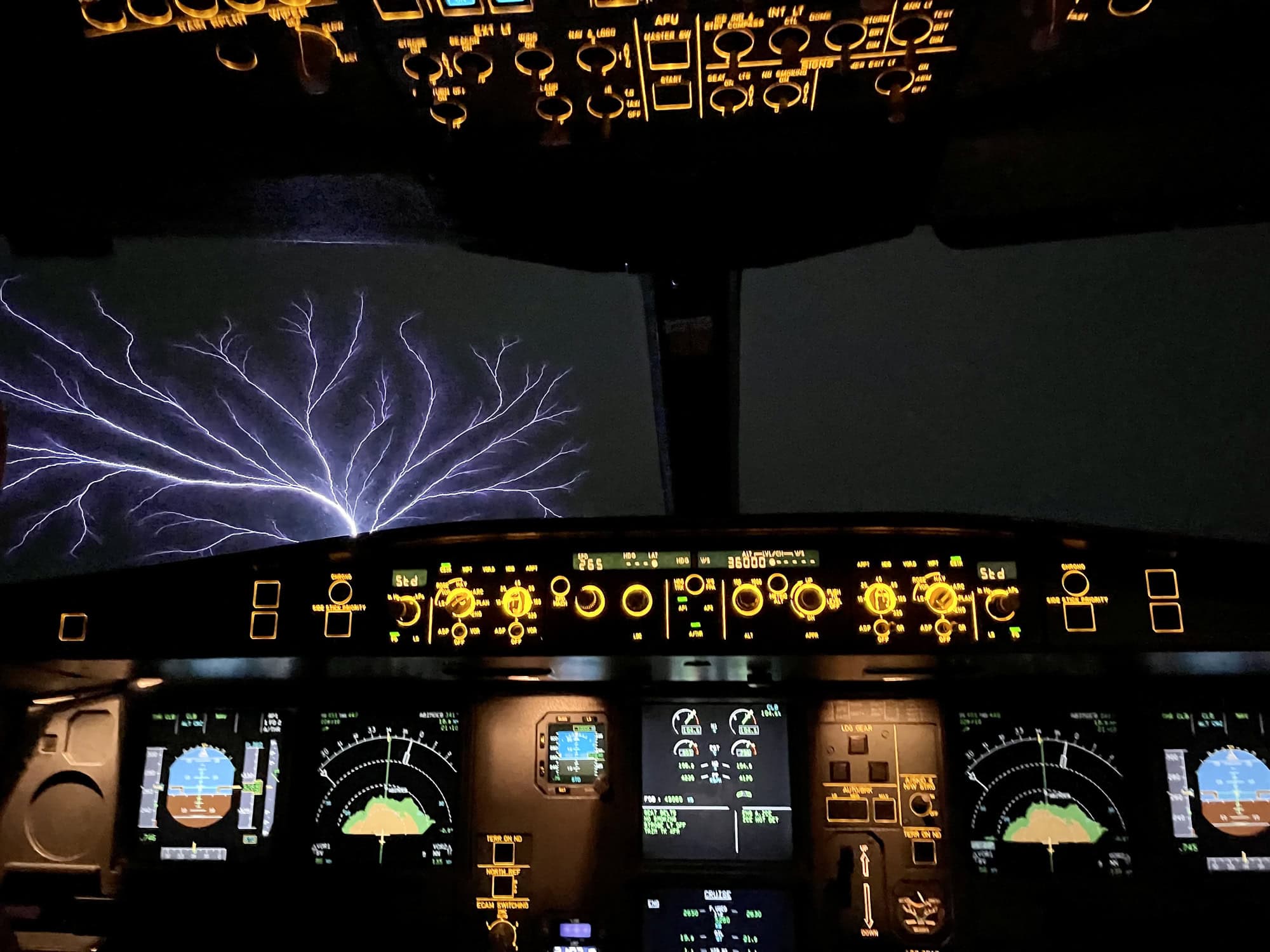
St. Elmo's Fire
With St. Elmo's Fire, you enjoy a feast for the eyes. But it can be scary if you witness it and don't know what it is. You may be flying high in an airplane, settled into your window seat (or the cockpit, as pictured), and watching a thunderstorm in the sky. Suddenly, you notice a blue or violet glow at the tip of the airplane's wing. That is St. Elmo's Fire – an electrical discharge that lights up with a blue or violet hue on pointed objects.
Heat Burst
A heat burst is a rare weather phenomenon. For this to occur, the humidity needs to drop and the temperature needs to increase. These conditions are typically seen at the tail end of thunderstorms when they've lost their power. Additionally, this tends to occur mostly at night. Winds pick up, you feel the sudden increase in heat, and a drop in surface dewpoint.
Kelvin-Helmholtz Clouds
This is a type of cloud that looks a lot like ocean waves. It's a rare occurrence and requires two air streams that cause a vertical shear. The result is fast winds in the top section and slower winds in the lower section. These rare cloud types were named after the physicists who spent their time studying chaotic and uncontrolled airflow.
Petrichor
You may not know the word but you know the experience of breathing in a sweet, earthy scent after rainfall. It's distinctive and unmistakable. Many find the scent pleasant. That's Petrichor. This occurs because the water from the rain and other compounds like plant oils combine to tantalize your senses. The term was coined in 1964 by Australian scientists.
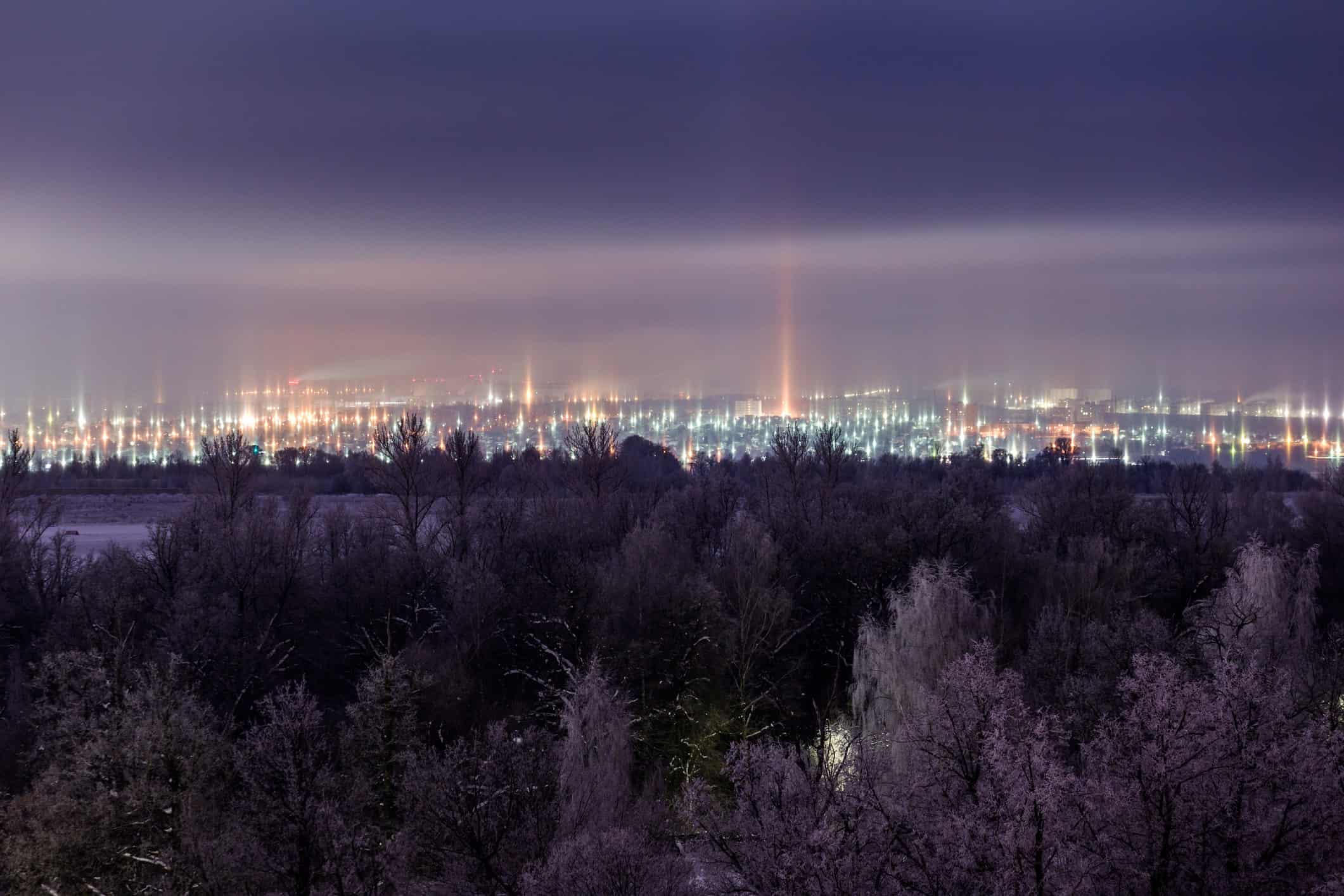
Light Pillar
This is an optical phenomenon that lights up the sky in vertical, pillar-like sheets. The light may be artificial, emanating from Earth or it may be the light emanating from the sun or the moon. This occurs because ice crystals reflect the light. Since it's a reflection, the colors that extend into the sky are the same as the colors from the original light source.
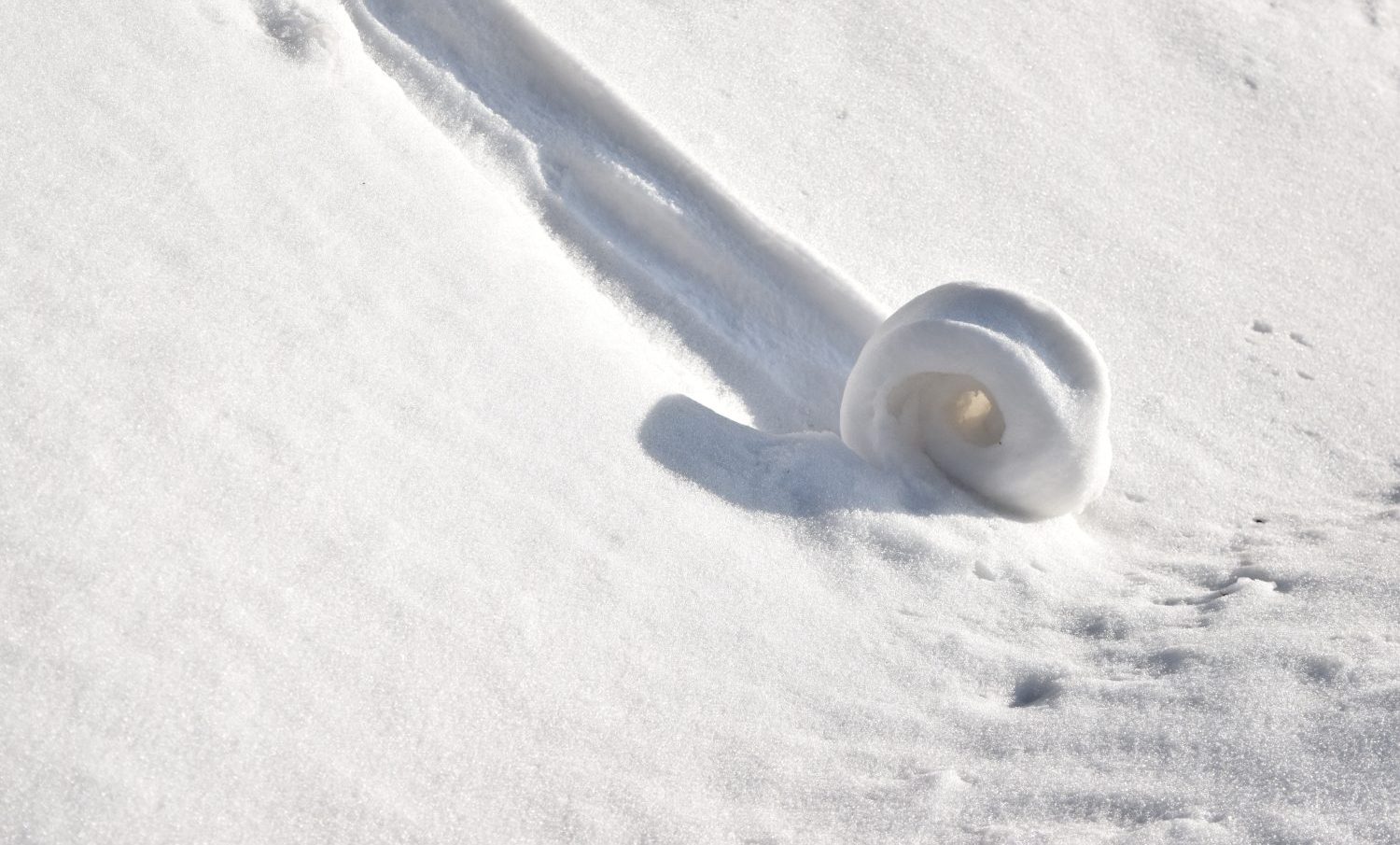
Snow Rollers
This rare meteorological phenomenon looks kind of like rolled ice cream. The cylindrical shape occurs naturally but it looks like it was formed by a giant ice cream scoop. However, snow rollers form when chunks of snow roll down a hill. It's kind of like a frozen tumbleweed and not often captured.
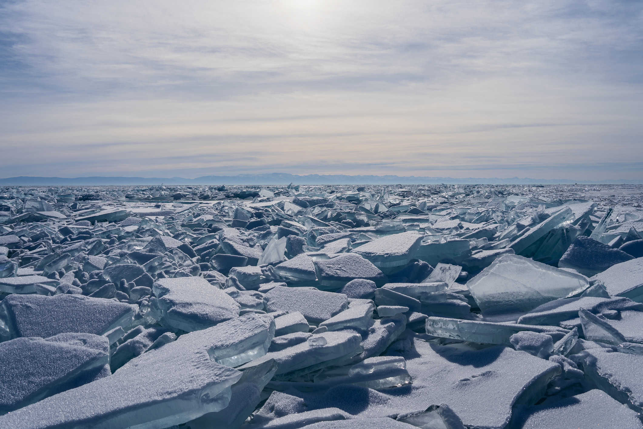
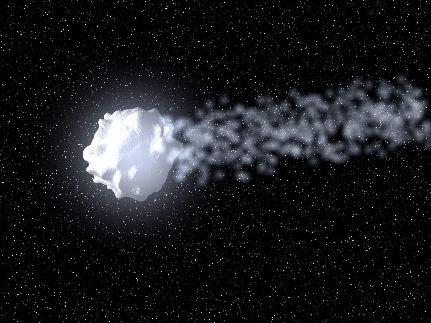
Megacryometeor
This term is relatively new and describes large ice formations that researchers are still studying. Not only do these large chunks of ice form in the atmosphere, but they also remain in the atmosphere. Megacryometeors are not hail and they aren't formed by any aircraft vessels. After 1950, the number of megacryometeors in the atmosphere has increased significantly. Researchers consider this phenomenon an indicator of climate change.
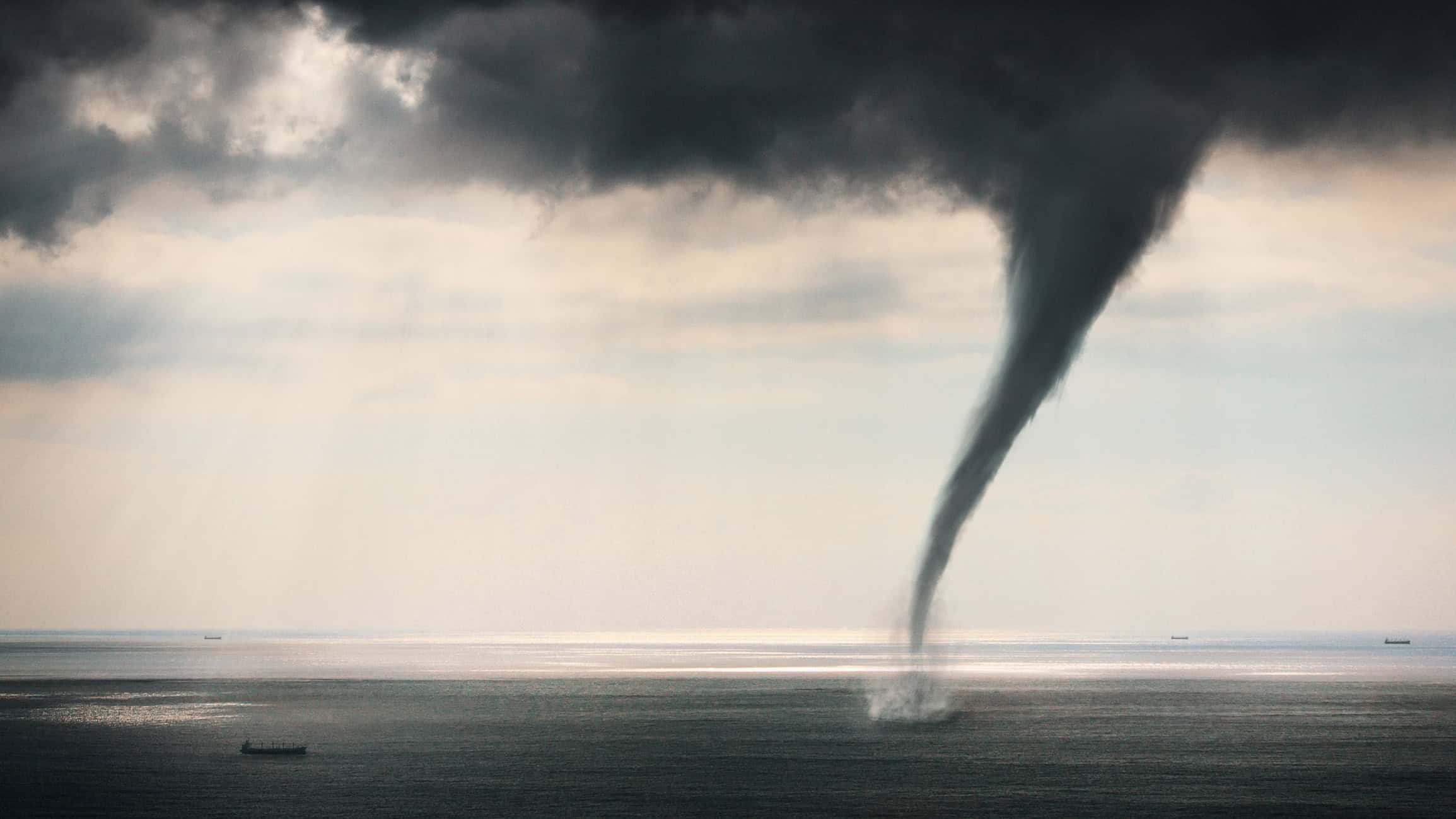
Waterspout
There are two primary types of waterspouts – fair weather and tornadic. A tornadic waterspout is a tornado that forms over water or moves from land to water, is associated with severe thunderstorms, and has the same characteristics as a land tornado. The fair weather waterspout is not associated with thunderstorms and develops on the water's surface along the base line of developing cumulus clouds
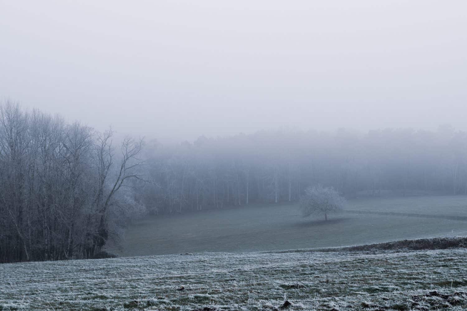
Ice Fog
With ice fog, you witness tiny ice crystals floating in the air. This happens when the air is extremely cold and water vapor interacts with it. That's what forms the tiny crystals you perceive. It looks similar to regular fog, but the crystals remain suspended in the air. This only occurs when temperatures plummet significantly.
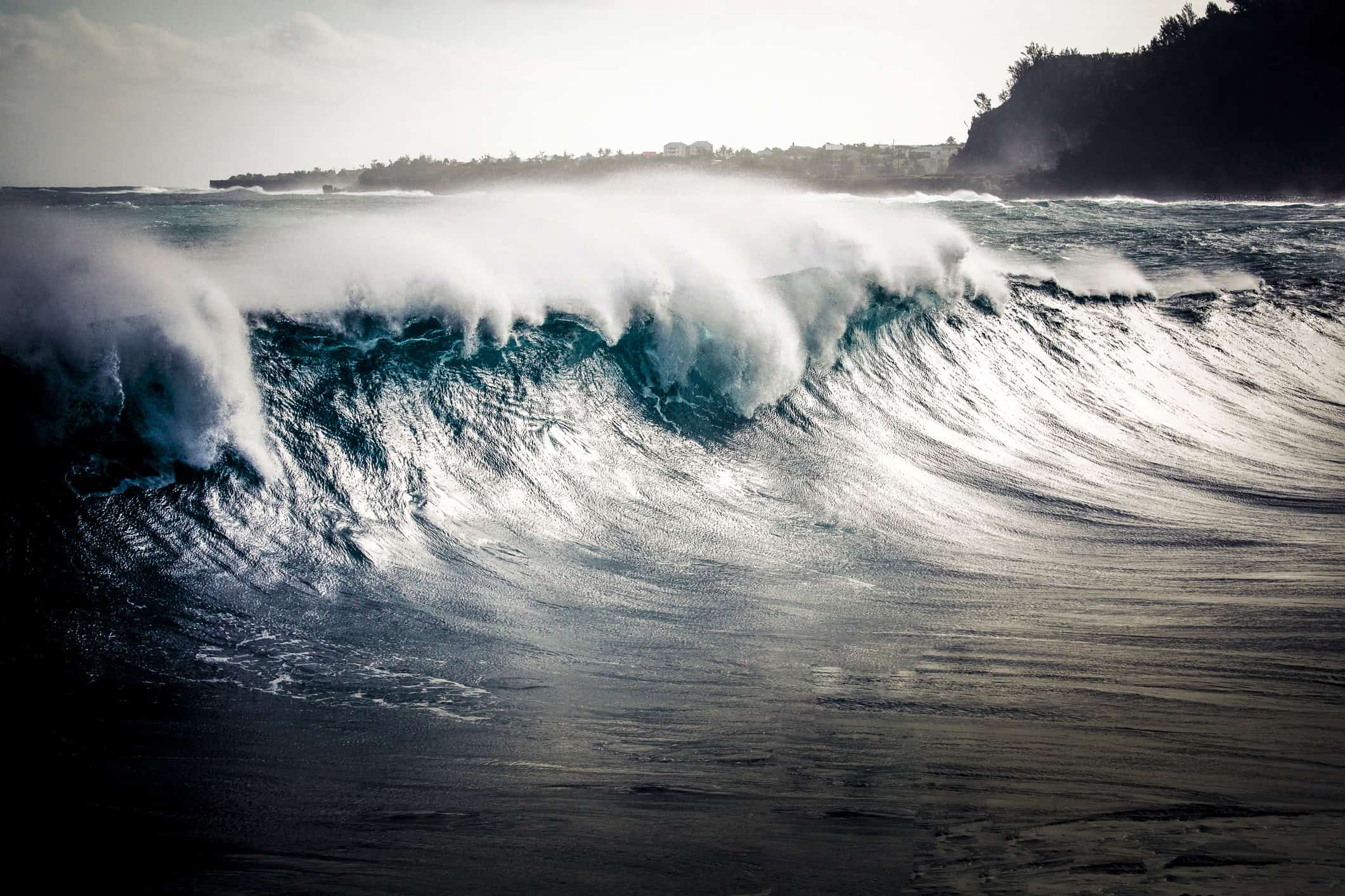
Rogue Waves
The National Ocean Service describes rogue waves as "large, unexpected, and dangerous." Rogue waves were believed to be folklore for hundreds of years before scientists took them seriously, noting the reality of these massive waves appearing in ocean waters. What makes rogue waves terrifying is their unpredictability. Caught in the waters when one hits could very well be deadly.
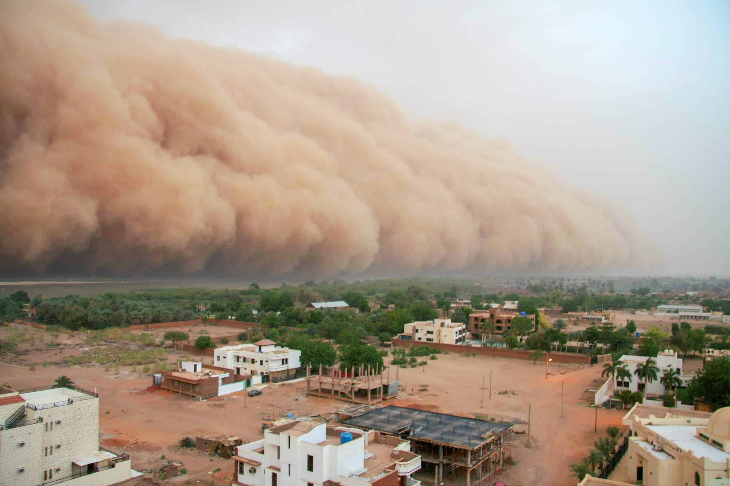
Haboob
This is a weather event you don't want to get trapped in because even if you're protected inside a vehicle, you find that low visibility renders you hardly able to inch forward. Haboobs are dust storms formed by thunderstorm winds. They look like entire walls of dust and if you spot one, don't drive into the area.
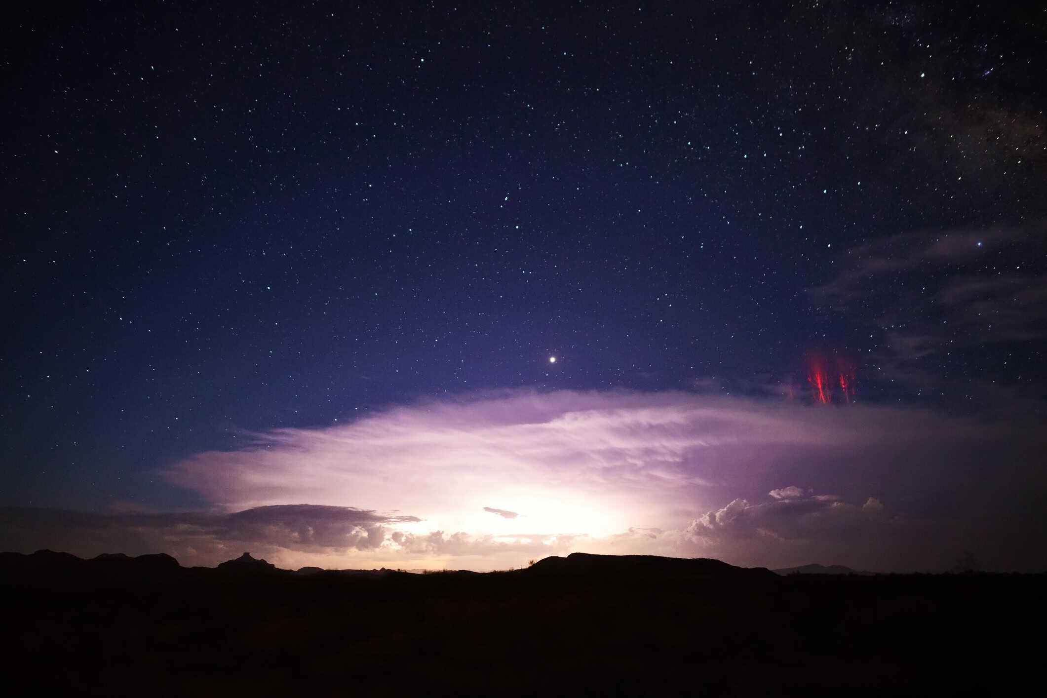
Sprites and Elves
This optical phenomenon occurs in the atmosphere as a result of thunderstorms. Lowlight-level television technology allowed scientists to observe these weather events. There are red sprites (pictured), which show up just above a thunderstorm and flash in a luminous fashion. Elves are disk-shaped illuminations that flash quickly and, according to the University at Albany, they last for "less than a thousandth of a second."
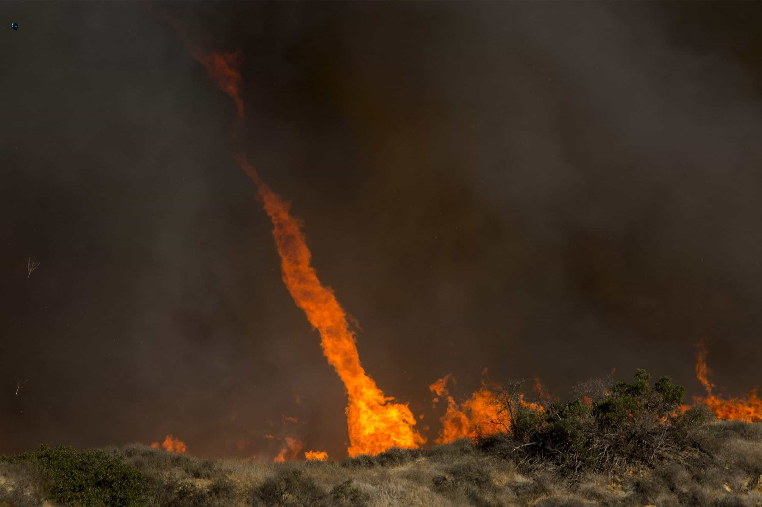
Fire Whirl
You can probably picture what this weather event looks like. It's shaped like a tornado and whirls like one, only this vortex is fiery. It occurs during severe wildfires. You can make out the fire whirl based on its glow but these events are also messy with smoke and ash filling the sky.
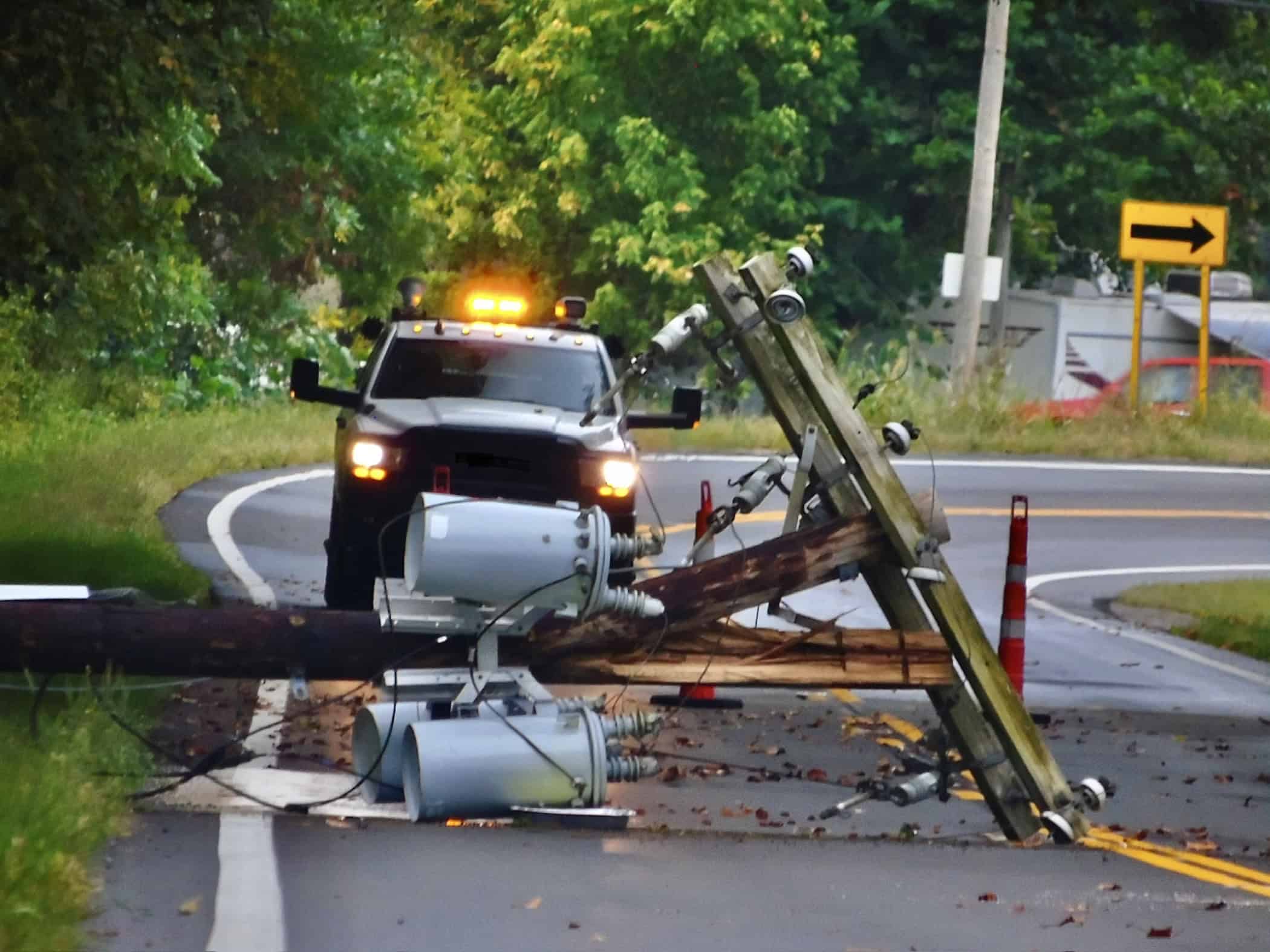
Power Flash
If you don't have a trained eye, you may confuse power flashes for lightning. However, power flashes originate from downed power lines or other electrical equipment. This often occurs alongside other weather events like tornadoes. If you notice that the flash originates from the ground instead of the sky, it's likely a power flash.
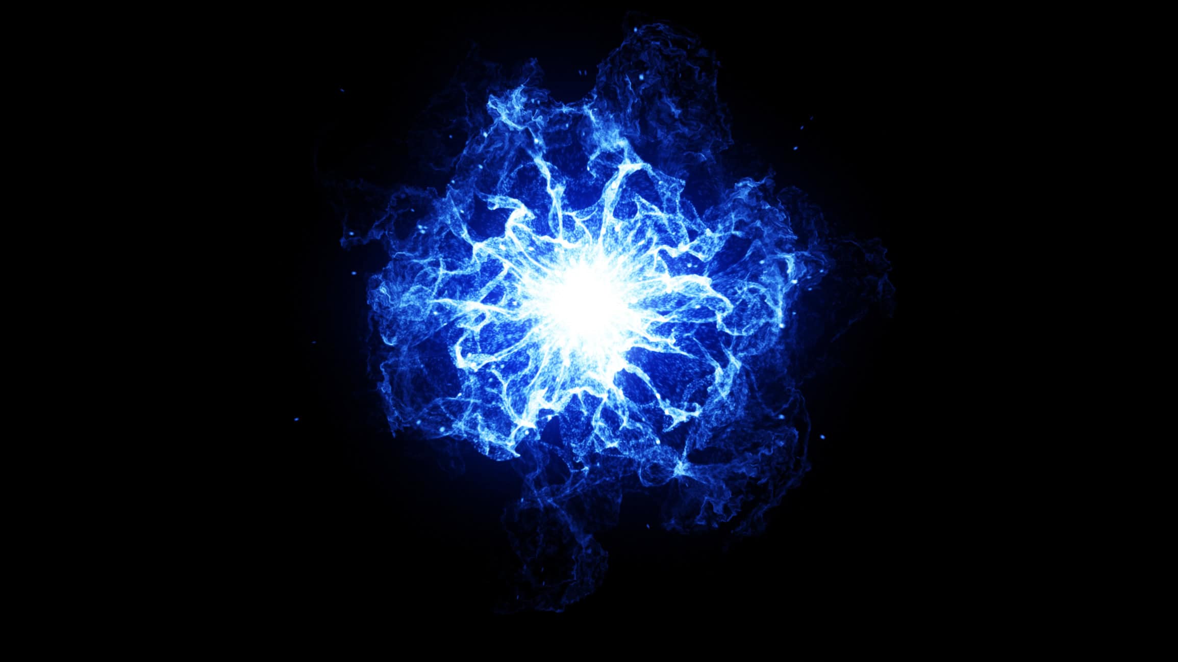
Ball Lightning
It's just what it sounds like. This type of lightning is not shaped like your typical jagged strikes. It's an ultra-rare phenomenon that occurs during thunderstorms. The shape is spherical and glows, illuminated in the sky for longer moments when compared to common lightning strikes. Ball lightning moves unpredictably as well, only adding to its wonder.
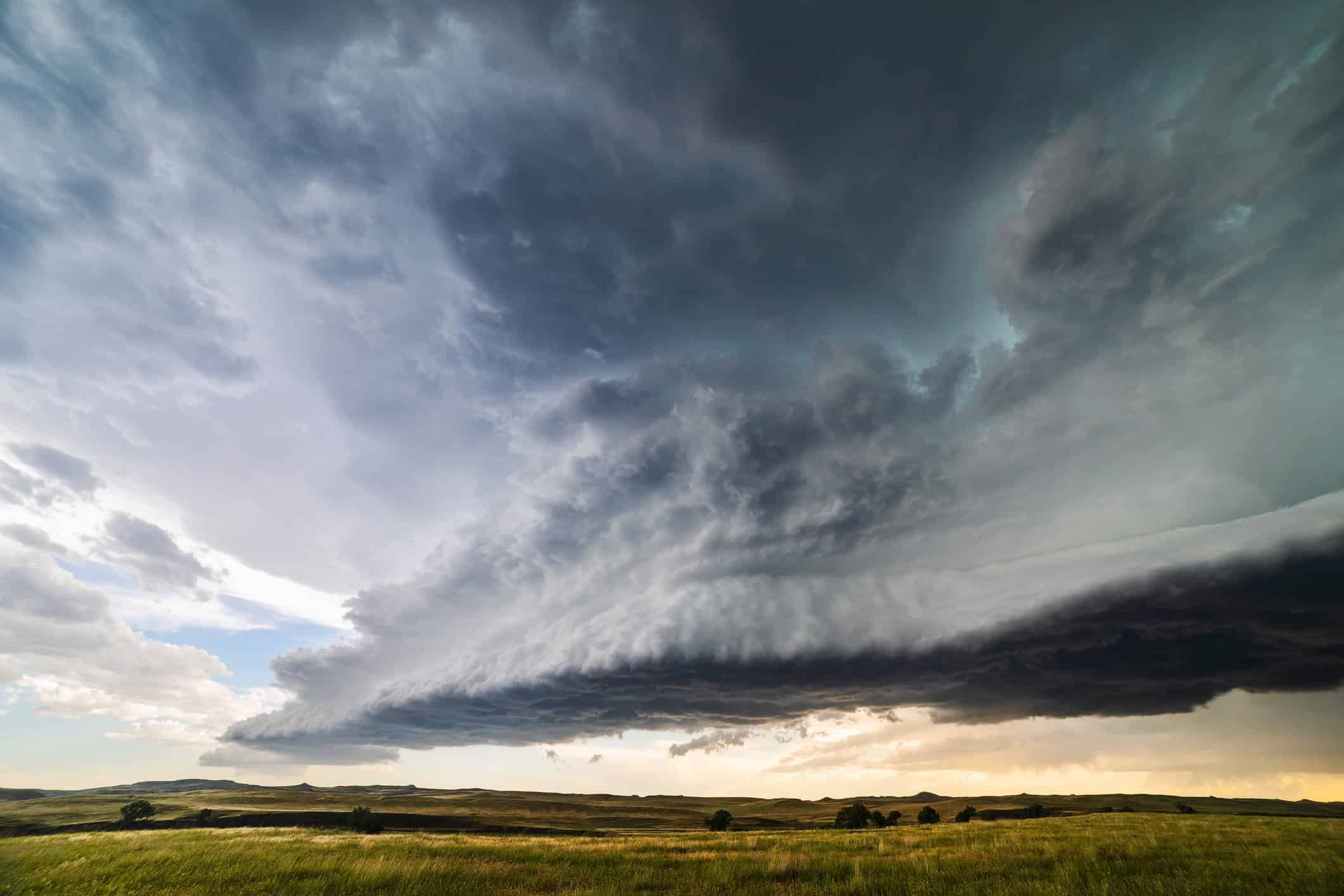
Derecho
A derecho is a wind storm—but not just any kind. It's capable of creating hurricane-force winds and may bring heavy rain along with it. This type of weather event is so powerful, it can also bring forth tornadoes. It moves quickly along with rain or thunderstorms and covers a wide area while it kicks up more damage.
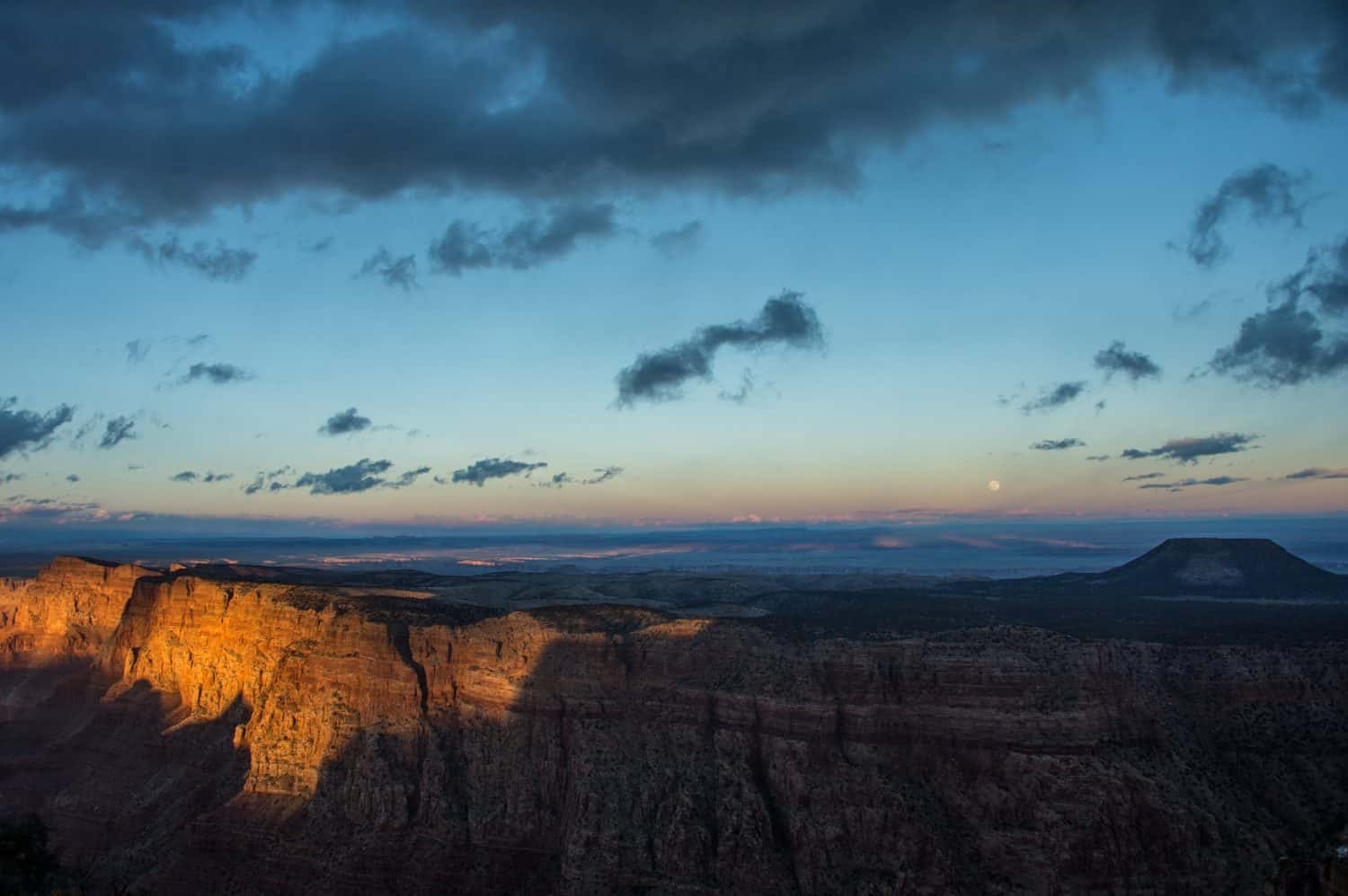
Earth's Shadow
You can witness this weather phenomenon at sunrise and sunset. The Earth casts a shadow in space that extends nearly 900,000 miles. If you're looking for it after sunset, look toward the east. If you're looking for it before sunrise, look toward the west. It shows up like a band with a blue hue.
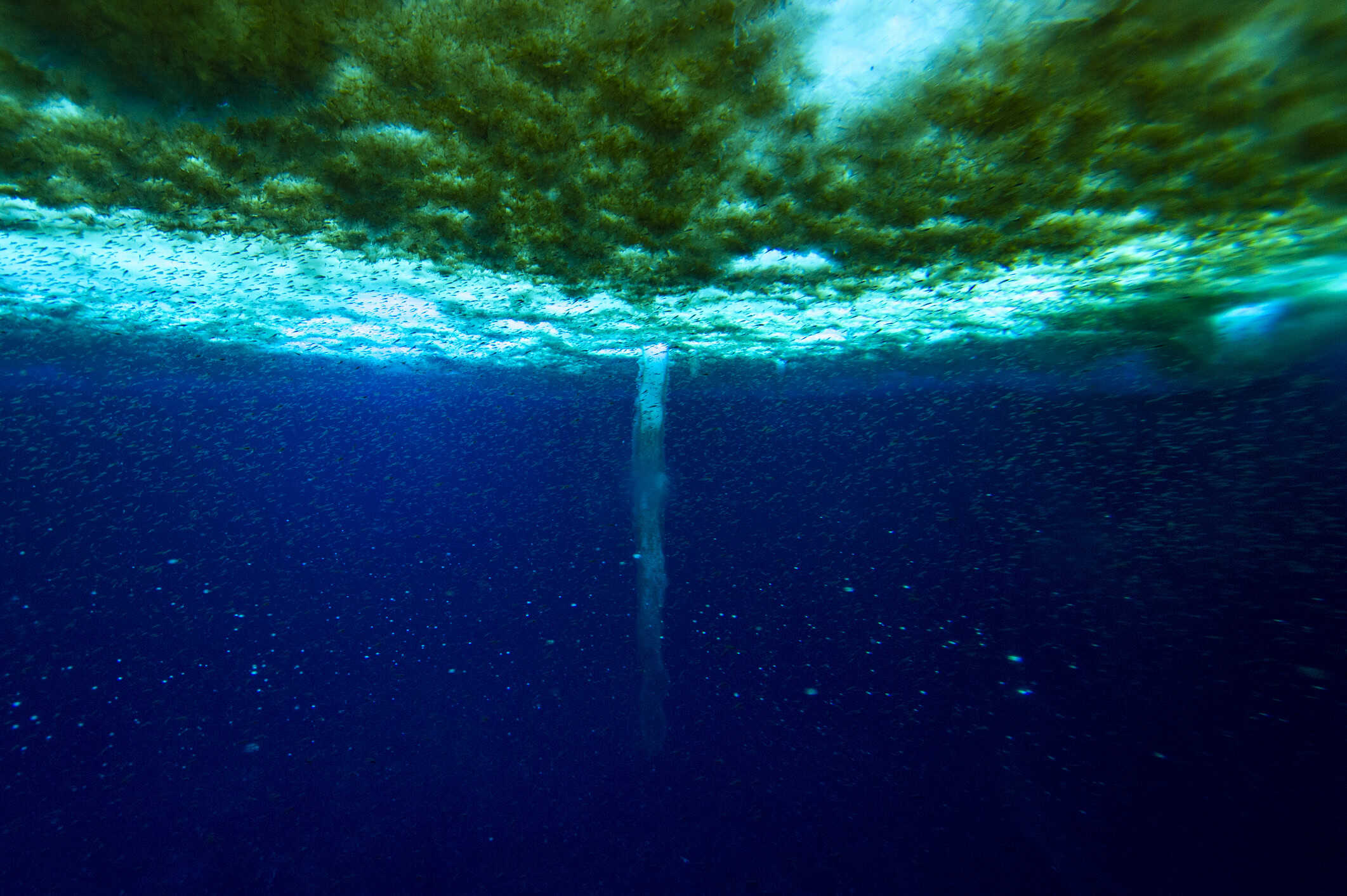
Brinicles
This underwater weather phenomenon has an eerie nickname: "The Finger of Death." It occurs in calm Arctic and Antarctic waters. It appears like a long icy tube that reaches downward toward the bottom of the ocean and floats on the surface. Brinicles are easily disrupted, so they require a serene environment to form. It's similar to an icicle, only it's formed from brine (extra salty water).
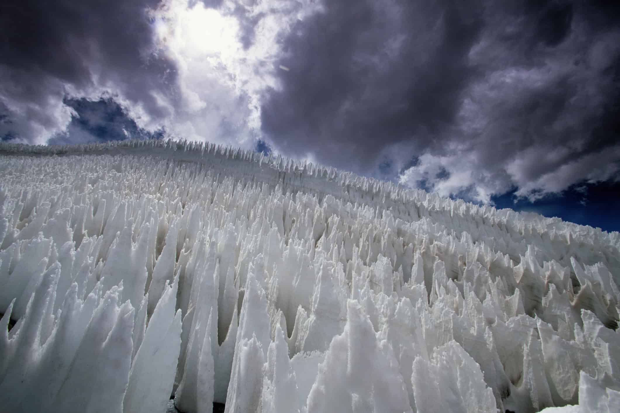
Nieve Penitente
This is another icy phenomenon. Nieves penitentes are sharp ice formations that have wide bases. These form in clusters, their pointed tops reaching toward the sky. The National Weather Service confirms they were named based on their "resemblance to monks in robes."
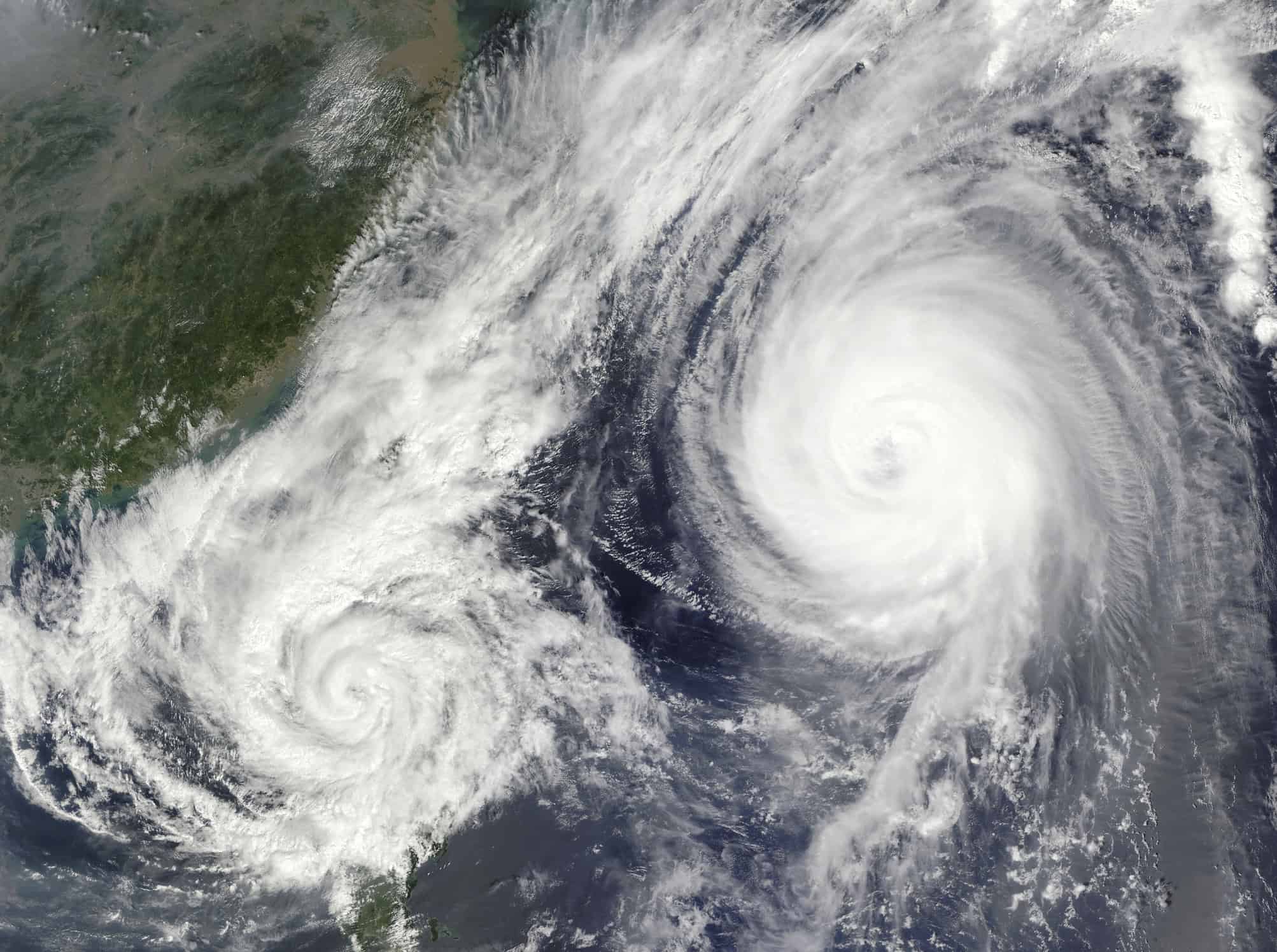
Fujiwhara Effect
For a Fujiwhara effect to take place, two hurricanes must be spinning in the same direction and come together for a dance of sorts. Their centers collide and if one of the hurricanes is smaller than the other, it gets sucked up into the vortex of the larger hurricane. Larger hurricanes may also merge but often, they just do a short dance and split off, going in different directions.
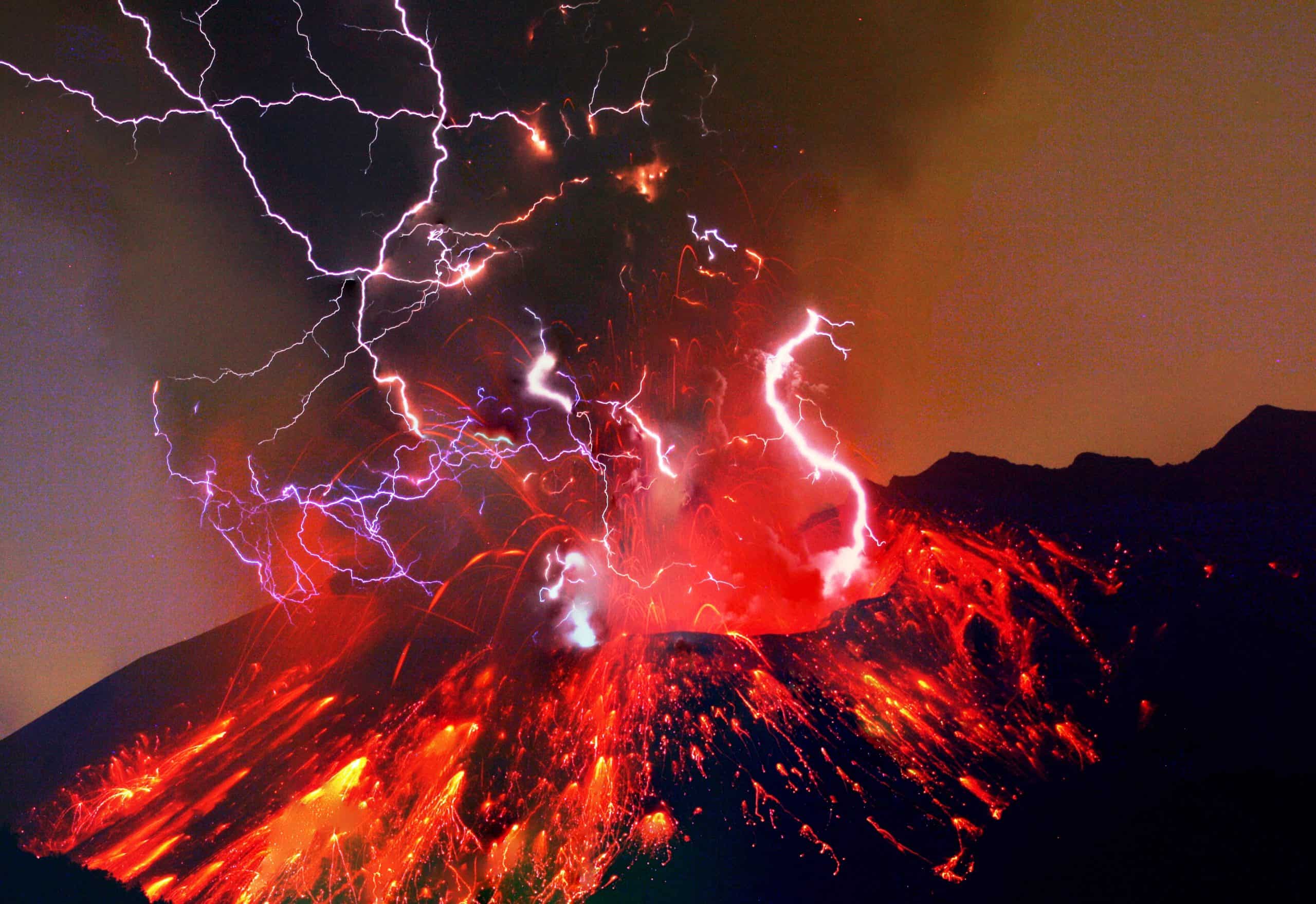
Volcanic Lightning
A volcanic explosion takes over the sky and you expect to see rock chunks and gases emanating from the eruption. However, there is also volcanic lightning to witness. It shoots out of the ash cloud. This occurs when the rock chunks crash and generate electricity. This is such a dangerous phenomenon that researchers are limited in their ability to study it.