When many Americans think of travel, our minds immediately wander to far-off lands and international destinations. These destinations hold incredible beauty, from the Cliffs of Moher and Victoria Falls to Mont Blanc and the Galápagos Islands. But what some of us may not be aware of is that we can find breathtaking scenery right here in the United States.
The United States is rich in natural beauty. Whichever state you decide to visit, you will most likely find something that will be awe-inspiring. America is a nation that has more than 60 National Parks that are designated protected areas and more than 400 designated park sites that range from historic sites to wildlife refuges.
The most breathtaking natural wonders in every state give people ample opportunity to discover a country filled with adventurous excursions. Glacial valleys, ancient river-carved canyons, and volcanic islands exemplify some of America’s most stunning scenery. Some of these areas may not be the most popular locations in each state, but many of these geological formations showcase nature’s majesty and shouldn’t be missed.
24/7 Tempo compiled a list of exquisite natural places of interest in every state after reviewing numerous travel guides and photography collections. Though subjective, these diverse landscapes deserve recognition for their beauty and uniqueness. (For incredible beauty engineered by man, see the most photographed structures in the world.)
Here is the most breathtaking natural wonder in every state
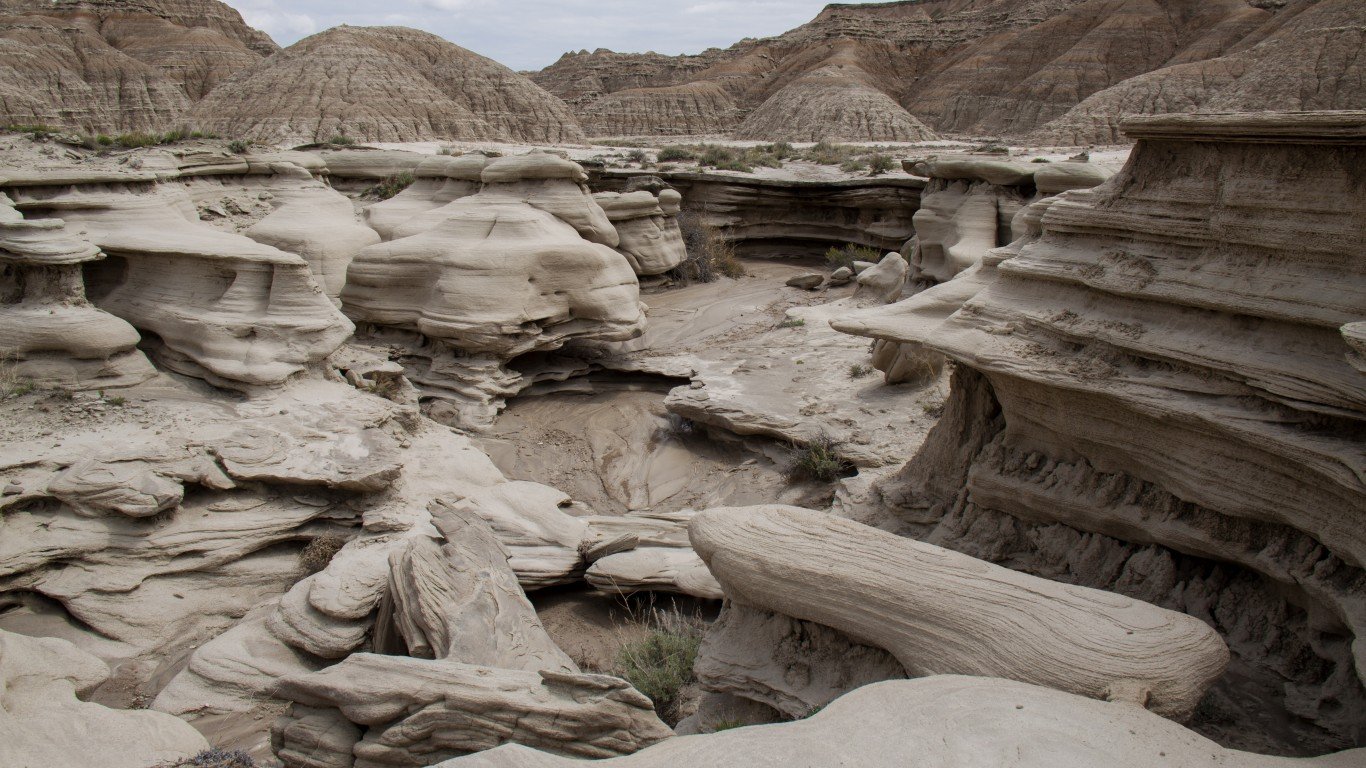
Alabama: Stephens Gap
- Location: Woodville, Jackson County
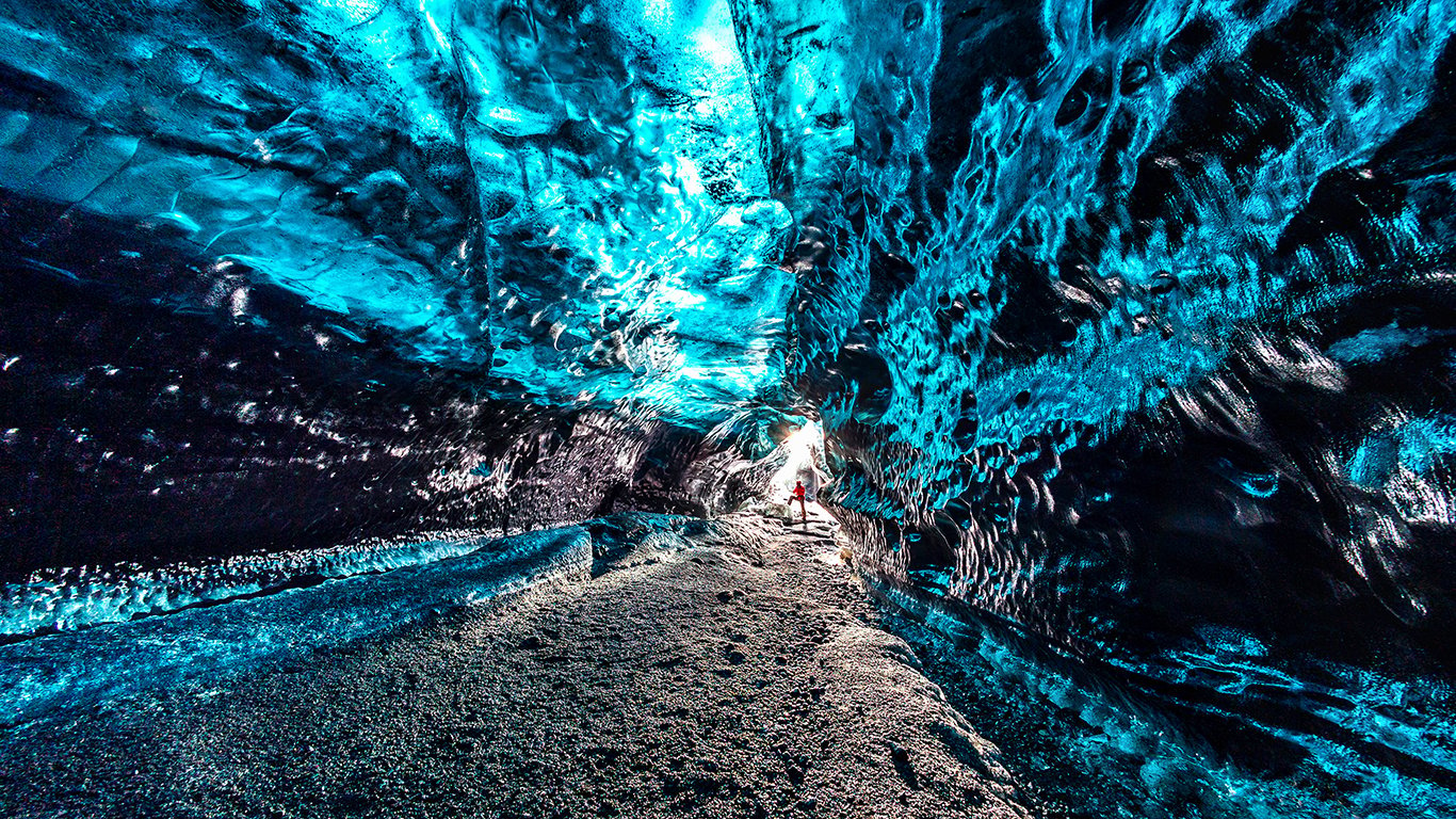
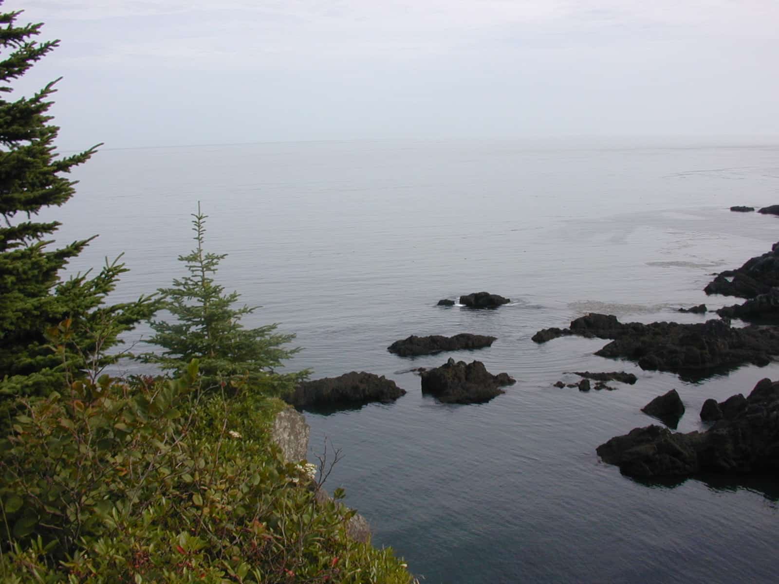
Alaska: Mendenhall Ice Caves
- Location:
Inside the 12-mile-long Mendenhall glacier is a network of ever-changing ice caves created by the melting of the glacier. Visitors can only access the caves by first kayaking to the glacier, and then climbing over it to reach the opening.
Arizona: The Wave
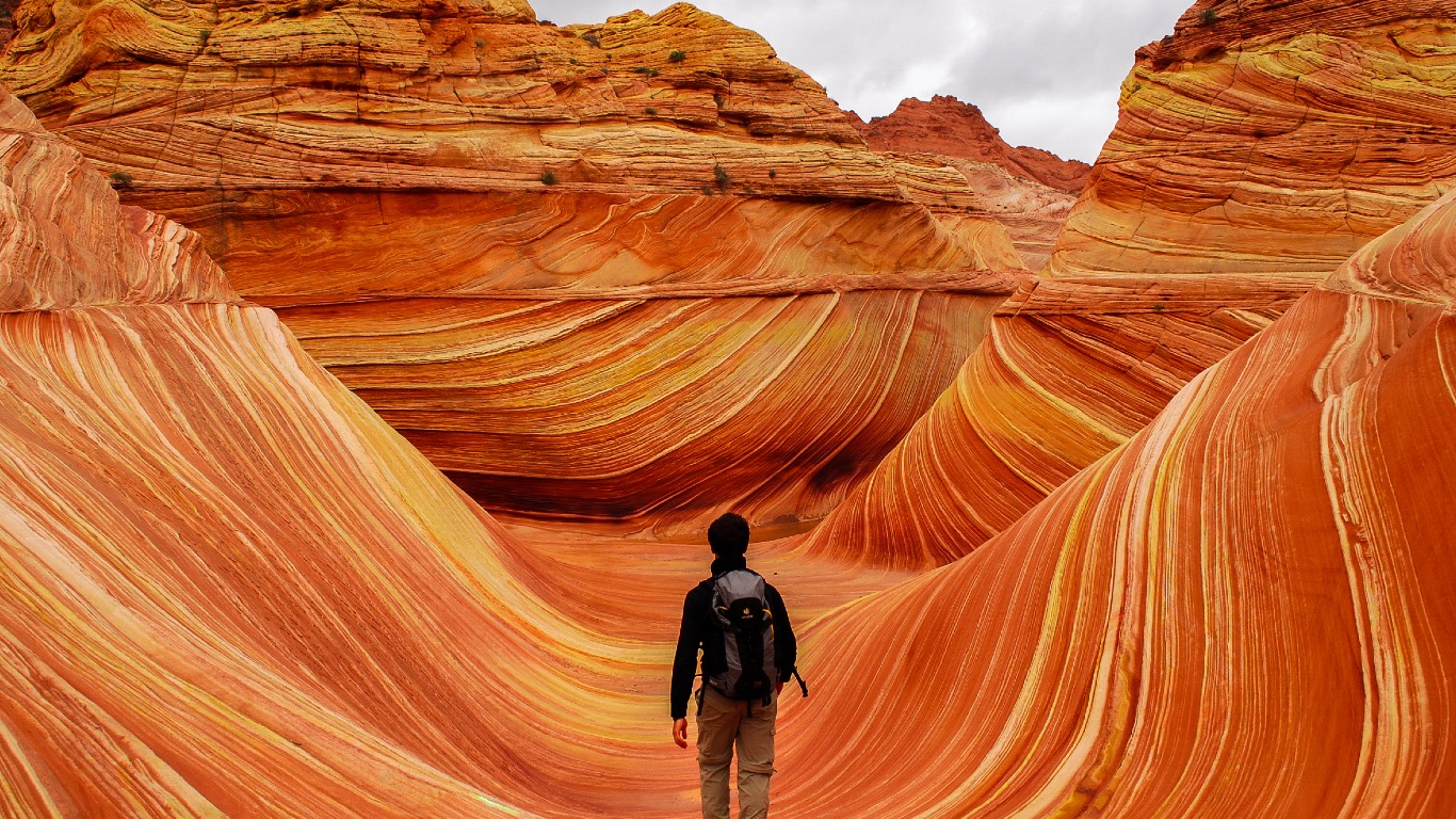
- Location: Coyote Buttes North area on the Utah/Arizona border
The Wave, a sandstone rock formation is one of the most photographed sites in the country. Photos of the Wave always appear to be photoshopped, even though it is not. Getting to the Wave requires a 3-mile hike and a permit.
Arkansas: Whitaker Point
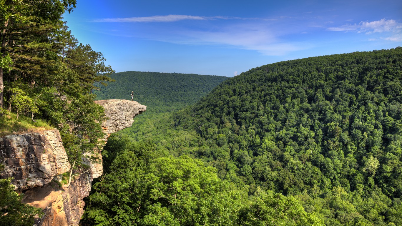
- Location: Deep inside the Ozark National Forest
The Whitaker Point offers beautiful views of the Buffalo National River, and the 2.9-mile trail that gets you to the Point is worth the trip. It’s located near Pettigrew, open year-round, and is easy to hike.
California: Lake Tahoe
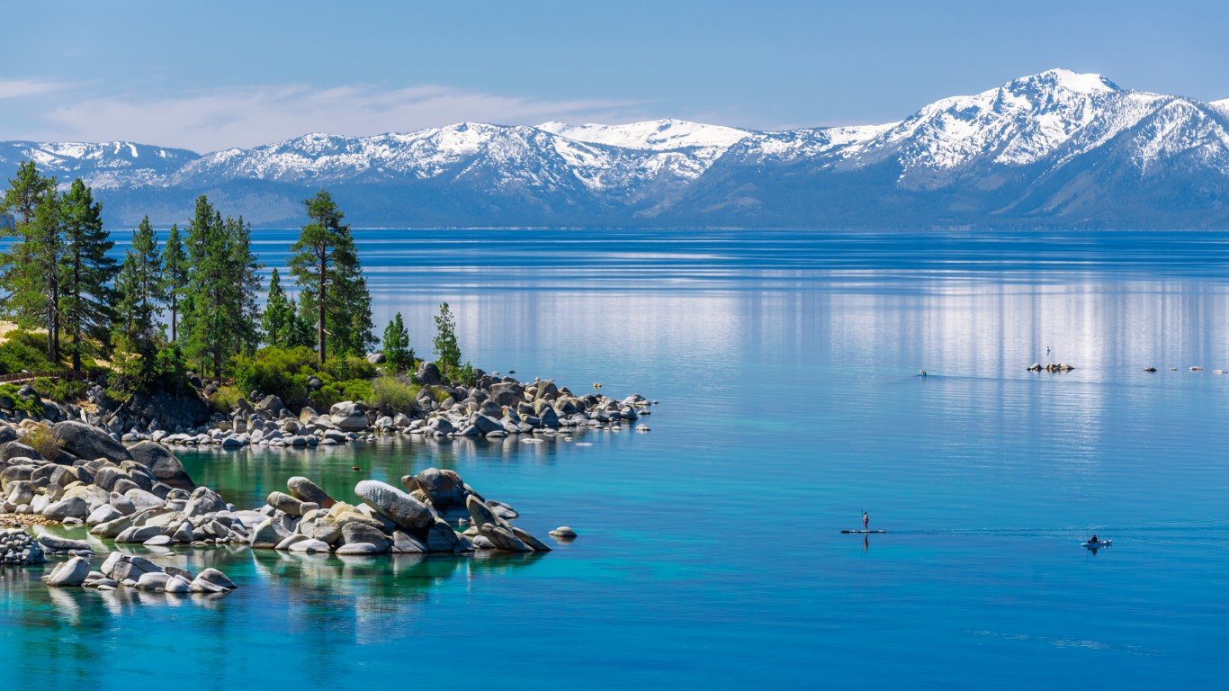
- Location: on the border of California and Nevada
The largest alpine lake in the United States, Lake Tahoe covers 191 square miles and sits over 6,000 feet above sea level, surrounded by mountains. The waters are famous for appearing in different shades of blue, turquoise, indigo, and purple depending on the location and weather.
Colorado: Maroon Bells
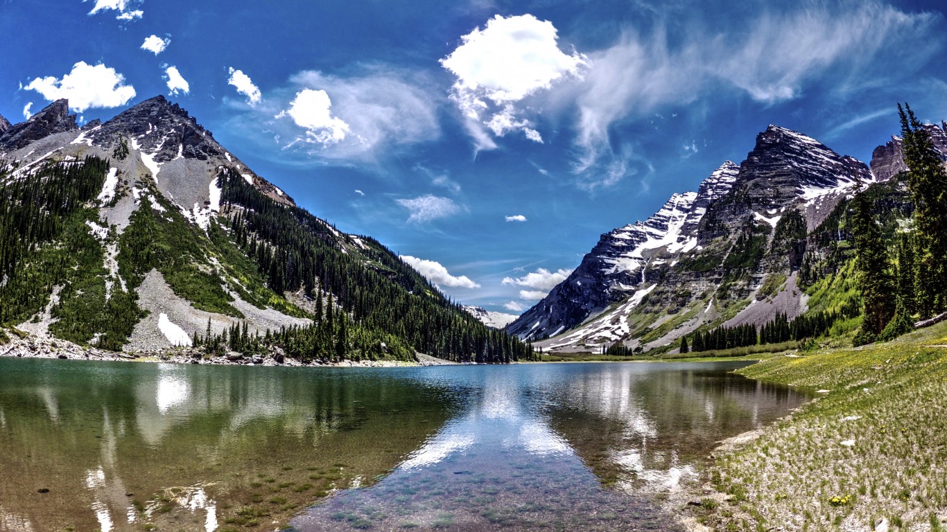
- Location: Colorado Rockies, Aspen
North and South Maroon Peaks tower over Maroon Lake, reflecting the red hue of the water on sunny days. The Bells, along with their neighbor Pyramid Peak, are made of red mudstone and are known as the most photographed mountains in the Rockies.
Connecticut: Kent Falls

- Location: Kent Falls State Park
A series of falls that spans a quarter mile and drops 250 feet total, Kent Falls is one of Connecticut’s most popular natural attractions. The park offers picnic tables, a paved path to the upper falls, and a handicap-accessible viewing area at the lower falls.
Delaware: Great Cypress Swamp

- Location: headwaters of the Pocomoke River
The Great Cypress Swamp covers 50 square miles and consists of seasonally flooded forests made up of bald cypress, white cedar, pines, and various hardwoods. It’s the northernmost bald cypress grove in the country and an important habitat for several at-risk bird species.
Florida: Juniper Springs
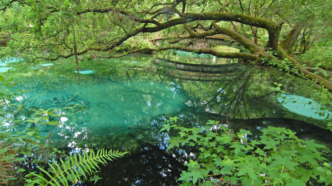
- Location: Ocala National Forest north of Orlando
Juniper Springs is a series of clear, bubbling freshwater springs. Contained in a recreation area that allows swimming and snorkeling, the springs are surrounded by palm and oak trees and are home to alligators, river otters, and eels.
Georgia: Tallulah Gorge
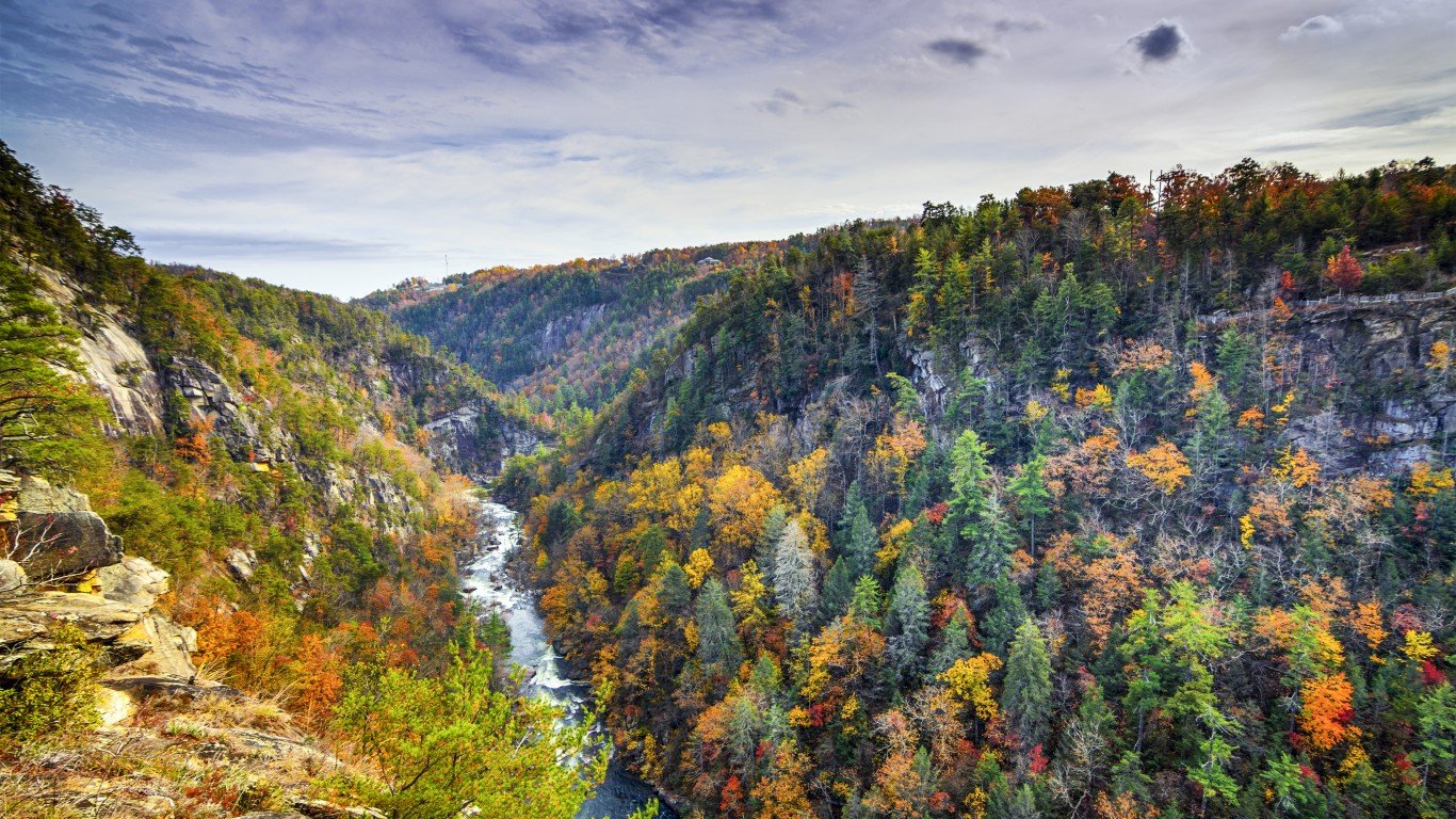
- Location: next to Tallulah Falls
The gorge is about 2 miles long and almost 1,000 feet deep. A suspension bridge about 80 feet above the gorge offers stunning views of the area’s waterfalls and landscapes. Though very popular, the Tallulah Gorge’s trail is strenuous, and a free permit is required to hike it.
Hawaii: Nā Pali Coast
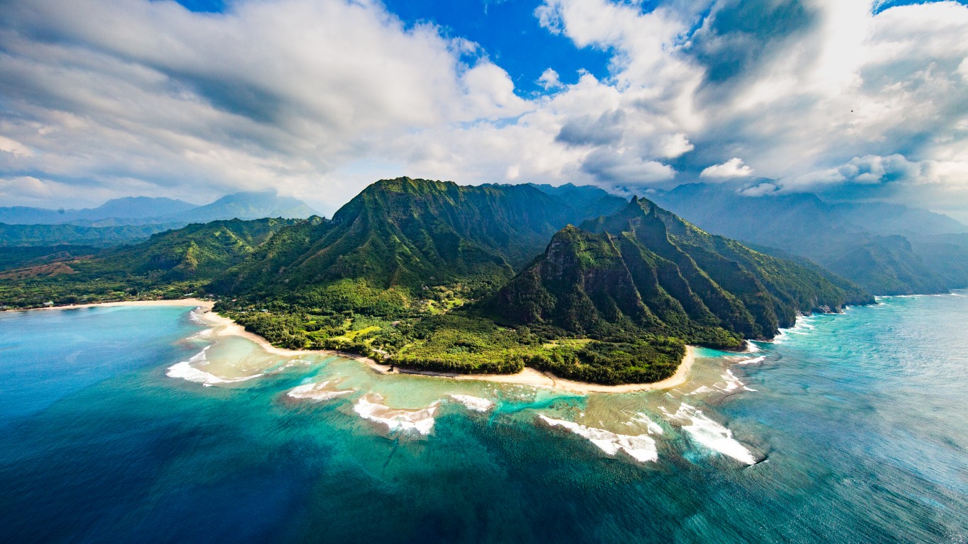
- Location: Nā Pali Coast State Wilderness Park, Northwest coast of Kauai
Once home to ancient Hawaiian communities, the Nā Pali coast is characterized by sharp peaks and mountains that fall steeply to the ocean, forming deep valleys, caves, and cliffs. The only ways to see the coast are by helicopter, boat, or hiking a grueling 11-mile trail over the steep ridges.
Idaho: Sawtooth National Forest
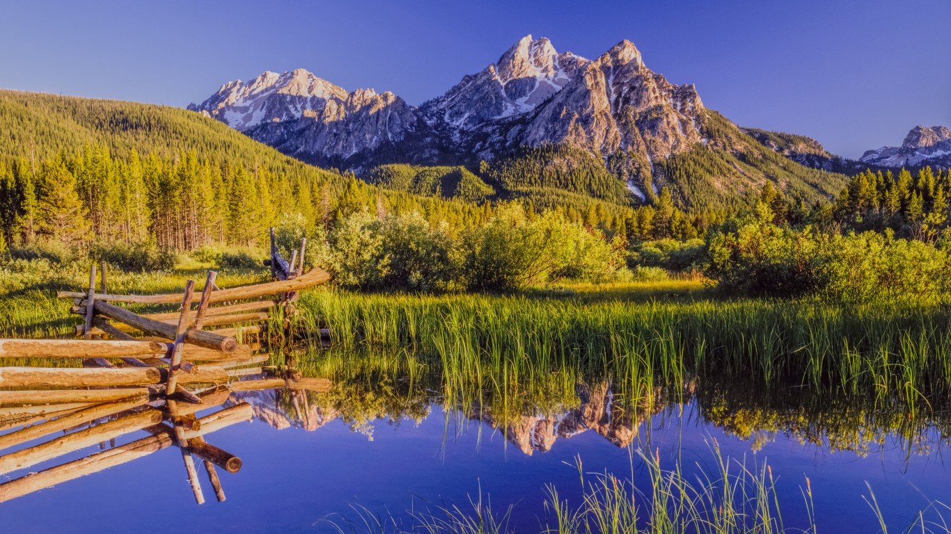
- Location: outside of the city of Jerome
The Sawtooth National Forest is home to over 300 alpine lakes, dozens of 10,000-foot snow-capped peaks, and over 700 miles of trails. While Sawtooth is a haven for all types of outdoor sports and activities, those who wish to see it firsthand from the comfort of a vehicle can drive the Ponderosa Pine Scenic Byway.
Illinois: Garden of the Gods
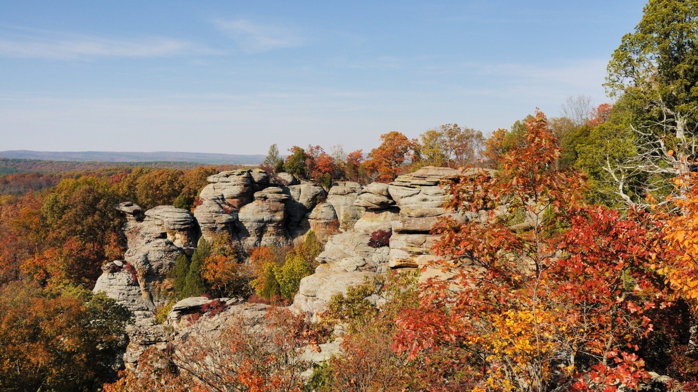
- Location: Shawnee National Forest
These 300-million-year-old sandstone formations are accessible by a quarter-mile observation trail and are one of the most photographed locations in Illinois.
Indiana: Indiana Dunes
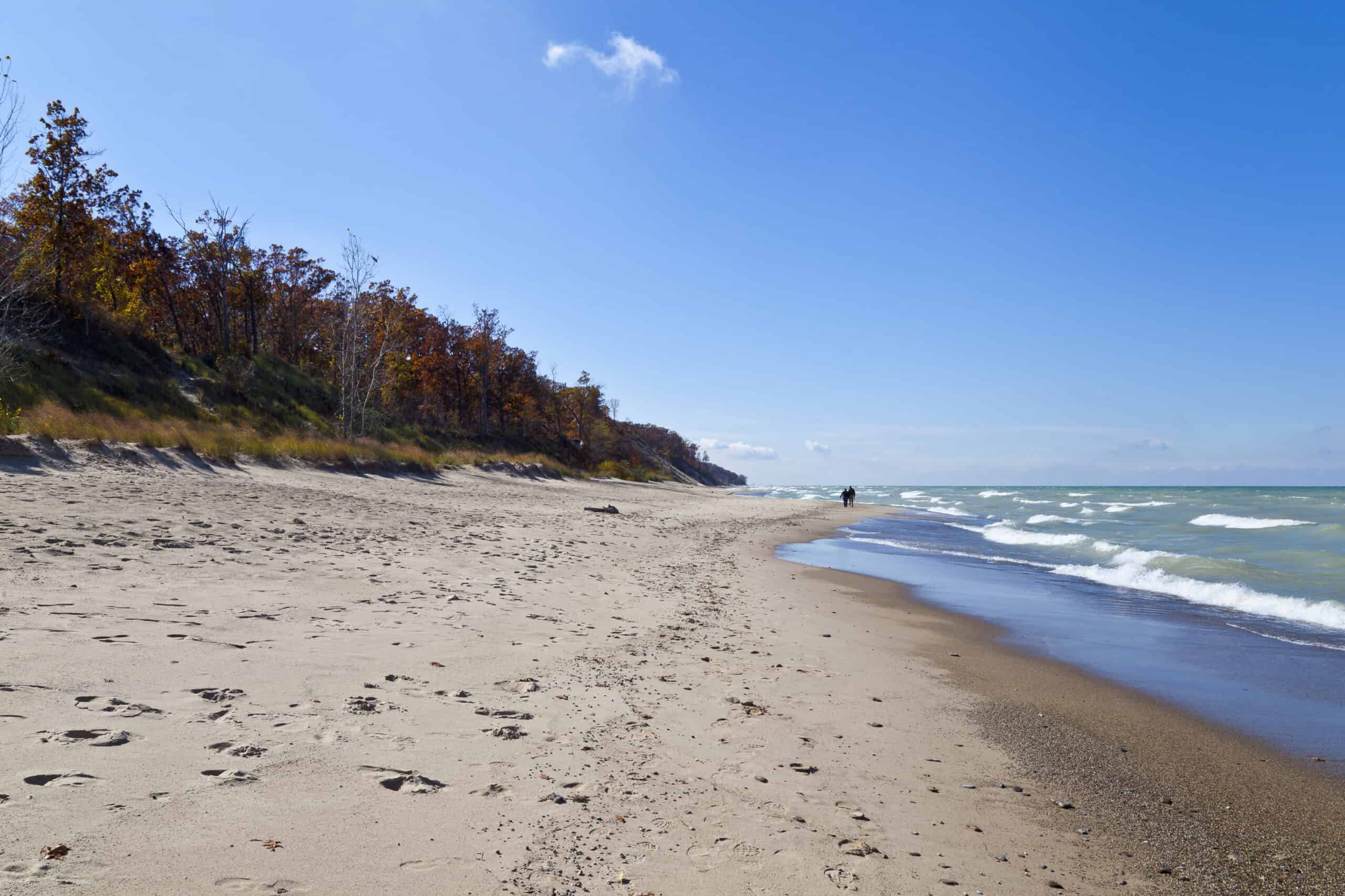
- Location: southern shore of Lake Michigan
Spanning 15 miles of coastline, Indian Dunes National Park has over 50 miles of dune trails, as well as beaches, wetlands, rivers, forests, and prairies.
Iowa: Upper Iowa River
- Location: Howard, Winneshiek, and Allamakee counties
The Upper Iowa River traverses part of what is known as the Driftless Area, a region untouched by glaciers during the last ice age, which has left the land with intact ancient topography. High bluffs surround this stretch of water, which is a popular area for kayaking and canoeing.
Kansas: Monument Rocks
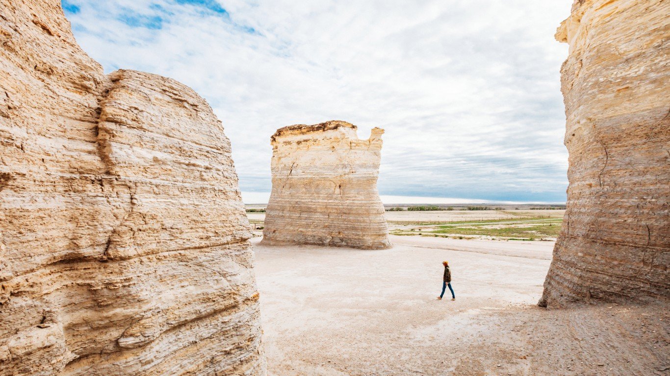
- Location: near U.S.-83 in western Kansas
The Monument Rocks, also known as Chalk Pyramids, are one of the Eight Wonders of Kansas. Though they are on private land, the 70-foot tall rock formations, formed around 80 million years ago, are open to the public during the day.
Kentucky: Grayson Lake
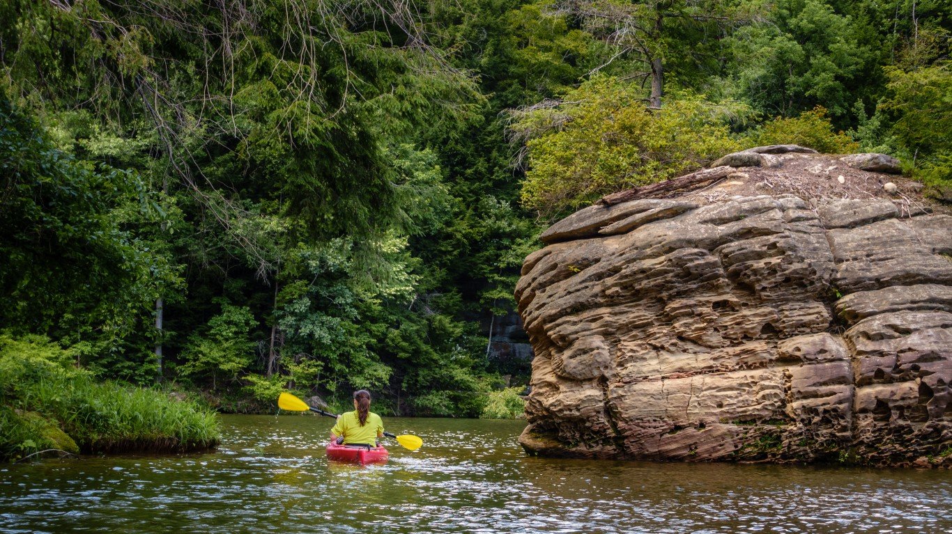
- Location: Olive Hill
Grayson Lake is surrounded by sandstone bluffs covered in dense forest. Part of a 1,500-acre state park, the lake is open to canoeing and kayaking, and is particularly beautiful after rain, when waterfalls appear along the rock formations, some of which can only be viewed by boat.
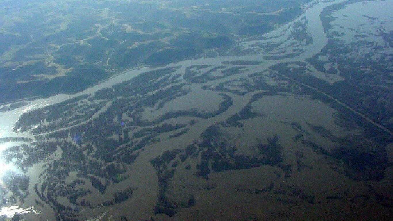
Louisiana: Atchafalaya Basin

- Location: south-central Louisiana
The largest swamp in the United States, the Atchafalaya River Basin covers nearly a million acres. Composed of marshes, iconic moss-draped cypress groves, lakes, and bottomland hardwood forest, the area is a crucial wildlife habitat and home to the largest population of nesting bald eagles in the region.
Maine: Cutler Coast
- Location: close to the Canadian border outside of Cutler
The Cutler Coast Public Reserve features hiking trails ranging from 2.8 to 9.2 miles round-trip with access to the sheer cliffs and undeveloped coves often referred to as the Bold Coast.
Maryland: Great Falls
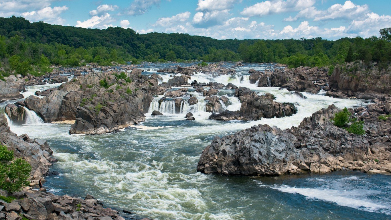
- Location: Potomac River outside of Washington DC
Great Falls Park in Maryland offers multiple overlooks of the many rapids and waterfalls. Though there are numerous hiking trails in the park, the Billy Goat Trail offers some of the best close-up views of the falls.
Massachusetts: Gay Head Cliffs
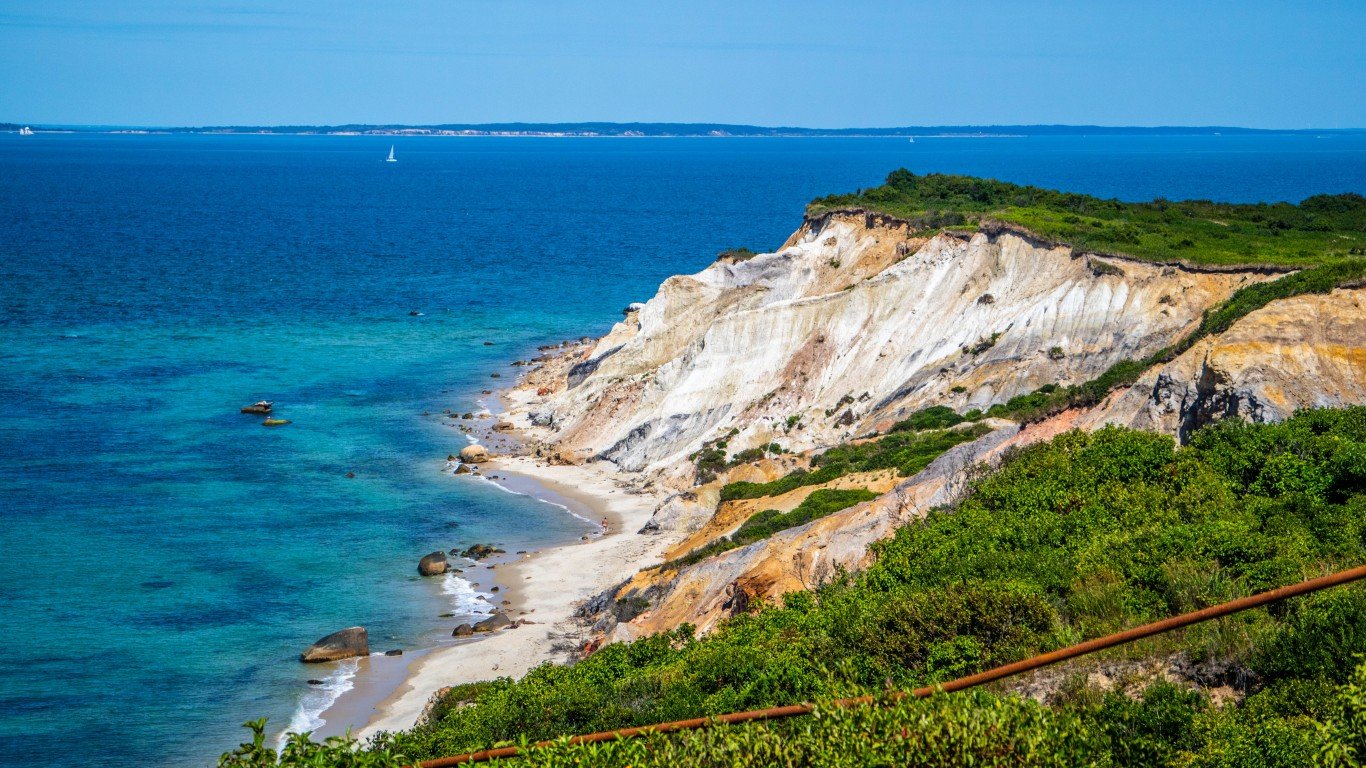
- Location: Aquinnah, Martha’s Vineyard
These colorful hundred-foot clay cliffs are constantly eroding, which has led to the historic Gay Head Lighthouse being moved to save it from falling into the ocean.
Michigan: Pictured Rocks
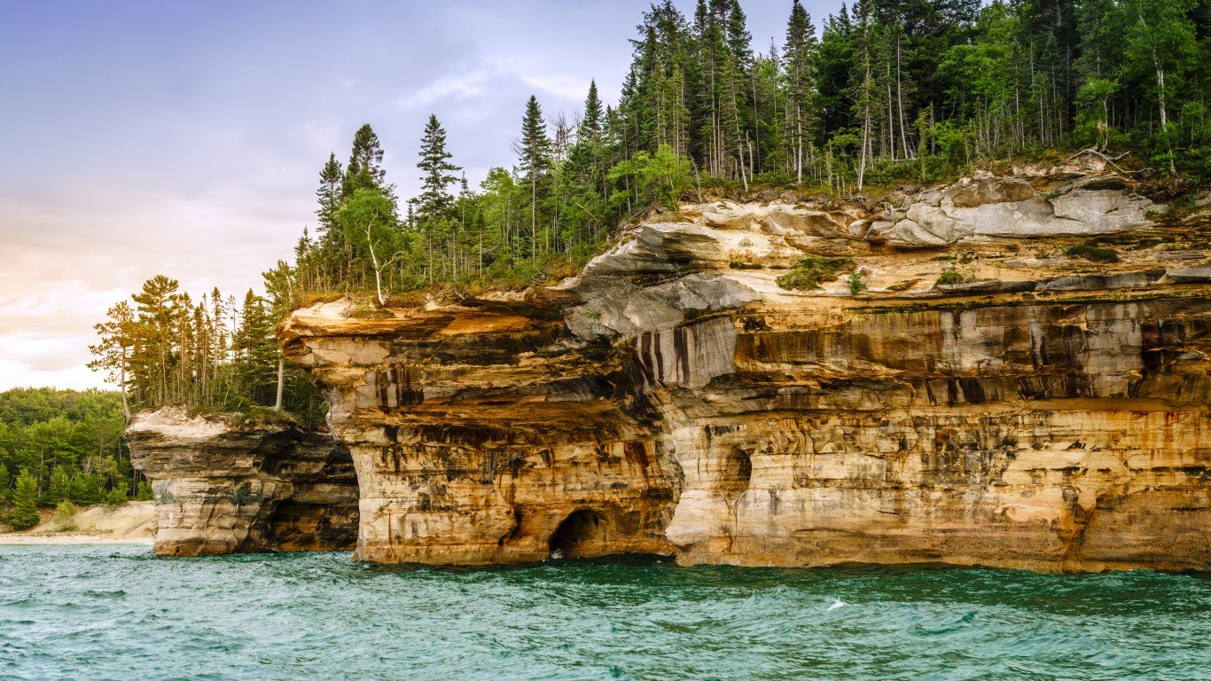
- Location: between the communities of west Munising and east Grand Marais
While there is no dearth of beauty along Michigan’s Great Lakes coastlines, the Pictured Rocks National Lakeshore offers a little bit of everything beautiful about the coast, including dunes, cliffs, beaches, forests, and inland lakes.
Minnesota: Boundary Waters Canoe Area Wilderness
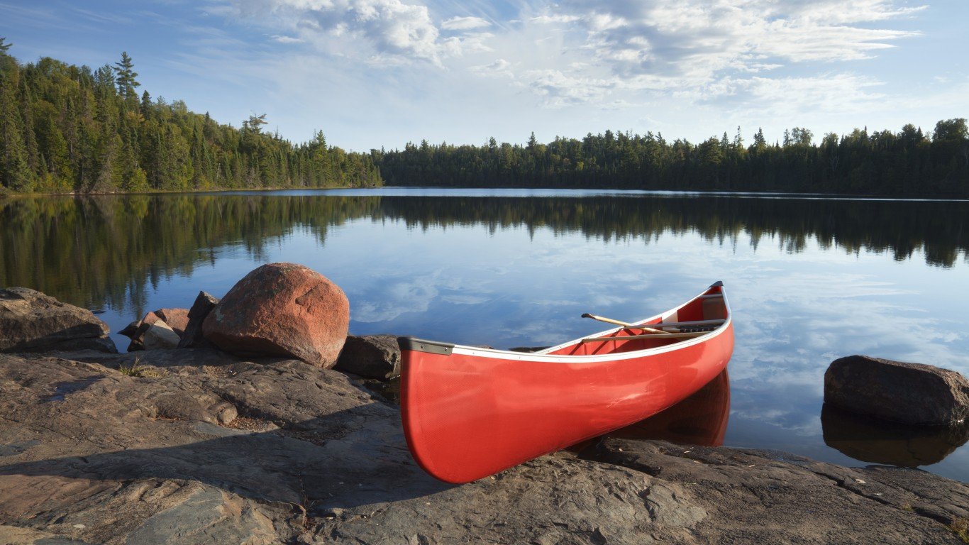
- Location: Superior National Forest in northeastern Minnesota
The area has more than 2,000 campsites, 12 hiking trails, and over 1,200 miles of canoe routes. Permits are required for day use as well as overnight trips.
Missouri: Onondaga Cave State Park
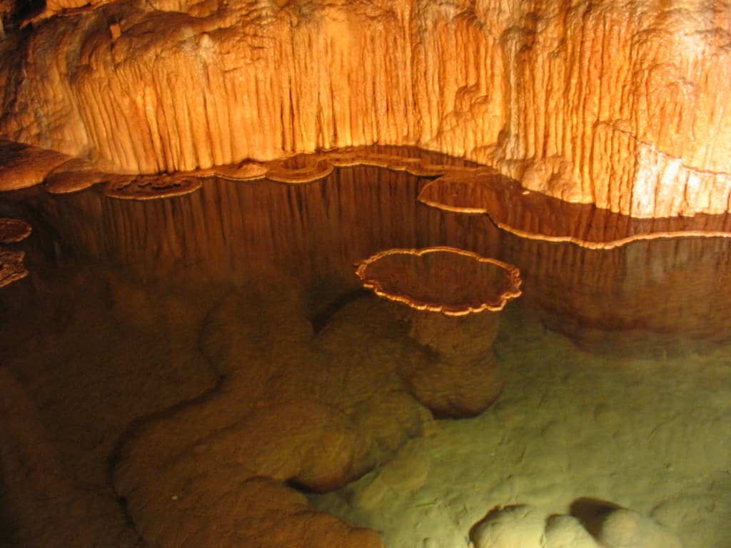
- Location: Leasburg
Designated a National Natural Landmark due to the quality of its formations, Onondaga Cave features a wide variety of pristine cave structures and an underground river deeply entrenched in a canyon.
Mississippi: Red Bluff
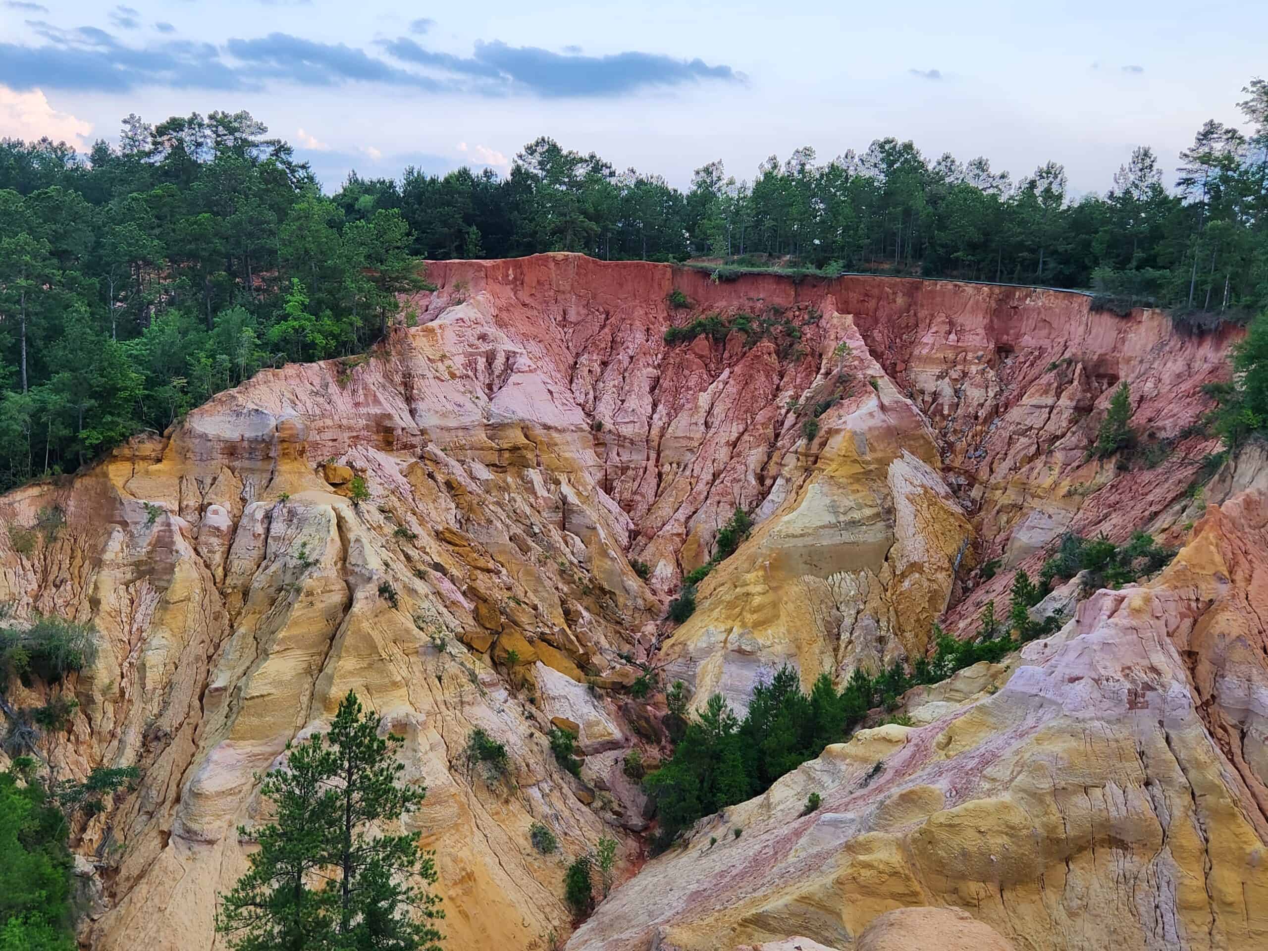
- Location: Marion County, outside of Foxworth
Red Bluff Canyon was formed by the erosion of sand, soil, and red clay by the Pearl River. About 200 feet deep at present, the canyon will continue to get deeper as the river continues to erode its banks.
Montana: Lake McDonald
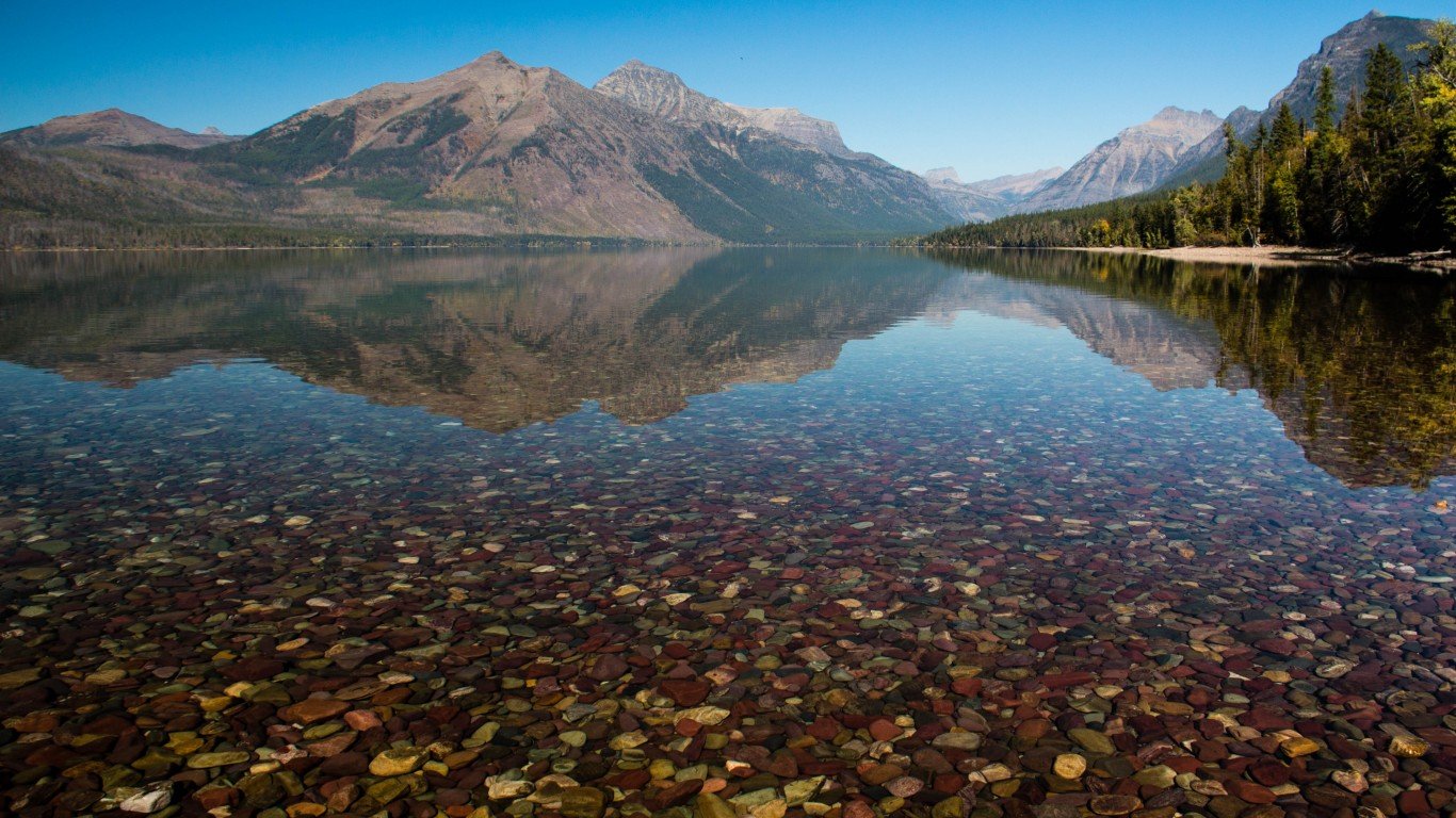
- Location: Glacier National Park
Lake McDonald is the largest, longest, and deepest lake in the park. The lake features a spectacular array of colorful stones on its shores and beneath its waters. The rocks were formed in different eras then broken apart by glaciers and deposited in the lake over the years by rivers.
Nebraska: Toadstool Geologic Park
- Location: Harrison
A surprising sight within the plains of Nebraska, Toadstool Geologic Park consists of oddly shaped clay and sandstone formations within the bed of an ancient river that went dry about 26 million years ago. Fossils of saber-tooth cats and prehistoric horses are visible among the eroded cliffs.
Nevada: Fly Ranch Geyser

- Location: Northern Nevada near the Black Rock Desert
This geyser was created in 1964 when a geothermal energy company drilled a well to the 200-degree underground spring. The formation around the multiple spouts has been growing ever since due to mineral deposits from the water and is covered in colorful algae.
New Hampshire: Franconia Notch Basin
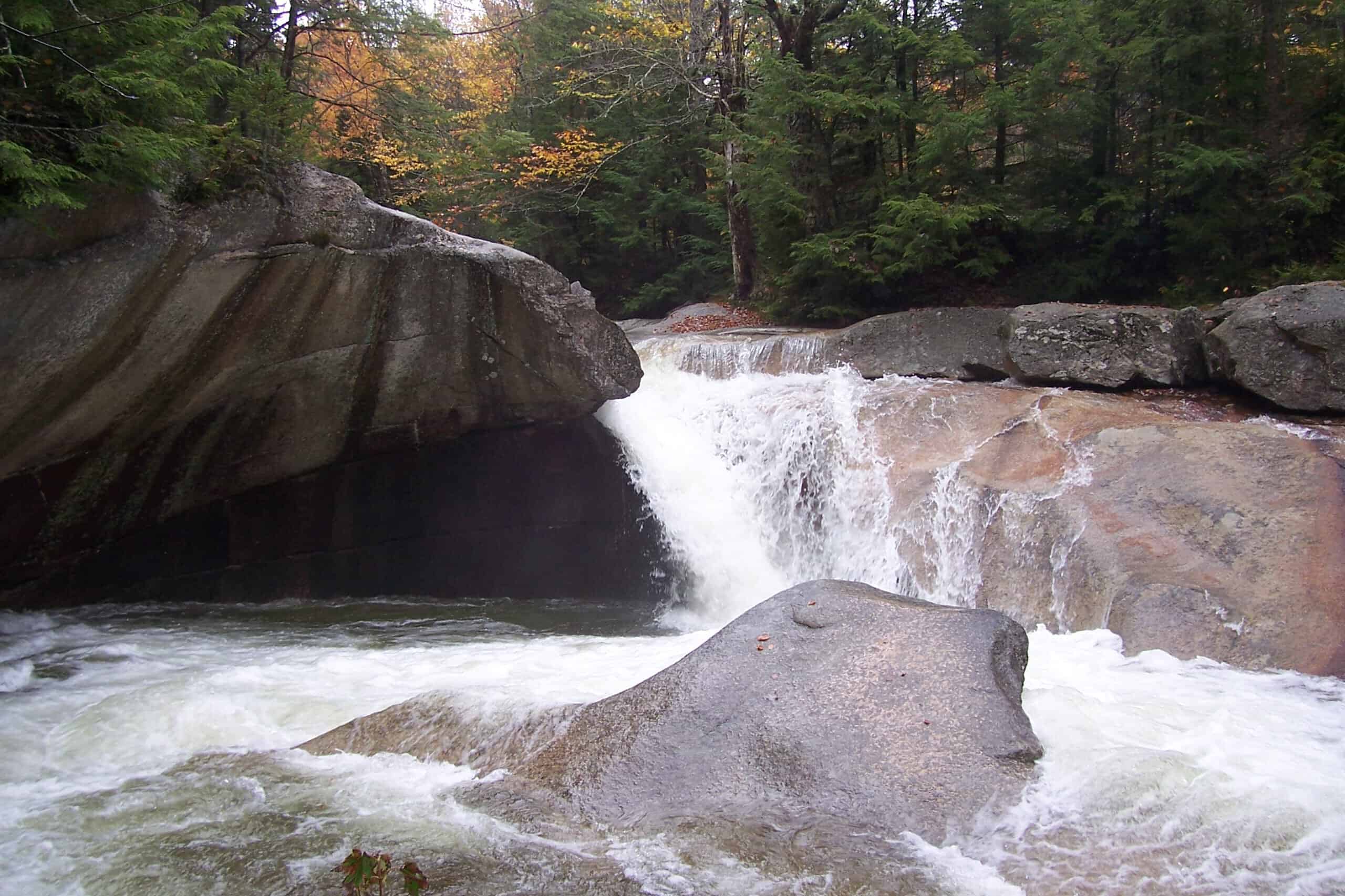
- Location: Franconia Notch State Park, Lincoln
The Basin is a 15-foot-deep, 30-foot-wide bowl carved into granite by a rushing waterfall. Henry David Thoreau called the Basin “perhaps the most remarkable curiosity of its kind in New England.”
New Jersey: Island Beach State Park
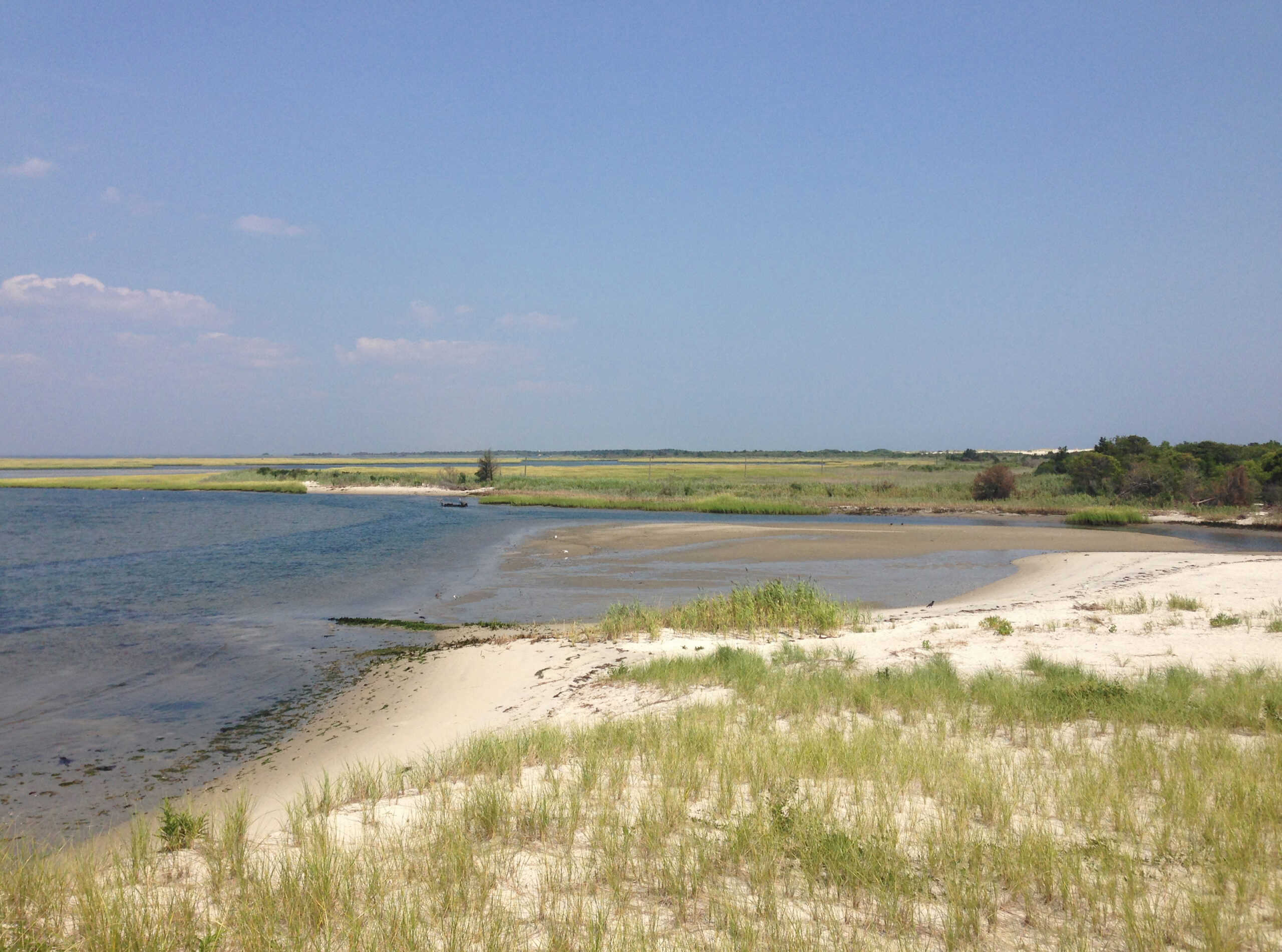
- Location: between the Atlantic Ocean and Barnegat Bay
The narrow Island Beach State Park is about 10 miles long. The 3,000 acres of land, shaped by storms and tides over thousands of years, is almost the same as when it was first described by Henry Hudson, an English explorer, in 1609.
New Mexico: White Sands
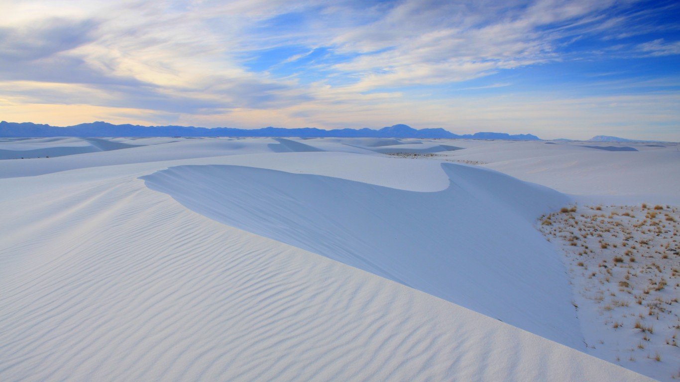
- Location: near Alamogordo, Doña Ana County
White Sands National Monument is the largest gypsum dune field in the world. Gypsum is rarely seen as sand, as it dissolves in water, but New Mexico’s dry climate has preserved the dunes. The pure white sand mounds stretch for 275 square miles.
New York: Niagara Falls
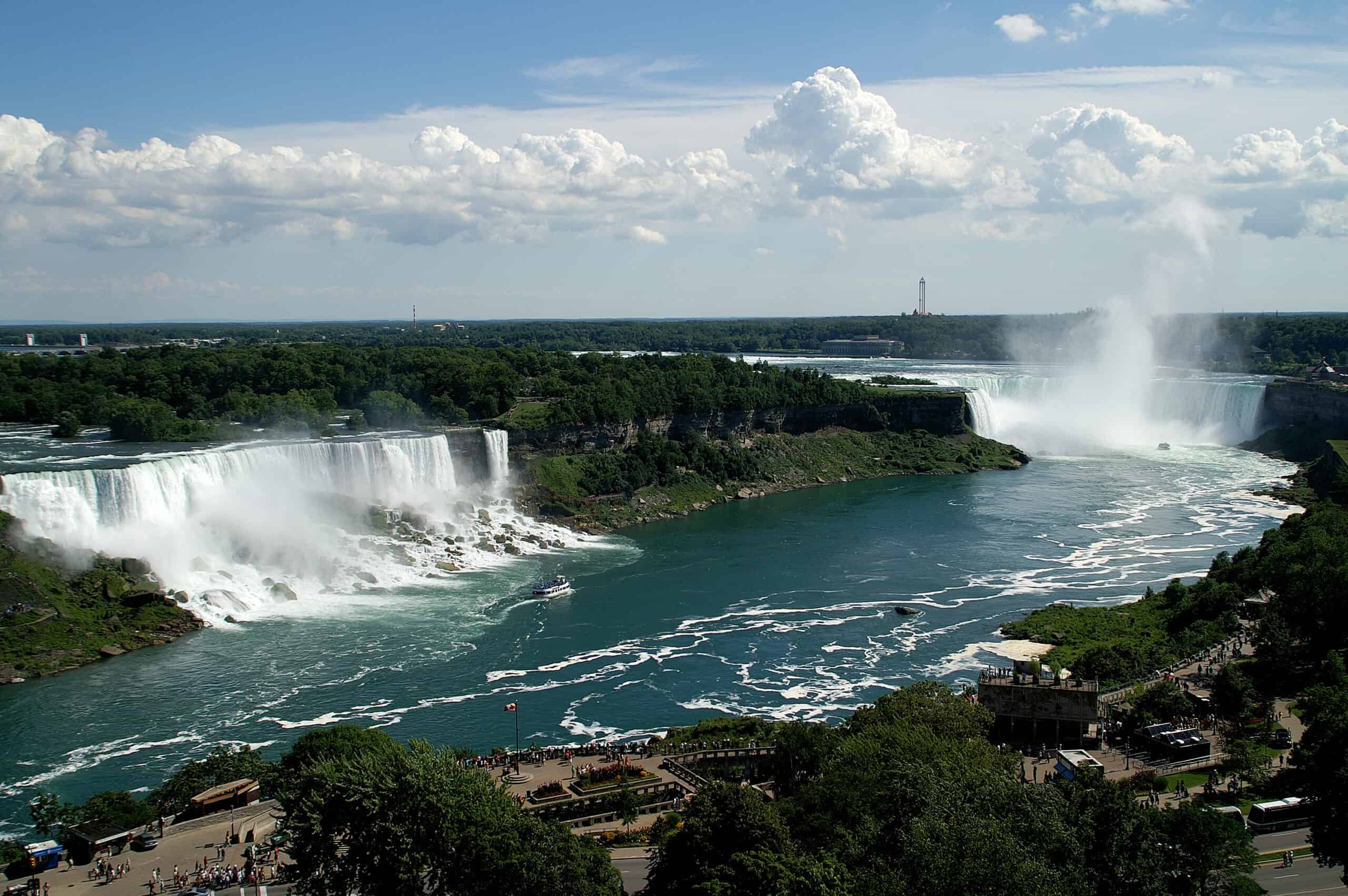
- Location: border between Niagara Falls, NY and Niagara Falls, Ontario, Canada
Niagara Falls are formed not by a river, but by Lake Erie draining into Lake Ontario. Niagara is an attraction that spans the border into Canada and is made of three falls: Horseshoe, Bridal Veil, and American Falls. On the U.S. side, Niagara Falls State Park is the nation’s oldest state park.
North Carolina: Linville Falls
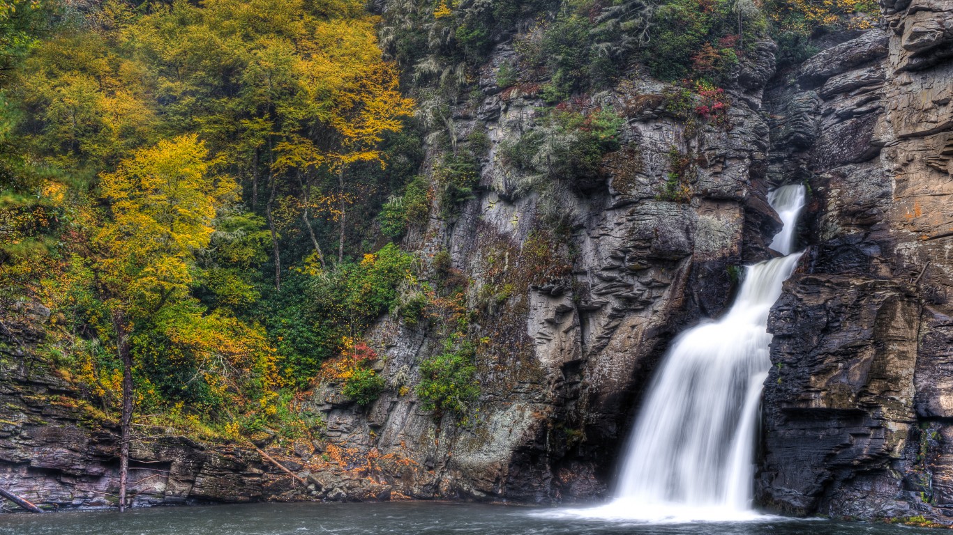
- Location: Blue Ridge Parkway
This three-tiered waterfall plummets 90 feet into the 12-mile-long Linville Gorge. Multiple trails between one and two miles round trip provide overlooks to the falls.
North Dakota: Painted Canyon
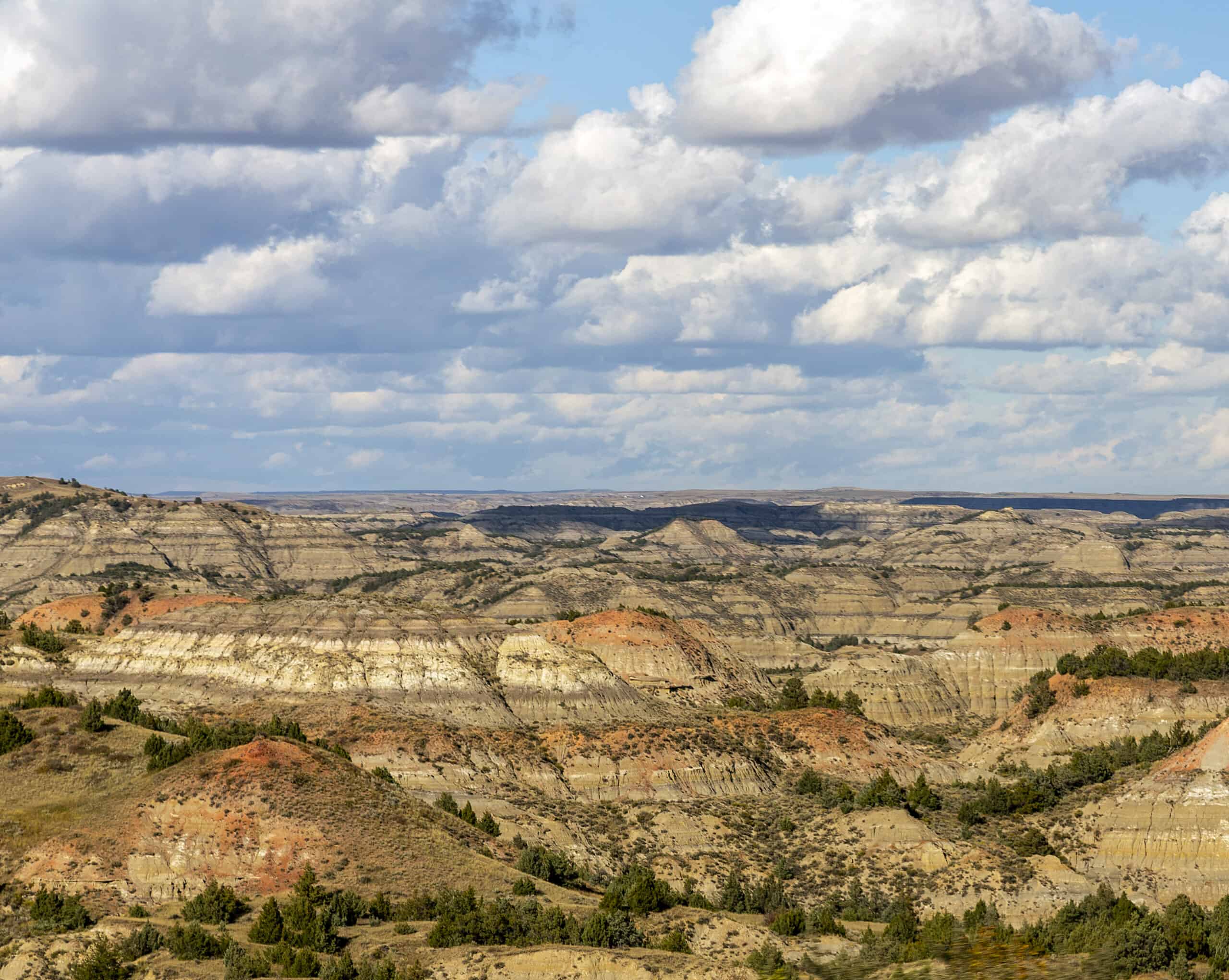
- Location: South Unit of Theodore Roosevelt National Park
Painted Canyon is one of the most photographed areas in North Dakota. Painted Canyon Overlook affords views of the Canyon, and a one-mile walking trail dips down below the rim to offer views of the unique strata.
Ohio: Hocking Hills Rock House

- Location: Hocking Hills State Park, Logan
A tunnel-like cave high up on a 150-foot cliff, the Rock House is a 200-foot-long, 25-foot-high tunnel caused by water erosion. Seven window-like holes and massive sandstone columns helped give the cave its name.
Oklahoma: Gloss Mountains
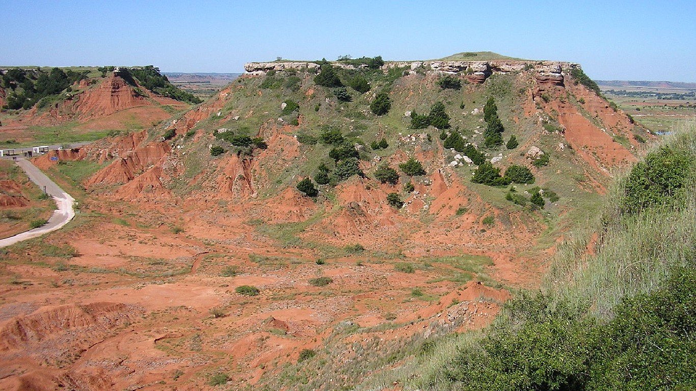
- Location: Gloss Mountain State Park, Fairview
Due to their reflective selenite content that mimics glass, especially when the sun hits at just the right angle, they are also called the Glass Mountains. These deep red buttes and mesas aren’t actually mountains, rising 150 to 200 feet.
Oregon – Thor’s Well
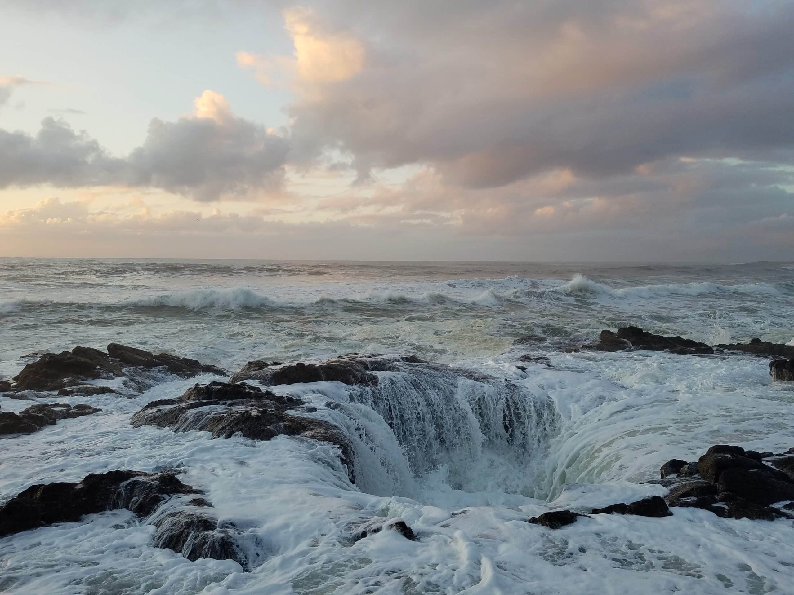
- Location: Yachats, Cape Perpetua Scenic Area
One of the most popular attractions in the state is a sinkhole that is repeatedly filled by the waves until the water sprays out from the top. The water then rolls back into the hole … until it fills the bowl again.
Pennsylvania: Cherry Springs State Park
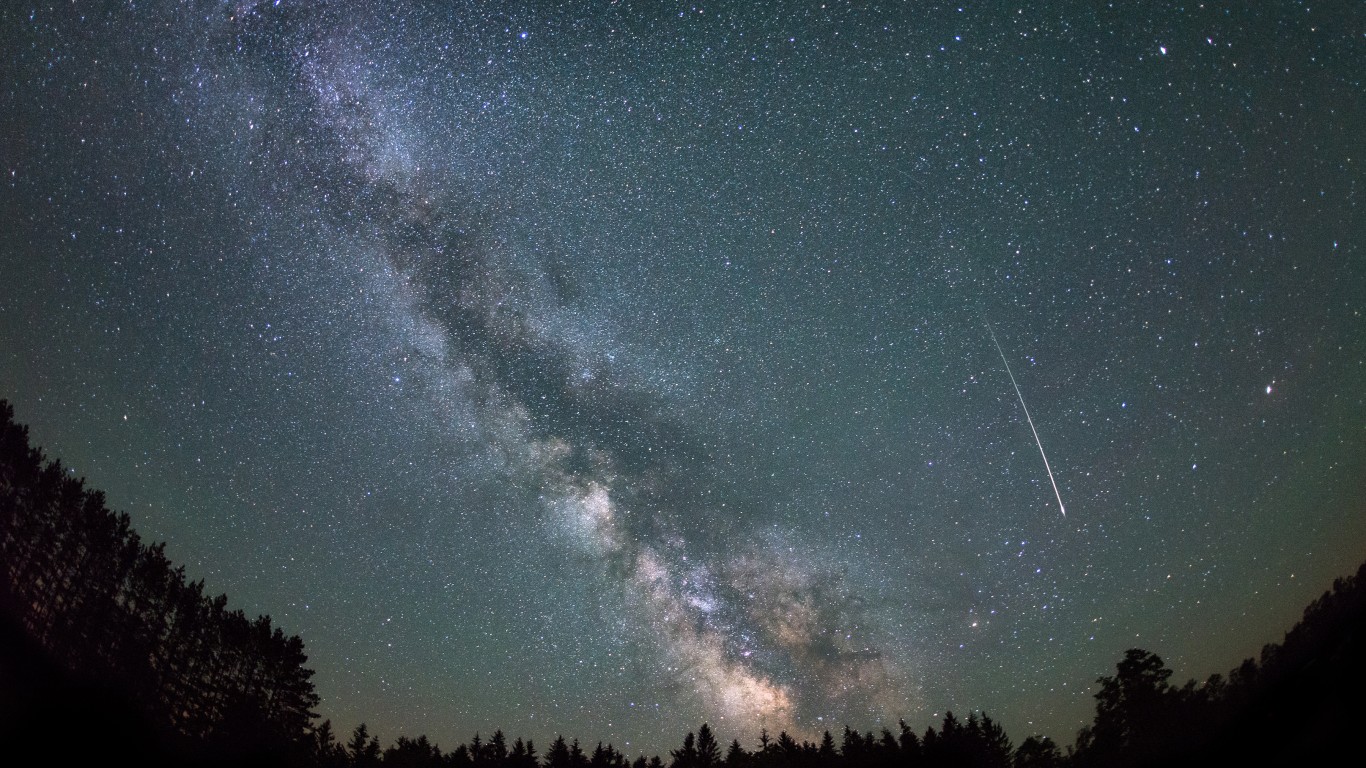
- Location: Susquehannock State Forest, Potter County
Surrounded by the 262,000-acre Susquehannock State Forest, this park is a remote location perfect for stargazing. Because the park has some of the darkest skies in the Eastern United States, it offers uniquely clear views of the Milky Way and other astronomical phenomena.
Rhode Island: Mohegan Bluffs
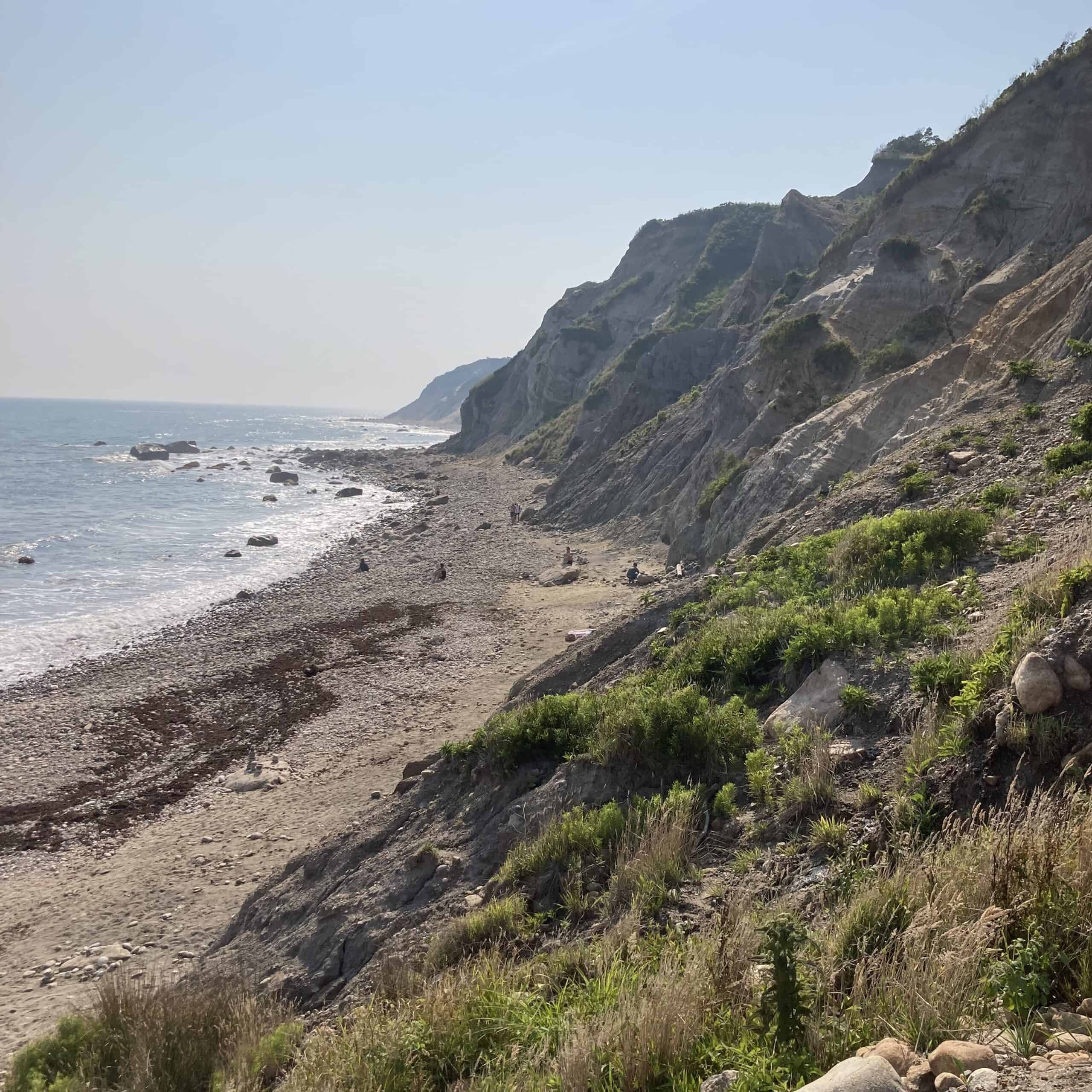
- Location: Block Island
The Mohegan Bluffs are a series of 200-foot-high coastal cliffs that span over two miles. A beach at the base of the bluffs is accessible by a steep trail from the top, and the overlooks offer views reaching as far as Montauk on Long Island.
South Carolina: Boneyard Beach
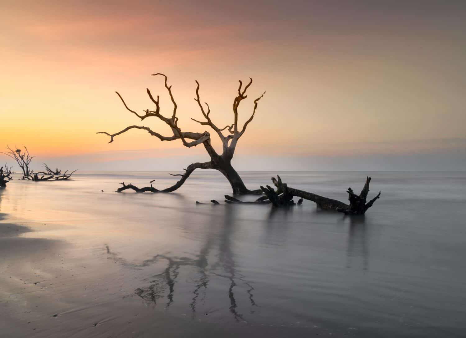
- Location: Bull Island
Boneyard Beach is an eerie stretch of coast where the ocean has overtaken trees that formerly grew on the shore. The saltwater eventually turned them white and grey; many have toppled over and lie in the waves.
South Dakota: Badlands
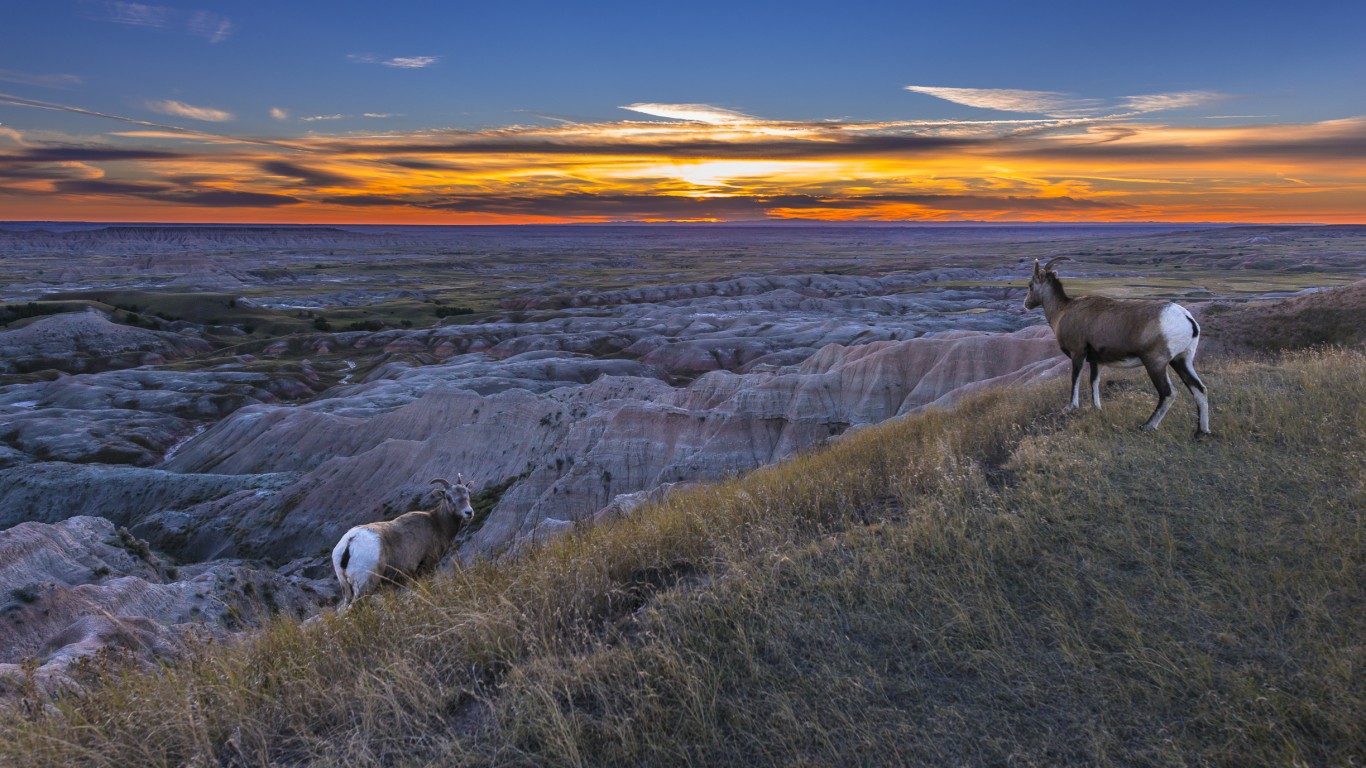
- Location: Badlands National Park, western South Dakota
Aside from being a diverse display of geologic deposits, the Badlands are also one of the most prolific fossil beds in the world. A 40-mile scenic byway through the park brings visitors up close to the colorful strata of the rock formations.
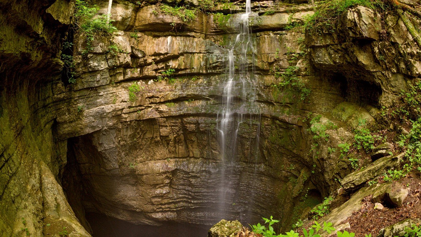
Tennessee: Fall Creek Falls
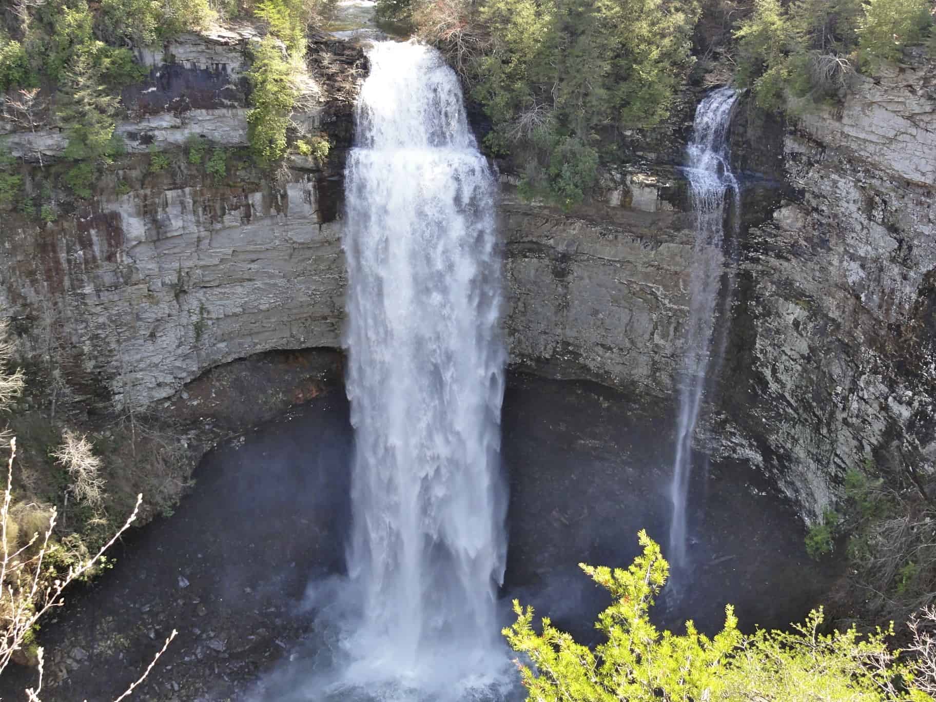
- Location: Spencer
One of the tallest single-drop waterfalls east of the Mississippi River, Fall Creek Falls is 256 feet high. A short walk from the parking lot leads to an overlook of the falls, and a steep trail leads to the base of the falls.
Texas: Big Bend National Park
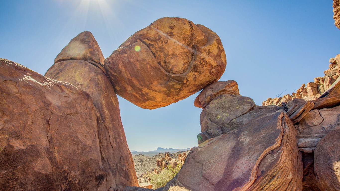
- Location: Brewster County, abutting the Rio Grande River along the Mexican border.
Big Bend National Park contains the Chisos mountains and miles of limestone canyons carved into the desert by the river.
Utah: Bryce Canyon
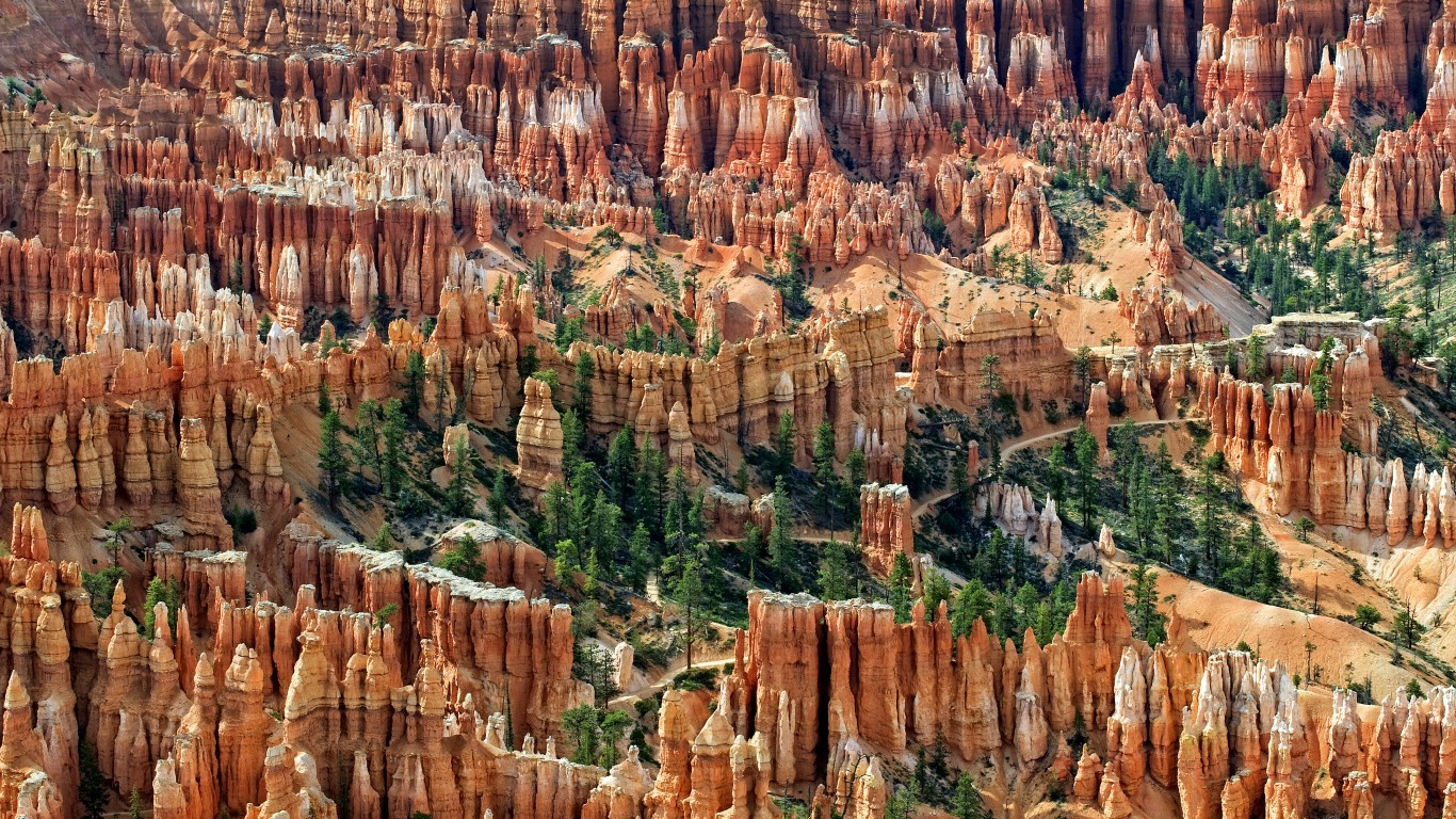
- Location: Bryce Canyon National Park
Eroded by wind and water over millions of years, the thousand-foot limestone and sandstone columns are striped with orange, pink, red, and white layers. This is not an actual canyon, however. The odd-shaped spires are a geologic formation called a hoodoo.
Vermont: Huntington Gorge

- Location: Richmond
The gorge is a series of cascades and waterfalls in a narrow rock slot that has claimed dozens of lives. While swimming in the gorge is not recommended, areas further downriver offer safe trails to the water’s edge and countless swimming holes.
Virginia: Skyline Drive
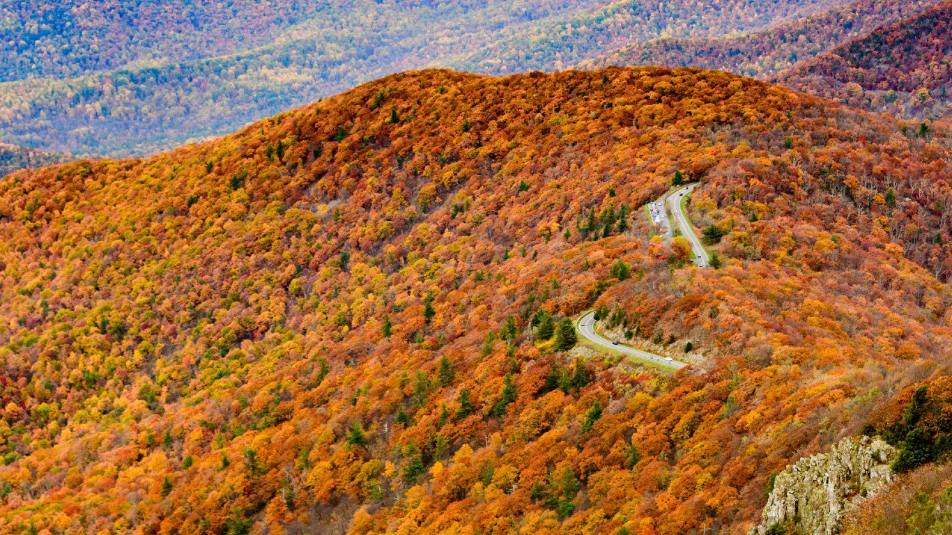
- Location: Shenandoah National Park
This iconic road is the only public road that runs 105 miles along the crest of the Blue Ridge Mountains. Though the drive should take you about three hours, realistically it will take you much longer because you will want to stop and take pictures at many of the road’s 70 overlooks and wildlife sightings.
Washington: Hoh Rainforest
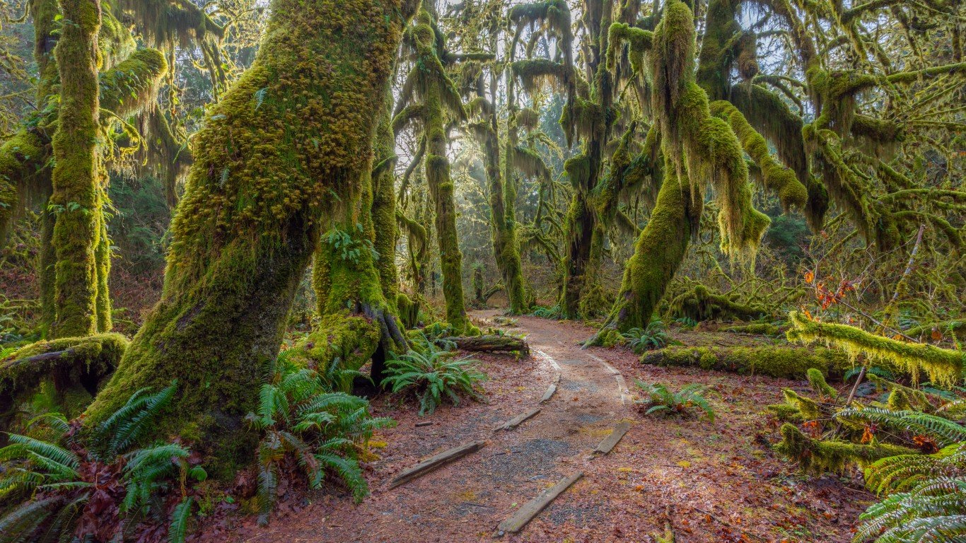
- Location: Olympic National Park
This temperate rainforest receives an average of 12 feet of rain a year and is one of the oldest living ecosystems on the planet. Multiple hiking trails bring visitors through the moss- and fern-covered trees, largely Sitka spruce and western hemlock.
West Virginia: Cranberry Glades
- Location: Hillsboro – part of the Monongahela National Forest in the Allegheny Mountains
The acidic soil of these boreal bogs in the Allegheny Mountains is home to many plants that usually live at higher altitudes, including carnivorous pitcher plants, cranberries, skunk cabbage, and sphagnum moss.
Wisconsin: Apostle Islands
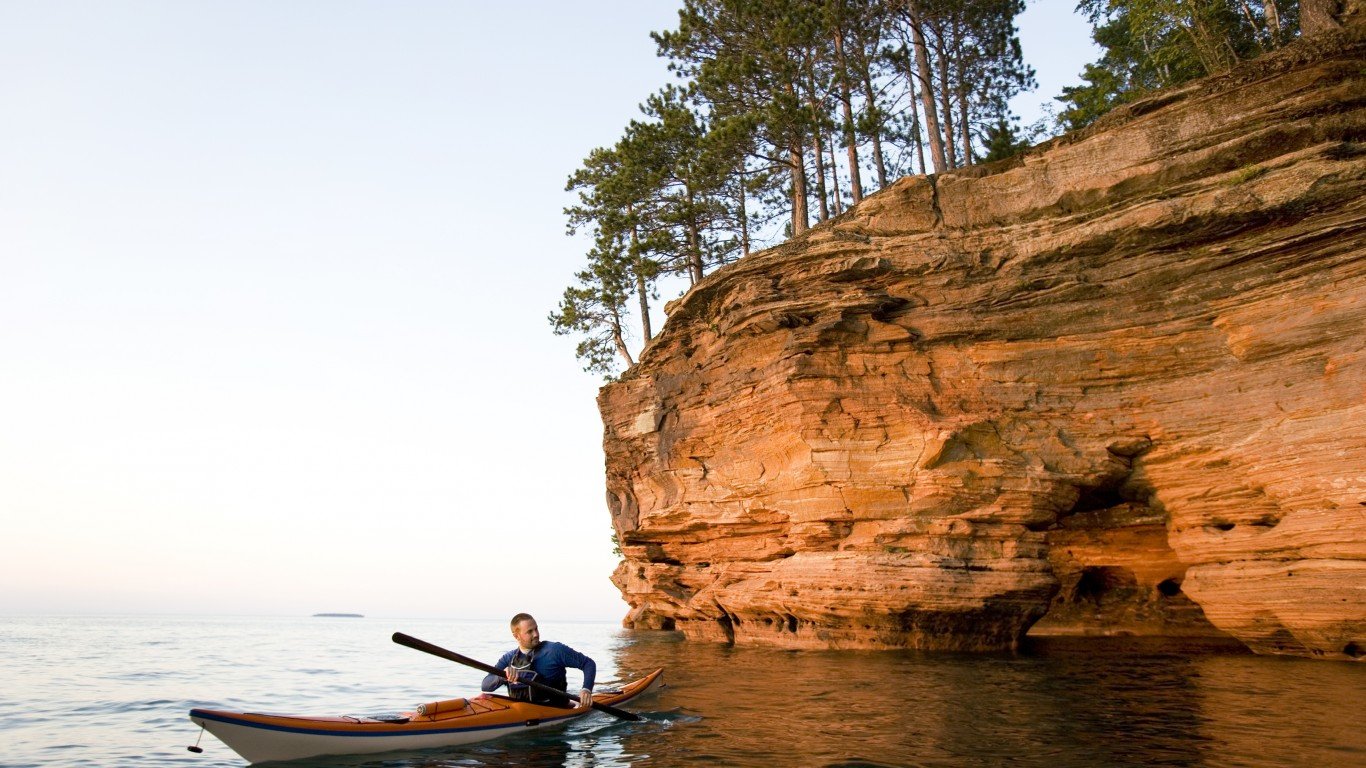
- Location: near Bayfield, along the southern shore of Lake Superior
The Apostle Islands are a group of about 20 islands covered in pits and caverns, old-growth forests, and waterfalls. They are accessible by boat during the warmer months, but if the lake freezes deep enough to provide safe passage in the winter, visitors can walk to some of the islands, which are covered in beautiful ice formations.
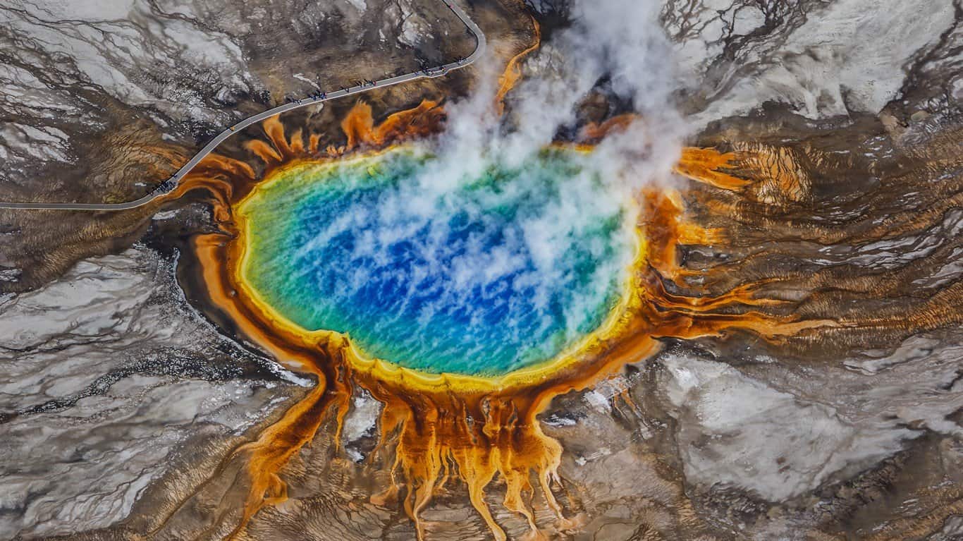
Wyoming: Grand Prismatic Spring

- Location: Midway Geyser Basin, Yellowstone National Park
The largest hot spring in the park, its color rings are due to bacteria that inhabit different temperature zones in the water, which is scalding in the center and cooler at the pool edges.