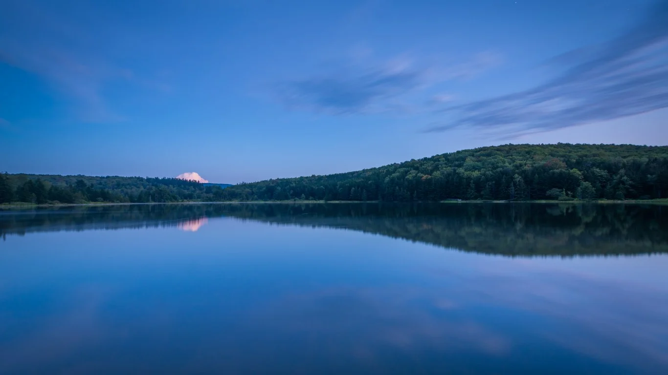
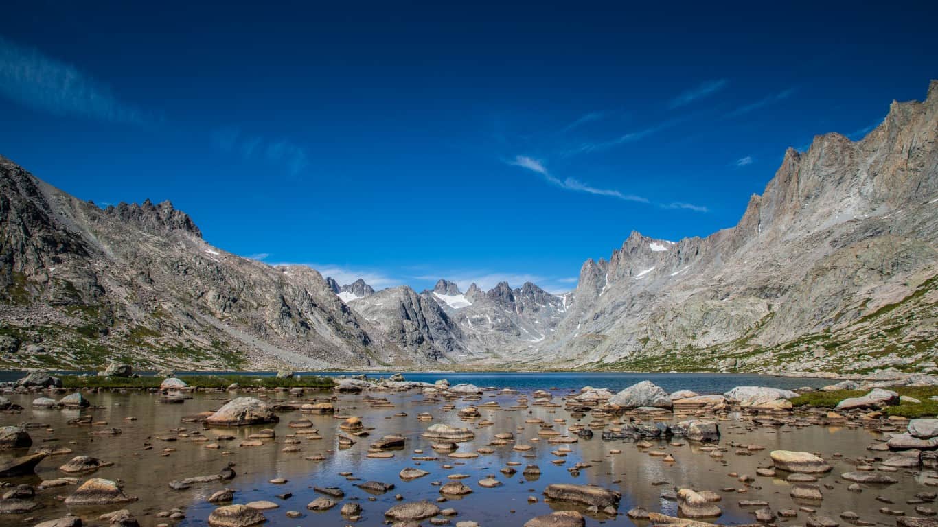
Every state in the U.S. has a high point or mountain that towers over the rest. That mountain is where you’ll find the highest peak, and many have multiple trails that lead to the peak. How many have you visited? I’ve been to the top of my state’s tallest mountain, and it’s something I recommend everyone do at least once in their lifetime.
Twenty years ago, the U.S. Congress launched the Federal Lands Recreation Enhancement Act allowing the collection of fees at national parks. One aspect of this act was the creation of the America the Beautiful Pass. The National Park Service refers to this pass as “your ticket to more than 2,000 federal recreation sites.” Eighty percent of the fees from these passes and other park fees must be reinvested in the maintenance of the trails and buildings.
Where do the remaining 20% of the collected fees go? Every park has staff at visitor centers. You have rangers helping people who encounter issues on the trails. Fees also provide the money to pay their salaries.
The pass covers the entrance fees at national parks, national forests, federally managed lands, and wildlife refuges. Pay one price at the USGS Online Store for a pass that lasts one year or a lifetime if you are 62 or older. The pass is free for military members and people with permanent disabilities.
Use the pass to start exploring the highest point in every state yourself. Using USGS statistics, here are the 50 highest points, and the best parks to visit to reach that peak. (In addition, read The Most Underrated Landmark in Every State to find more to do during your visit.)
Alabama
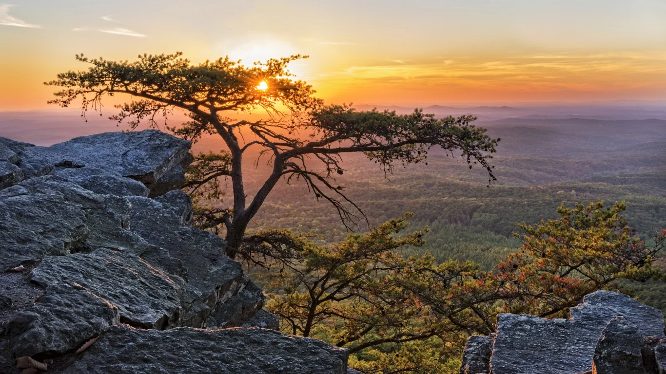
At 2,407 feet above sea level, Cheaha Mountain is the highest peak in Alabama. It’s nicknamed “Island in the Sky,” and the waters of Cheaha Lake provide a nice place to cool off after your hike.
- Tallest Peak: 2,407 feet
- Where to Go: Cheaha State Park and Talladega National Forest
Alaska
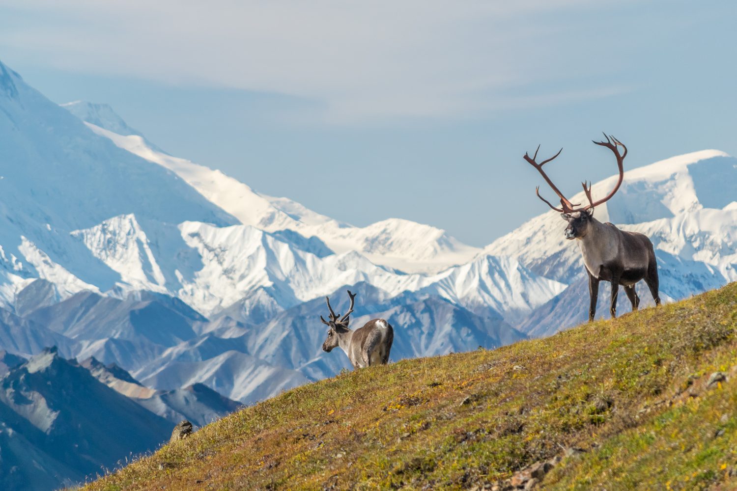
Denali is the highest peak in North America and was once known as Mount McKinley. President Obama signed the documents to return the mountain to its original name from the Athabascan indigenous people in 2015. It’s recommended that visitors who want to attempt the hike stop at the Talkeetna Ranger Station to learn the best routes and equipment they’re going to need.
- Tallest Peak: 20,320 feet
- Where to Go: Denali National Park and Preserve
Arizona
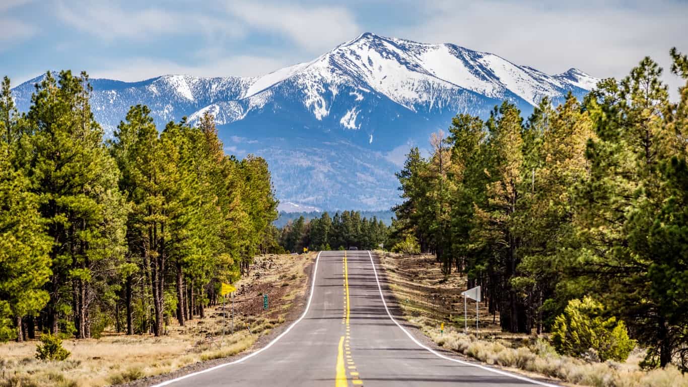
Humphreys Peak is just under 15 miles from Flagstaff. It’s a challenging five-mile climb that requires physical stamina. The trail starts in a field at about 9,200 feet in elevation. From there, it goes up a rocky trail to the peak.
- Tallest Peak: 12,633 feet
- Where to Go: Snowbowl Road to the lower parking lot for Humphreys Trailhead
Arkansas
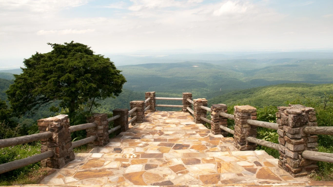
Mount Magazine is in the Ozark-St. Francis National Forests, with hiking trails and trails for mountain bikes, ATVs, and horses, too. Camping is available, but there’s also a lodge for those who want more luxurious accommodations after a hike.
- Tallest Peak: 2,753 feet
- Where to Go: Mount Magazine State Park
California
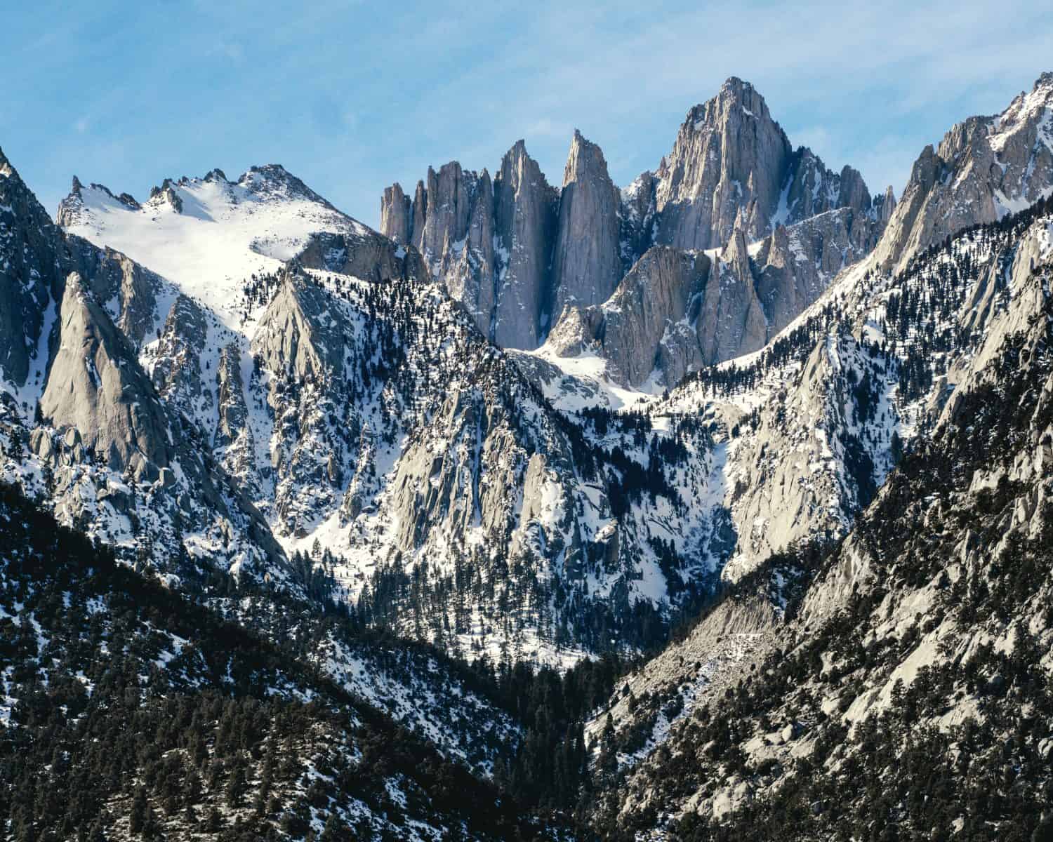
Eastern California is home to the highest peak in the state. Mount Whitney is on the border of Sequoia National Park and near Lone Pine. Surprisingly, the lowest point in the U.S., Badwater Basin, is just 90 miles away. A Wilderness Permit is required to reduce the impact of people on the mountain range.
- Tallest Peak: 14,494 feet
- Where to Go: Inyo National Forest or Sequoia National Park
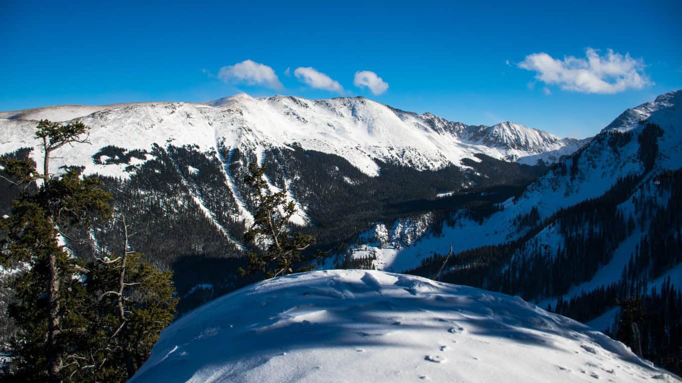
Colorado
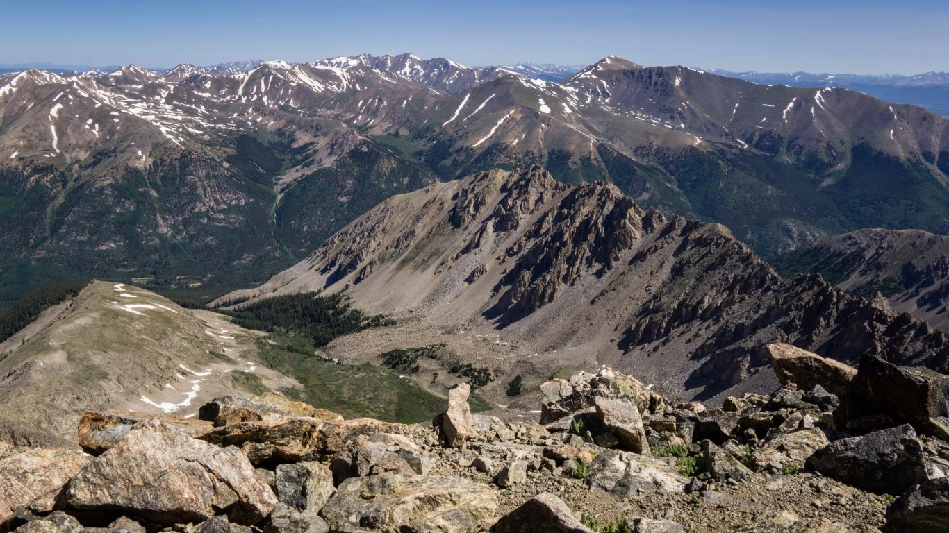
Colorado’s highest point is on what’s known as one of the “Fourteeners,” which are one of Colorado’s peaks measuring over 14,000 feet. Head up Mount Elbert on one of two trails near Leadville.
- Tallest Peak: 14,433 feet
- Where to Go: North Elbert Trail (4.3 miles) or South Elbert Trail (5.8 miles)
Connecticut
Mount Frissell is the location of Connecticut’s highest peak. In the 1880s, surveyors placed a plaque on Bear Mountain and built a tower to commemorate the highest point, but they were wrong. The Green Stake is on Mount Frissell and is reached by hiking about 2 ½ miles on the Mount Frissell Trail.
- Tallest Peak: 2,380 feet
- Where to Go: Mount Riga Road to the AMC parking lot
Delaware
An azimuth is an arc measurement between a north and south point of the horizon. This explains part of the name of Delaware’s highest point. Ebright Azimuth sits in a residential area just over six miles from Wilmington and has a sign and paved brick area off the sidewalk if you want to take a photo.
- Tallest Peak: 448 feet
- Where to Go: The intersection of Ebright Road and Ramblewood Drive near the Pennsylvania border
Florida
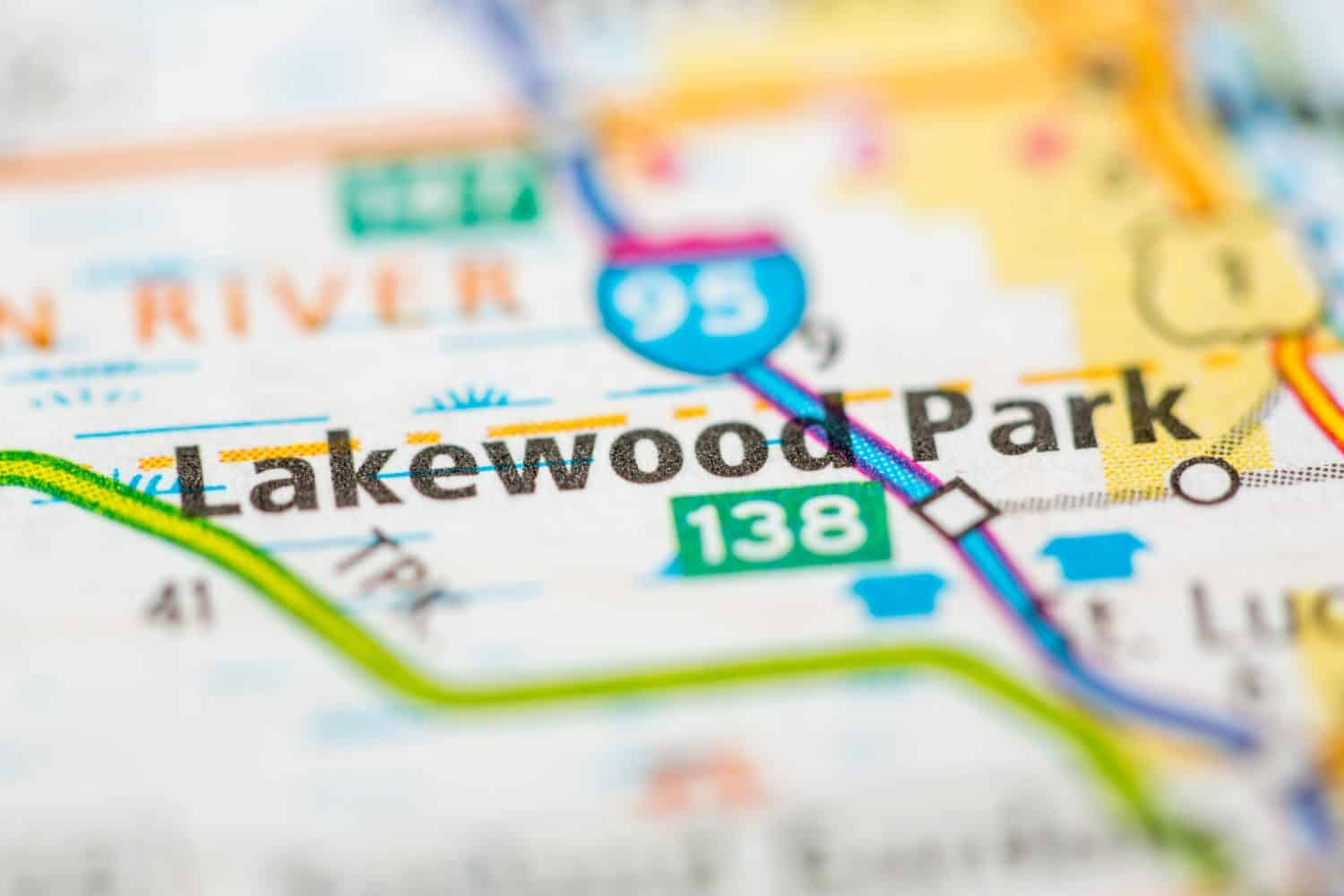
Britton Hill is Florida’s highest point, but it’s also the lowest of all high points in the U.S. The surrounding Lakewood Park is dog-friendly and has three easy trails.
- Tallest Peak: 345 feet
- Where to Go: Lakewood Park in DeFuniak Springs
Georgia
Located in Hiawassee in North Georgia, Brasstown Bald is the highest point in the state. It’s a half-mile steep hike that provides views of four states if you make it.
- Tallest Peak: 4,784 feet
- Where to Go: Chattahoochee-Oconee National Forest
Hawaii
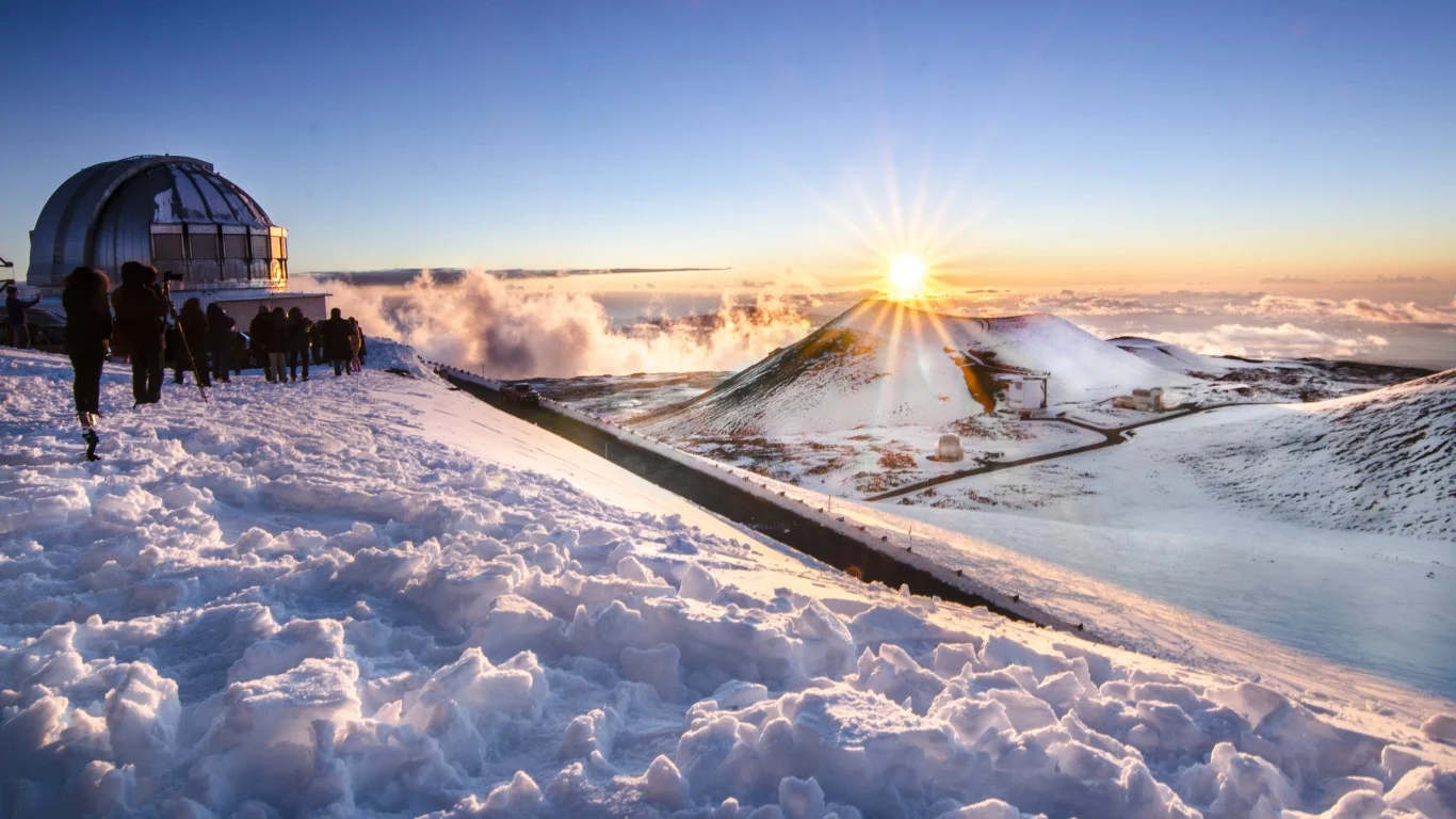
As both the highest point in Hawaii and in the entire Pacific Basin, Mauna Kea is about 35 miles from Hilo. It’s a dormant volcano that hasn’t been active for thousands of years.
- Tallest Peak: 13,796 feet
- Where to Go: The Mauna Kea Visitor Center and book an excursion, rent a 4×4, or start hiking to continue from there
Idaho
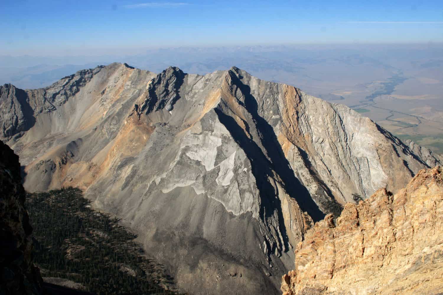
Borah Peak is the highest point in the state and is accessible via a 3.5-mile hike. The Borah Peak Trailhead starts at an elevation of 7,400 feet.
- Tallest Peak: 12,662 feet
- Where to Go: Borah Peak Wilderness Study Area near Mackay
Illinois
Charles Mound is the highest point in the state and is on private property about 11 miles from Galena. Willis Tower (formerly the Sears Tower) is higher at 1,451 feet, but it’s manmade and isn’t considered for that reason.
- Tallest Peak: 1,235 feet
- Where to Go: Private property and current owners only allow access on limited occasions
Indiana
The highest point in Indiana is found on Hoosier Hill in a bunch of trees. There’s a stone marker designating the spot.
- Tallest Peak: 1,257 feet
- Where to Go: Elliott Road in Bethel
Iowa
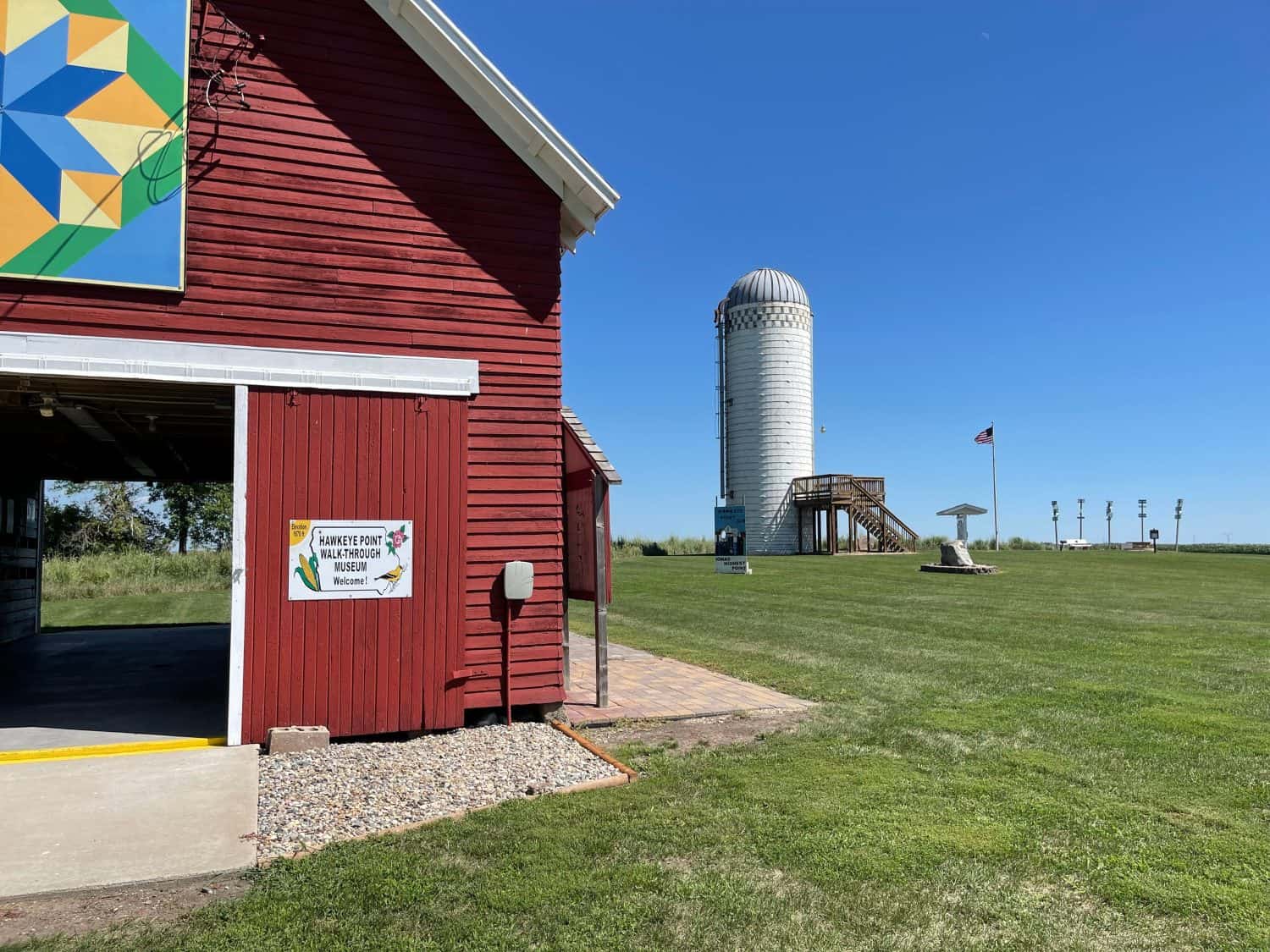
Hawkeye Point is the highest point and is found on a farm. Osceola County purchased seven acres of that farm to create a parking area and amenities including a campground for visitors to this high point.
- Tallest Peak: 1,670 feet
- Where to Go: 130th Street in Sibley
Kansas
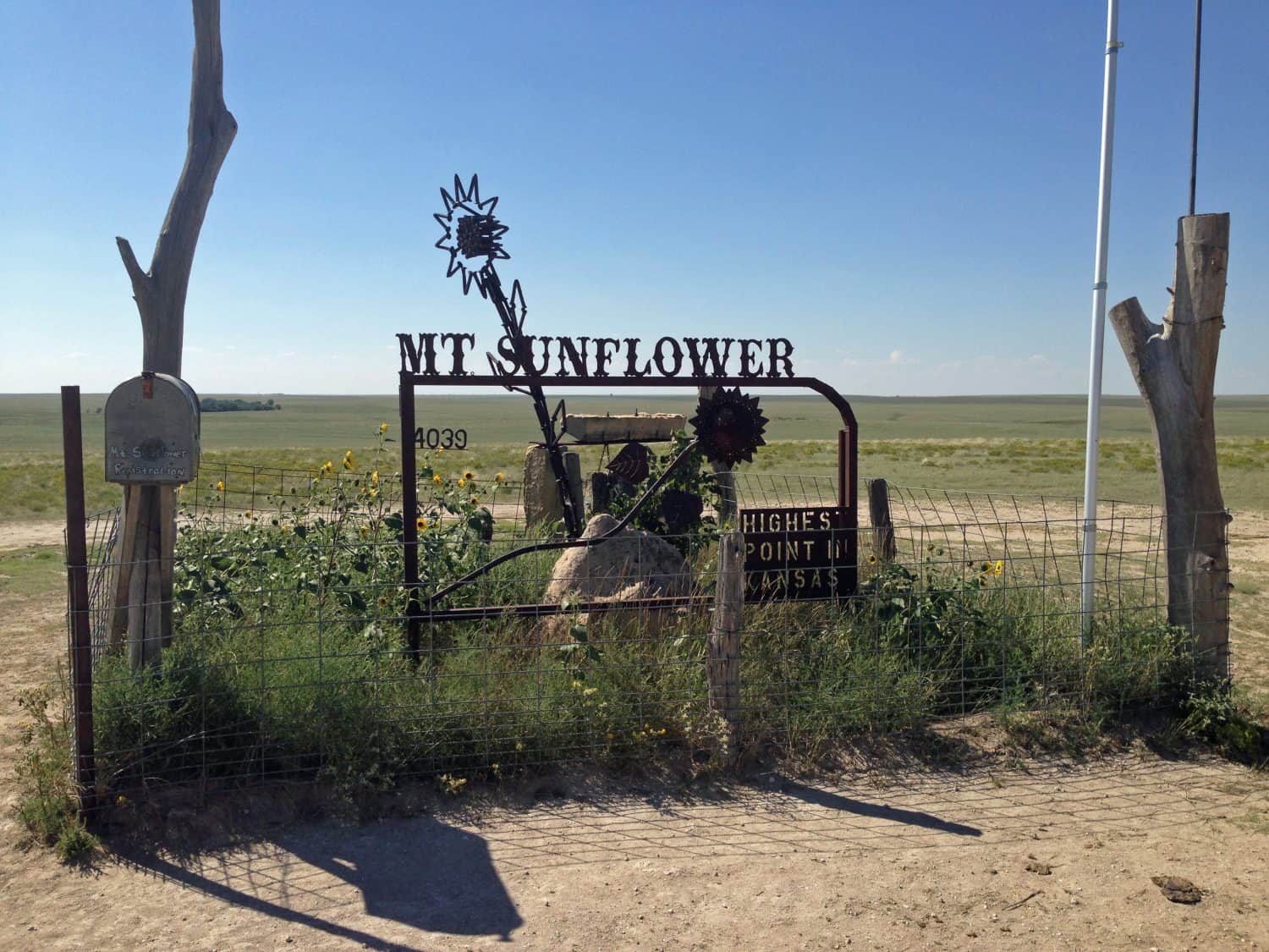
In a state known for its flat plains, Mount Sunflower stands over 4,000 feet above sea level. It’s over 3,300 feet taller than the lowest point in the state.
- Tallest Peak: 4,039 feet
- Where to Go: Private property with access allowed by the landowners
Kentucky

Black Mountain is owned by coal operators. There is an agreement between the state that prohibits surface mining on 1,800 acres at the top and a conservation area for over 18,000 acres that limits mining to areas below 3,200 feet in elevation.
- Tallest Peak: 4,145 feet
- Where to Go: Private property
Louisiana

Some buildings in New Orleans stand taller than Driskill Mountain. It’s not very tall, but it does offer a moderate hike for people who want to explore nature. It’s on private property so be respectful.
- Tallest Peak: 535 feet
- Where to Go: Mount Zion Presbyterian Church
Maine
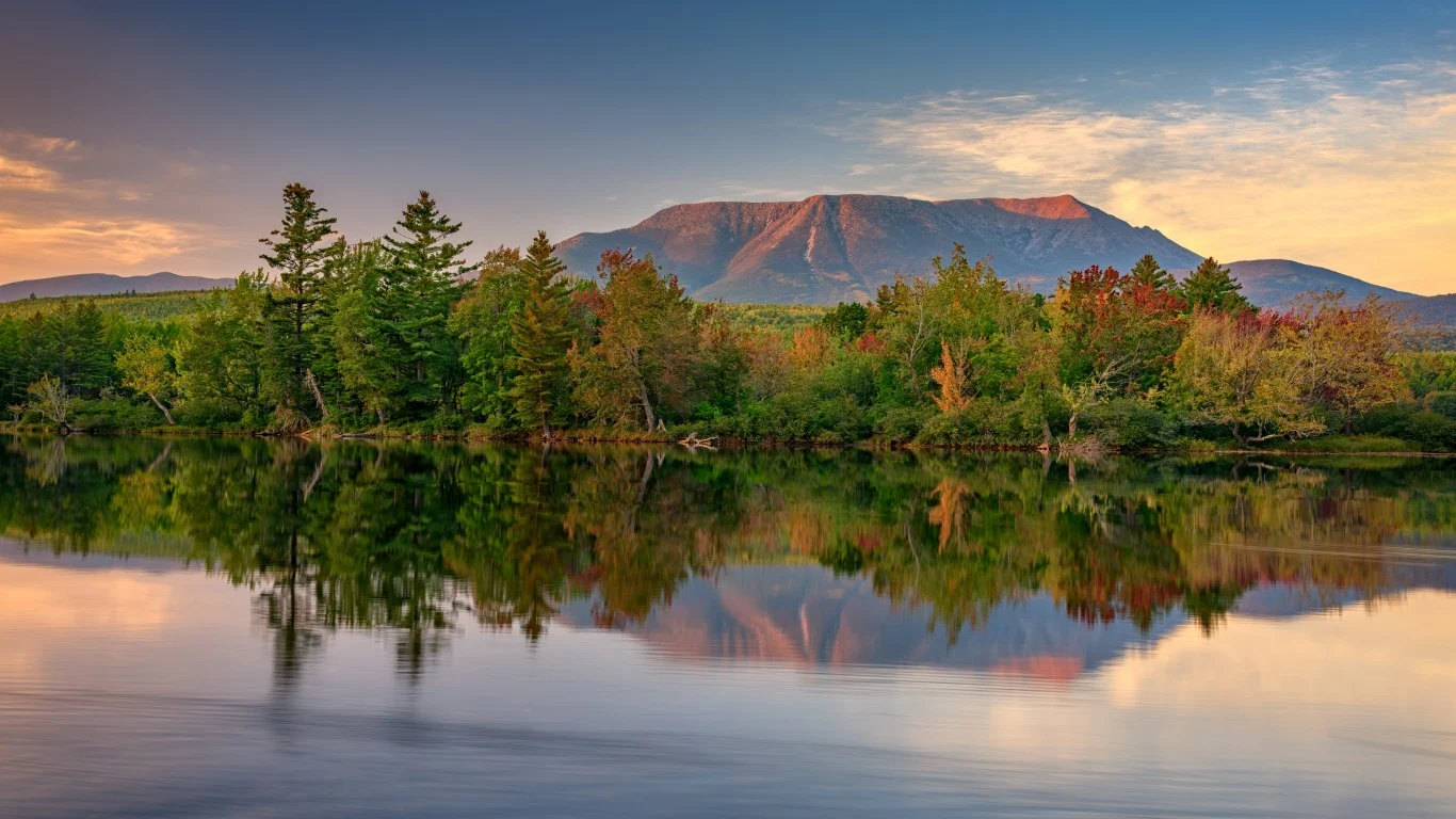
Mount Katahdin is the final point of the Appalachian National Scenic Trail and the tallest point in Maine. Baxter Peak is the final destination on the trail.
- Tallest Peak: 5,268 feet
- Where to Go: Baxter State Park
Maryland
Hoye Crest is on Backbone Mountain on the border of Maryland and West Virginia. The Maryland side of the slope is private property so the mile-long trail to the top goes up the West Virginia side.
- Tallest Peak: 3,360 feet
- Where to Go: Monongahela National Forest in West Virginia
Massachusetts
Mount Greylock is the highest point in the state and has several trails ranging from easy to extremely difficult. If you don’t want to hike, take the Mount Greylock Auto Road for vehicles less than 22 feet in length.
- Tallest Peak: 3,491 feet
- Where to Go: Mount Greylock State Reservation
Michigan
Mount Arvon is in Michigan’s Upper Peninsula about 30 miles from L’Anse. From the parking lot, you have a walk of about 300 feet to finish and see the panoramic Lake Michigan views.
- Tallest Peak: 1,979 feet
- Where to Go: East Board Street
Minnesota
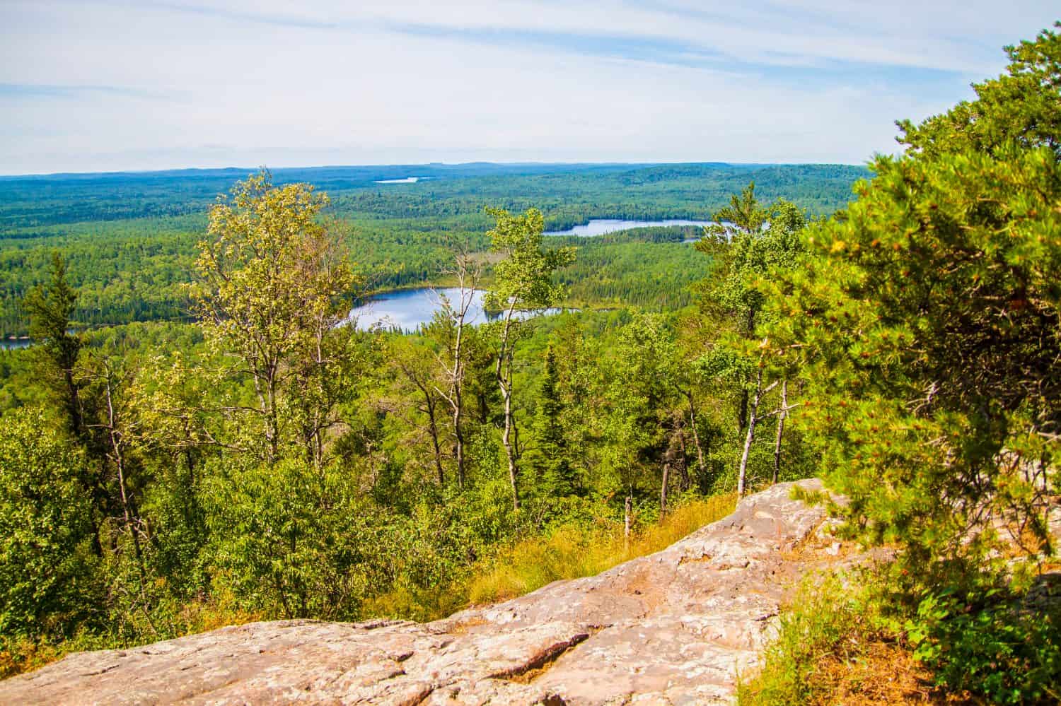
Permits are required for a day hike to the top of Eagle Mountain. Self-service kiosks are available at the trailhead. If you’re staying overnight, you need to go to the Boundary Waters site to get the correct Wilderness Permit.
- Tallest Peak: 2,301 feet
- Where to Go: Boundary Waters Canoe Area Wilderness
Mississippi
At less than 1,000 feet, Woodall Mountain isn’t very tall. It’s in the northeastern corner of the state near both Alabama and Tennessee.
- Tallest Peak: 806 feet
- Where to Go: Privately owned but the owner maintains a mile-long gravel road to the trailhead
Missouri
Taum Sauk Mountain is the location of Missouri’s highest point. The state park is also home to a gorgeous waterfall. Mina Sauk Falls plummet more than 130 feet down volcanic ledges to a clear pool
- Tallest Peak: 1,772 feet
- Where to Go: Taum Sauk Mountain State Park
Montana
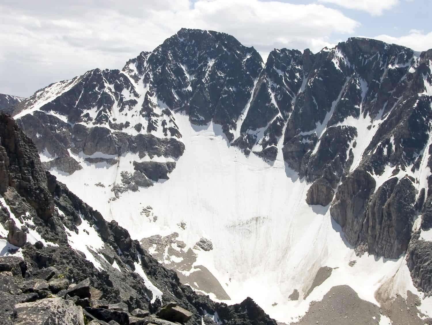
Granite Peak is Montana’s highest point and boasts the nickname “The Roof of Montana.” It’s not a climb for most people as rock faces require experienced rock climbers with the correct equipment.
- Tallest Peak: 12,799 feet
- Where to Go: Absaroka-Beartooth Wilderness
Nebraska
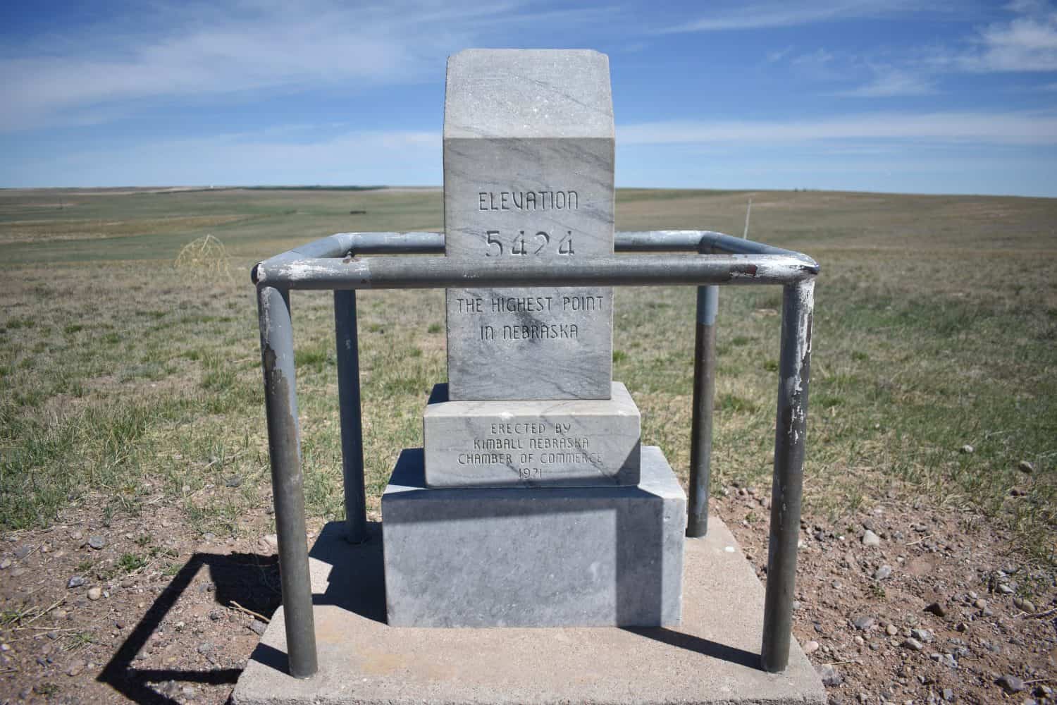
Panorama Point is the highest point in the state. It is also near the Three-State Marker where Nebraska, Colorado, and Wyoming converge. Buffalo make the area their home, so give them plenty of room. Panorama Point is on private property and has a lock box for an admission fee.
- Tallest Peak: 5,424 feet
- Where to Go: High Point Welcome Center
Nevada
Boundary Peak is Nevada’s highest peak and overlooks the Sierra Nevada Mountains, Mono Lake basin, and White Mountain Wilderness. Benton, California, and Dyer, Nevada, are the closest towns.
- Tallest Peak: 13,140 feet
- Where to Go: Boundary Peak Wilderness
New Hampshire
Views from the highest point in New Hampshire make it possible to see Quebec, Maine, Massachusetts, and Vermont. You can also see the Atlantic Ocean on a clear day. If you don’t feel like hiking, take the Mount Washington Cog Railway or Auto Road to the top.
- Tallest Peak: 6,288 feet
- Where to Go: Mount Washington State Park
New Jersey
High Point is on Kittatinny Ridge and is the highest point in New Jersey. It’s also home to the High Point Monument, a memorial to New Jersey veterans.
- Tallest Peak: 1,803 feet
- Where to Go: High Point State Park
New Mexico
Found in the Sangre de Cristo Mountains, Wheeler Peak is the most-used area of the Carson National Forest. It’s home to many animals including black bears, elk, mountain lions, and mule deer.
- Tallest Peak: 13,161 feet
- Where to Go: Wheeler Peak Wilderness
New York
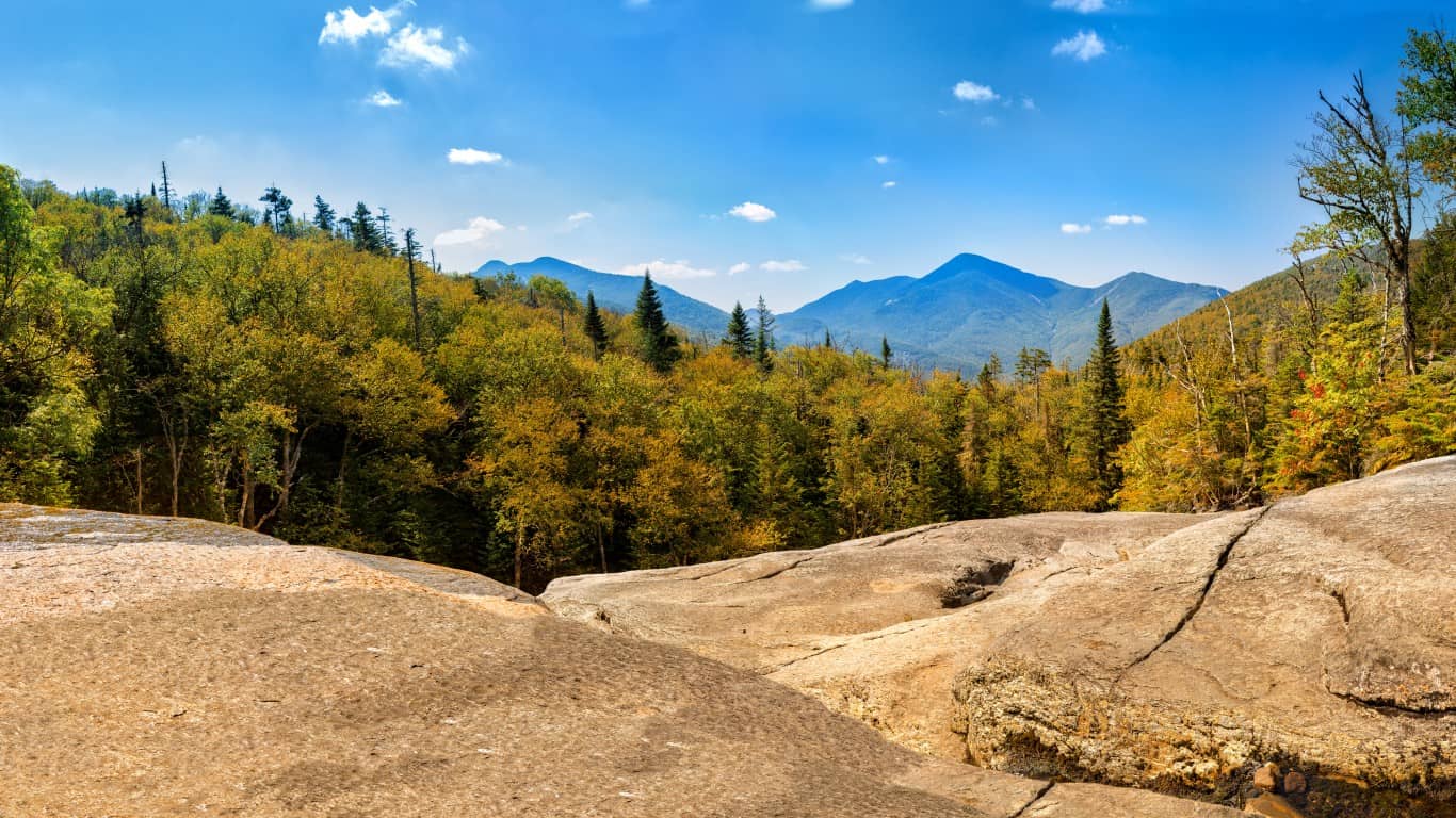
Mount Marcy is in the northern part of the state near Lake Placid, home of the 1932 and 1980 Winter Olympics. Theodore Roosevelt was known to hike here. The Hudson River gets its start in the Opalescent River and Lake Tear of the Clouds.
- Tallest Peak: 5,344 feet
- Where to Go: High Peak Information Center (Van Hoevenberg Trail)
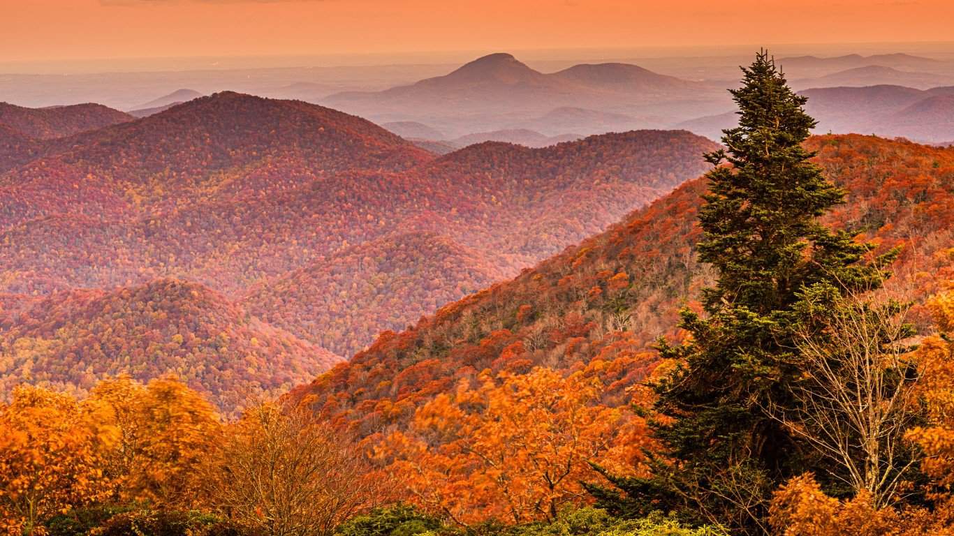
North Carolina
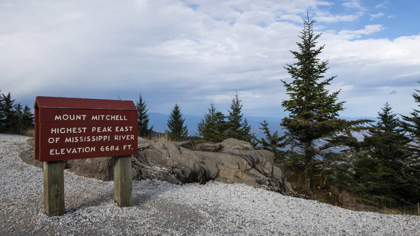
Mount Mitchell is not only the state’s highest peak, but it’s also in North Carolina’s first state park. There’s an observation deck, a museum, and a restaurant within the park.
- Tallest Peak: 6,684 feet
- Where to Go: Mount Mitchell State Park
North Dakota
As part of the Dakota Hogback Formation, the area is very rocky and challenging. It’s a 1.5-mile trip to the White Butte Peak, and if you make it, you get information on how to get a coupon booklet for the area and a White Butte T-shirt.
- Tallest Peak: 3,506 feet
- Where to Go: Head east on Highway 85 from Amidon and take 140th Avenue to 69th Street to the trailhead parking lot on White Butte Trail Road
Ohio
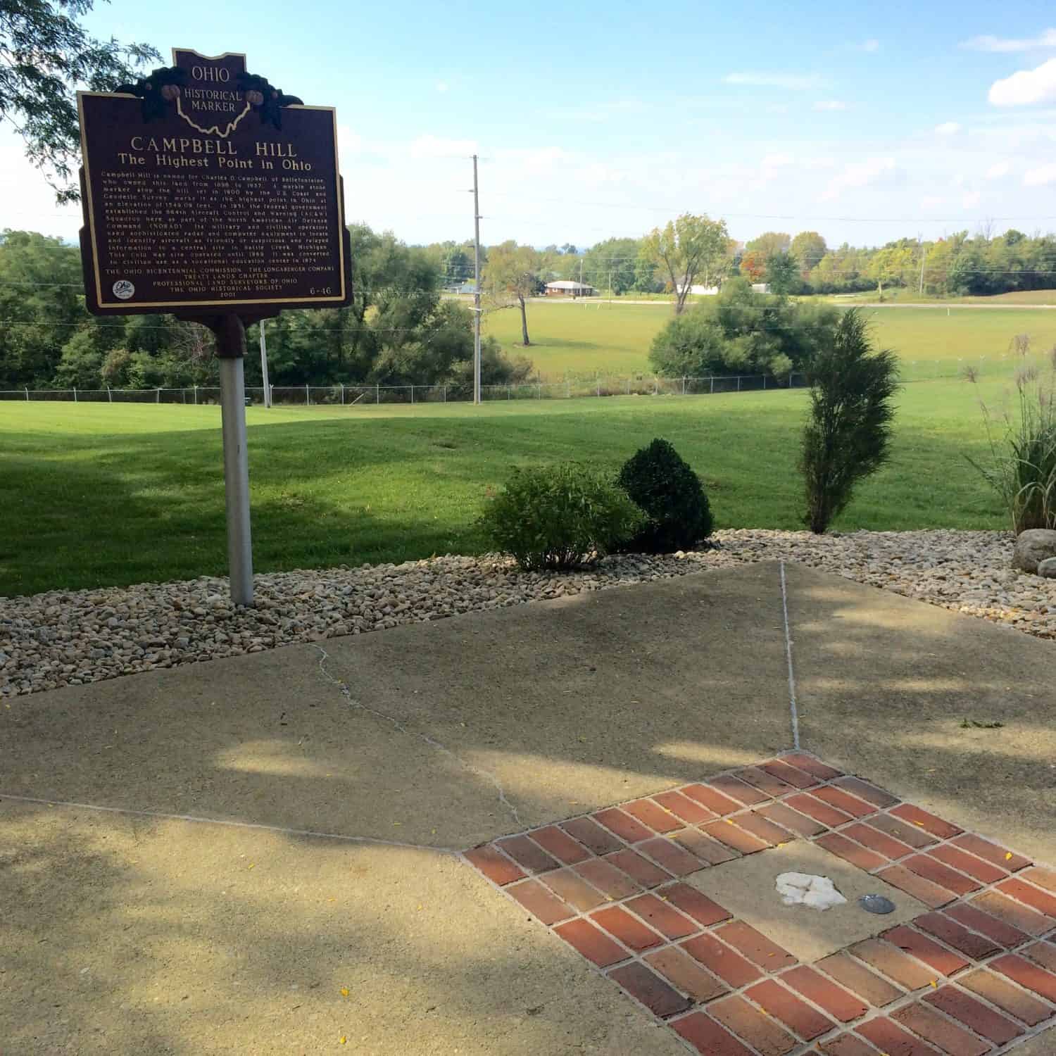
Campbell Hill housed an aircraft control and warning squadron during the Cold War. A piece of marble is located at the highest point in Ohio.
- Tallest Peak: 1,550 feet
- Where to Go: Take East Sandusky Avenue to Ohio Hi-Point Career Center
Oklahoma
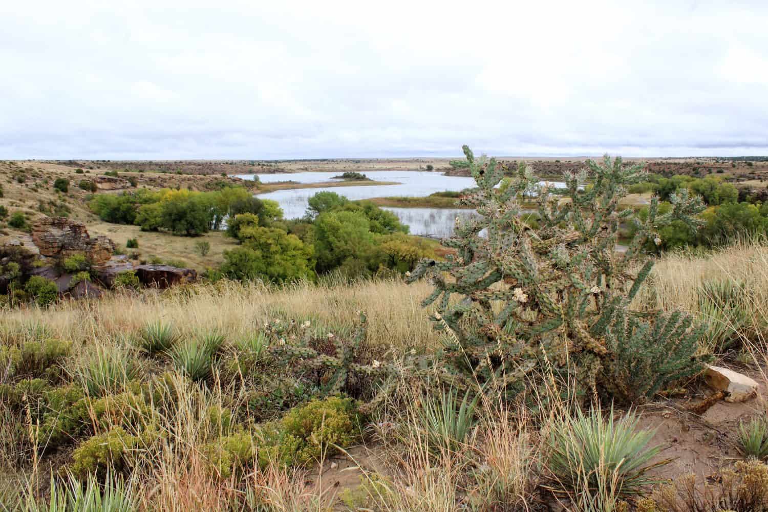
Black Mesa is the highest point in Oklahoma and brings hikers through prairies and foothills. It’s an almost 5-mile hike that’s not for the beginner once the rocky slopes begin.
- Tallest Peak: 4,973 feet
- Where to Go: Black Mesa Summit Trail in Kenton
Oregon
Mount Hood falls between Clackamas and Hood River. It’s about 45 miles from Portland, which is why it’s so visible from the city, and is the Cascade Range’s fourth-highest peak.
- Tallest Peak: 11,239 feet
- Where to Go: Mount Hood National Forest
Pennsylvania
Mount Davis is in Somerset County and the highest point in Pennsylvania. The Department of Conservation and National Resources manages the area and has wheelchair-friendly trails.
- Tallest Peak: 3,213 feet
- Where to Go: Forbes State Forest
Rhode Island

Jerimoth Hill is a short walk from Route 101. There’s a survey marker to point out the trail that leads to the high point on the hill.
- Tallest Peak: 812 feet
- Where to Go: Hartford Pike in Foster
South Carolina
Sassafras Mountain boasts a welcoming observation tower that’s accessible via wide planked walkways and a giant stone compass that shows where South Carolina ends and North Carolina begins.
- Tallest Peak: 3,160 feet
- Where to Go: Jim Timmerman National Resources Area
South Dakota
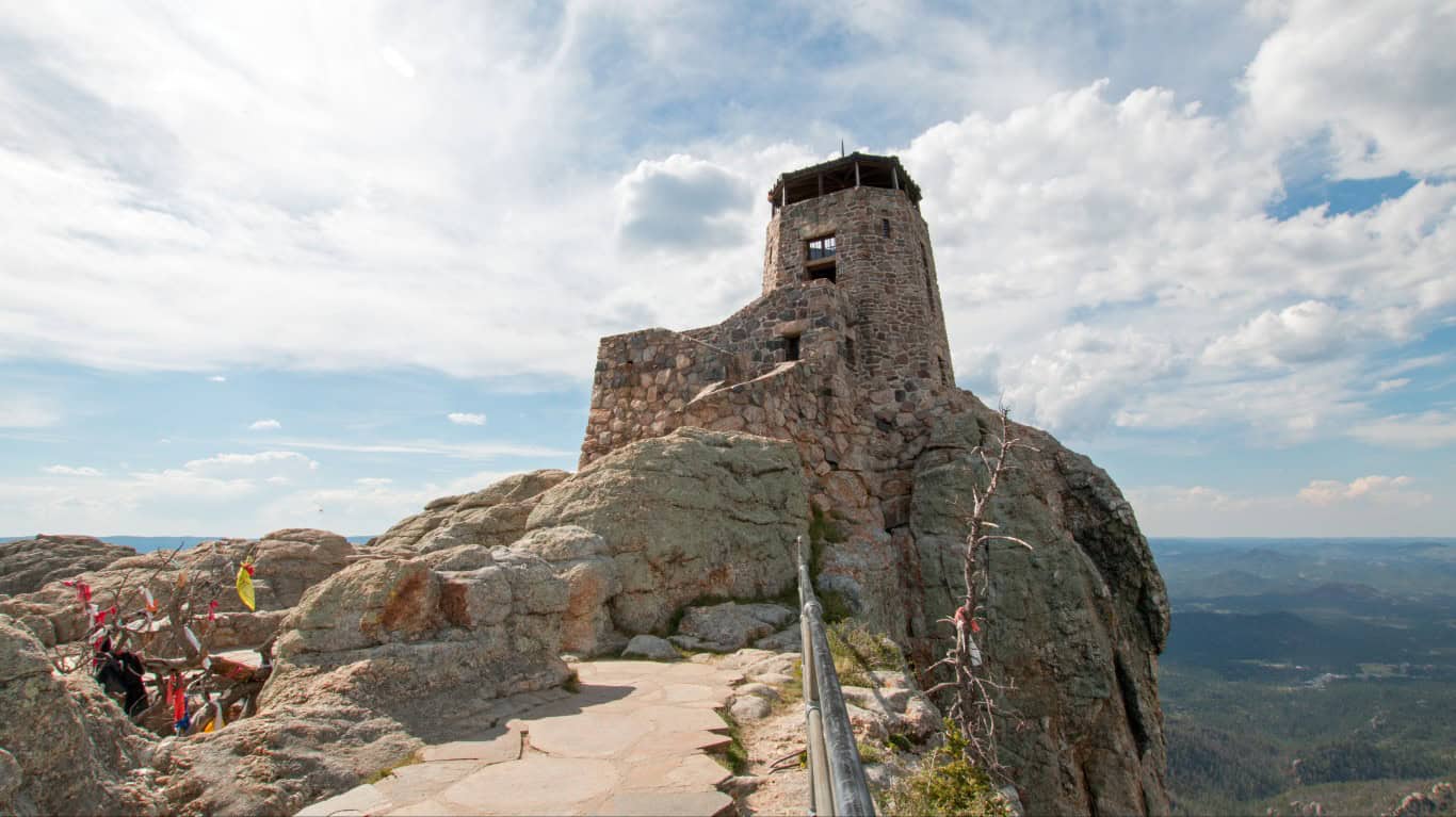
Formerly called Owl Maker and Harney Peak, Black Elk Peak is the highest point in South Dakota. The last official name change happened in 2016. There’s a fire tower at the peak, and it’s on the National Register of Historic Places.
- Tallest Peak: 7,242 feet
- Where to Go: Black Hills National Forest
Tennessee
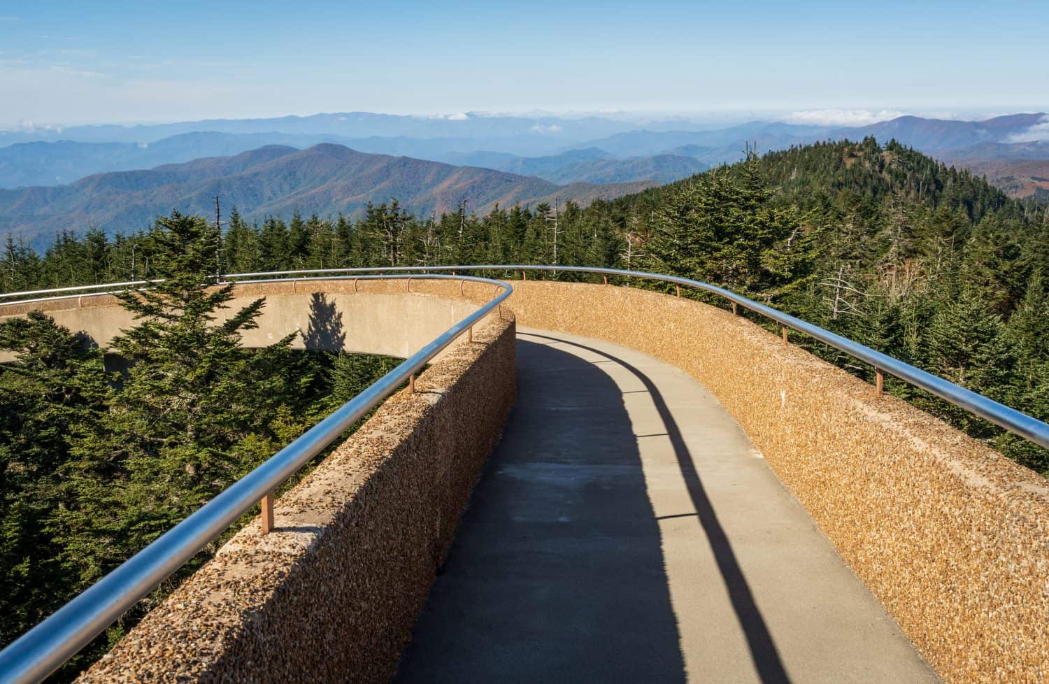
Clingmans Dome is Tennessee’s highest point. A steep paved trail leads to the observation tower and overlooks the Great Smoky Mountains.
- Tallest Peak: 6,643 feet
- Where to Go: Great Smoky Mountains National Park
Texas
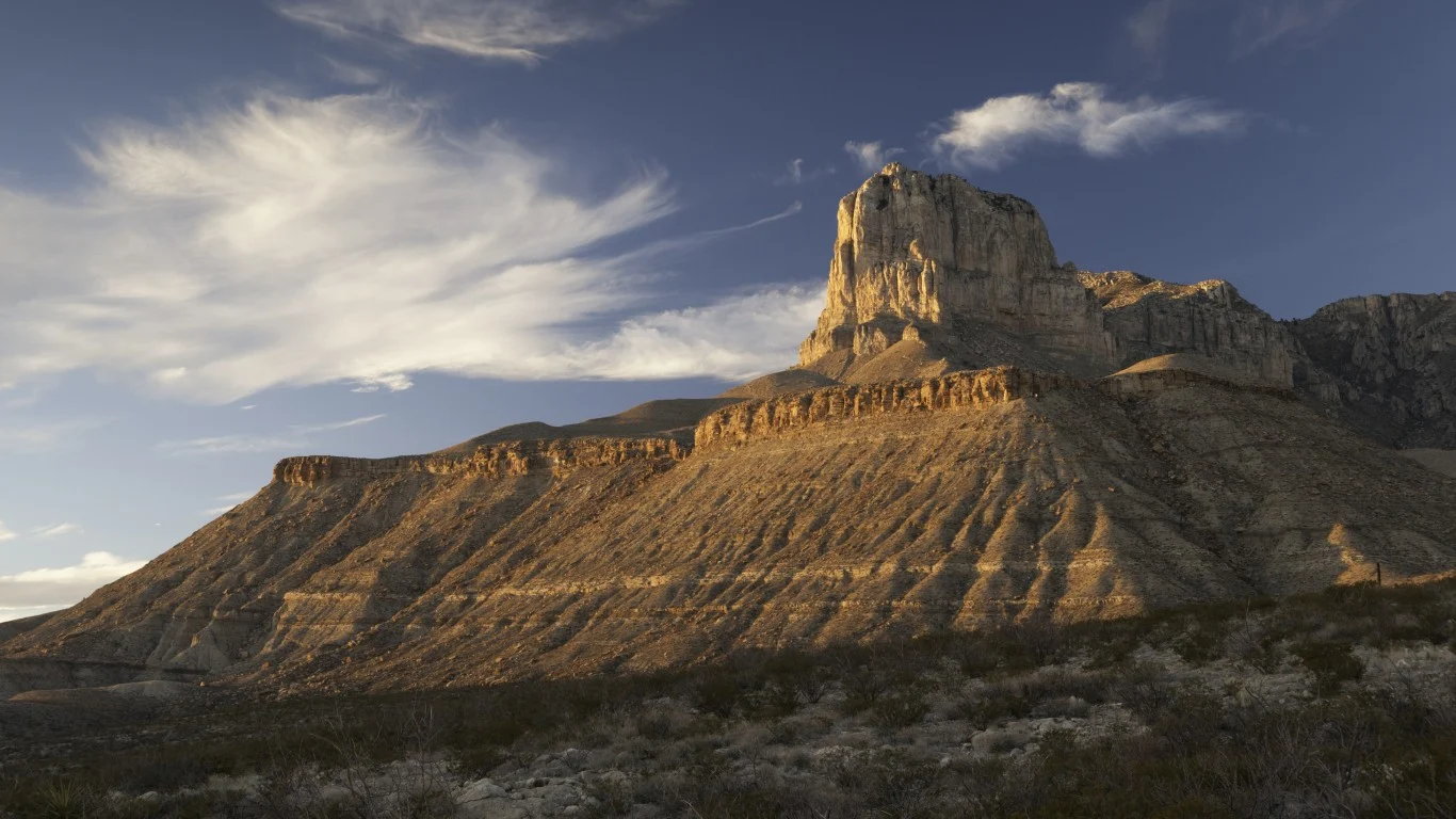
It’s a challenging hike to reach Guadalupe Peak, but the views of the land below and the stainless-steel pyramid marker are musts. American Airlines is responsible for that striking marker.
- Tallest Peak: 8,749 feet
- Where to Go: Guadalupe Mountains National Park
Utah
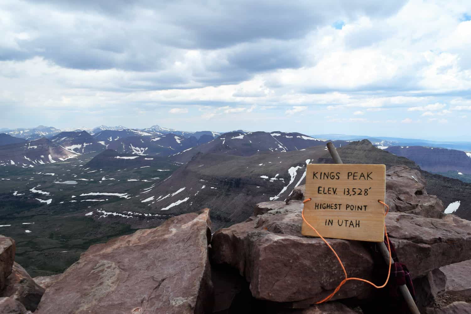
Kings Peak is in the northeastern portion of Utah in Duchesne County. It’s the 7th highest point in the U.S. It’s recommended that you make a weekend of hiking it and camp near one of the area lakes.
- Tallest Peak: 13,528 feet
- Where to Go: Ashley National Forest
Vermont
Some ski resorts put the highest peak on Mount Mansfield at 4,395, but I go with what Vermont Forest Parks and Recreation reports. If you go, heed the signs that ask people to stay off the alpine tundra. Several trails get you to the peak.
- Tallest Peak: 4,393 feet
- Where to Go: Underhill State Park, Smuggler’s Notch Long Trail South access, or Stowe Toll Road
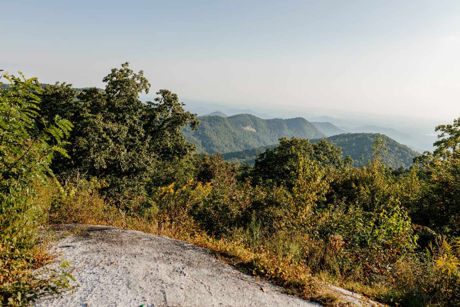
Virginia
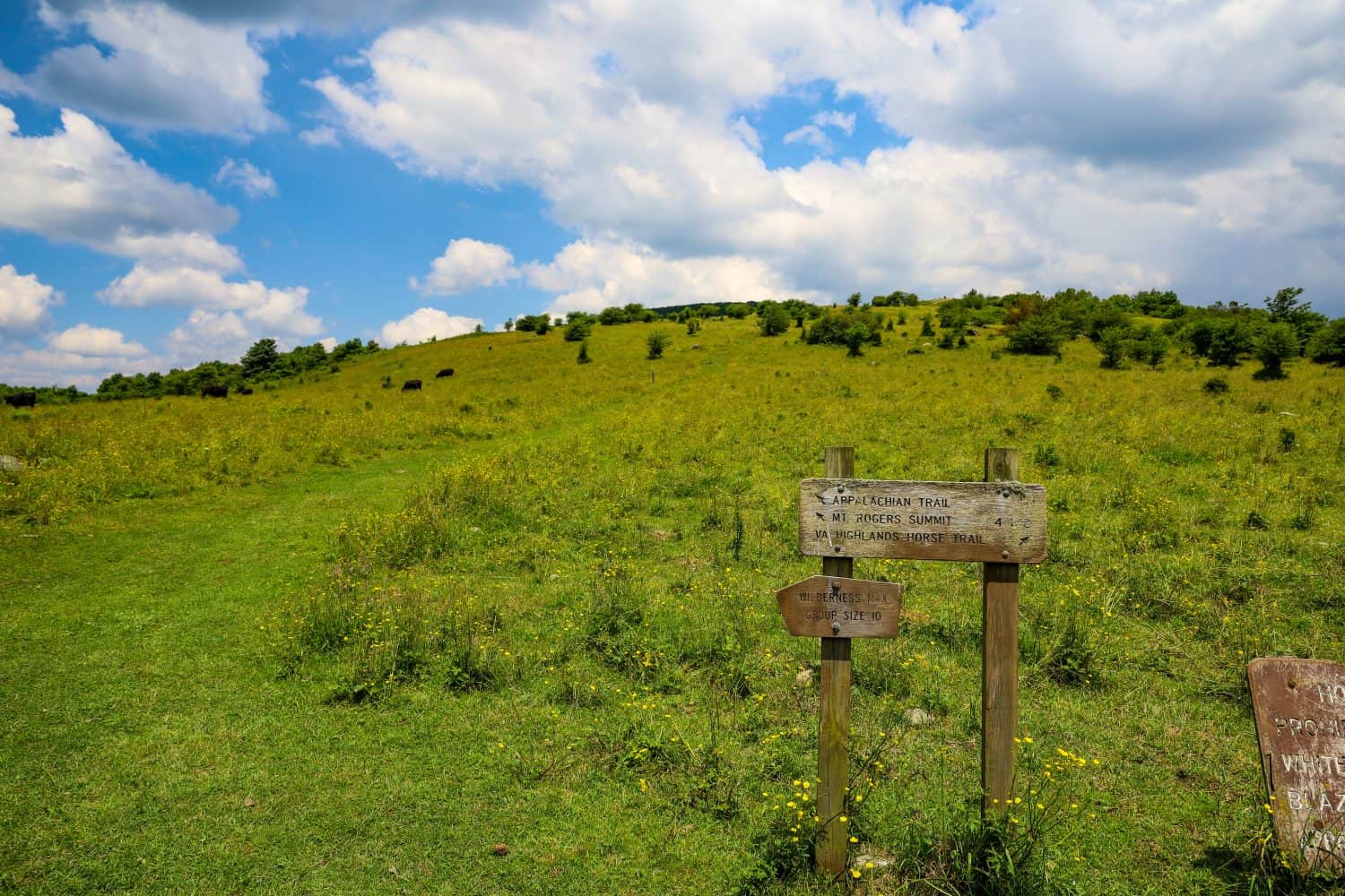
Mount Rogers is a must-see for birders as many songbirds call the area home. It’s also known for being a lot cooler than lower elevations during the summer, so jackets are recommended.
- Tallest Peak: 5,729 feet
- Where to Go: Mount Rogers National Recreation Area
Washington
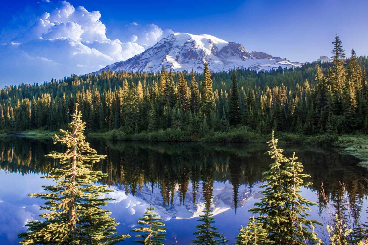
Mount Rainier is the highest point in Washington. Time entry reservations are required in the summer if you’re hiking between 7 a.m. and 3 p.m. By car, the highest you can go is Hart’s Pass, which stops at 6,000 feet in elevation.
- Tallest Peak: 14,411 feet
- Where to Go: Mount Rainier National Park
West Virginia
Once you make it to the highest point in West Virginia, there’s an observation tower available to give you the best views. Spruce Knob and Spruce Knob Tower are both near Seneca Rocks.
- Tallest Peak: 4,863 feet
- Where to Go: Seneca Rocks Discovery Center
Wisconsin
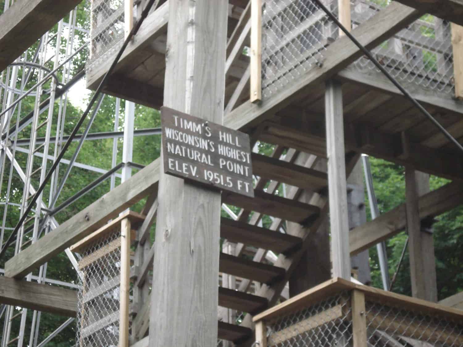
Timm’s Hill is in Price County and boasts two lakes. There’s an observation tower at the peak. Timm’s Hill National Ice Age Trail is one of the popular options for reaching the top.
- Tallest Peak: 1,951 feet
- Where to Go: Timm’s Hill County Park
Wyoming
Grand Teton is not the highest peak in Wyoming. That honor goes to Gannett Peak in the Wind River Range. It’s more remote and proves challenging to hike.
- Tallest Peak: 13,804 feet
- Where to Go: Trail Lake Ranch From Dubois or Elkhart Park (Pole Creek Trail) from Pinedale
During your visit to each state, celebrate your walk or hike by trying the state’s most unusual food.